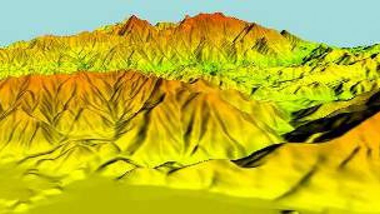
30-metre Digital Elevation Model of Iraq
Recently produced by East View for the northern one-third of Iraq is this 30-metre DEM produced from 50k and 100k topographic maps from the map library's collection. Accuracy was checked against a variety of sources for confirmation ensuring that this is an authoritative product. At 146,000 square kilometres, this DEM is one of the largest the company has ever produced.
The mountainous region of northern Iraq is rugged and sparsely populated making travel difficult and thorough planning paramount. This land is also rich in relatively undiscovered resources and is open for business. Exploration of oil, gas and mining resources is ongoing and increasing.
A Digital Elevation Model (DEM) is a vital tool for initial upstream exploration operations.

Value staying current with geomatics?
Stay on the map with our expertly curated newsletters.
We provide educational insights, industry updates, and inspiring stories to help you learn, grow, and reach your full potential in your field. Don't miss out - subscribe today and ensure you're always informed, educated, and inspired.
Choose your newsletter(s)


