Breaking the Ice with Sentinel-1 Data
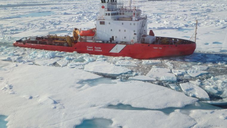
How can access to Sentinel data increase Canada’s ability to offer improved information on sea ice? Radar satellite data like those from Sentinel-1 can provide day and night information, and through clouds, of entire coastal areas even during harsh weather. This is especially important during the winter months, when conditions can be very unfavourable at northern latitudes.
Sentinel will allow the Canadian Ice Service of Environment Canada to offer better information on sea ice, helping mariners to avoid it or to find the safest route. Sentinel-1 is dedicated to providing information for a range of practical applications for Europe’s Copernicus environmental programme.
Competing services
Desmond Power, vice president of remote sensing at the Centre for Cold Ocean Resource Engineering , explained as a provider of maritime satellite surveillance services in ice-frequented waters, they have always found it challenging to get the satellite data we need, with the right balance of resolution and coverage, because the iceberg detection and sea-ice monitoring services compete with other maritime services that demand lower-resolution data.
Sentinel-1 gives coverage and resolution balance that can be used for both applications. The planned mission means that our wide regions of interests are effectively covered with a reasonable repeat frequency.
Using Sentinel-1 as a baseline enables it to more effectively integrate Radarsat-2 and other third-party radars to provide a complete maritime surveillance solution to clients, Power added. Since 1975, the Centre has helped clients to reduce the risk of working in harsh environments.
Environment Canada will use Sentinel satellite imagery to increase the frequency of monitoring Canadian waters for potential oil spills. Following ESA’s recent Sentinel agreement with Canada, the Canadian Space Agency will act as an interface between ESA and national initiatives from Canadian private and public organisations.

Value staying current with geomatics?
Stay on the map with our expertly curated newsletters.
We provide educational insights, industry updates, and inspiring stories to help you learn, grow, and reach your full potential in your field. Don't miss out - subscribe today and ensure you're always informed, educated, and inspired.
Choose your newsletter(s)


