Esri CityEngine Builds Smart 3D Cities Instantly
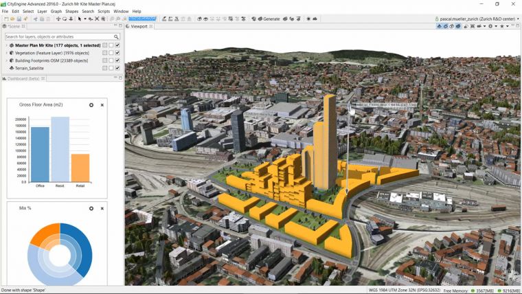
Esri has released Esri CityEngine 2016. This modelling technology allows GIS professionals, 3D artists, architects and urban planners to create smart 3D city models in a matter of minutes. The new Get Map Data interface will import satellite imagery, 3D terrain and street data from any city in the world. What was once a very complicated and time-intensive process now can be done quickly and simply.
This release integrates CityEngine with Esri's ArcGIS platform, said Pascal Müller, director of the Esri R&D Center, Zurich. They created a simple way to import real-world elevation data and basemaps from ArcGIS Online. In addition, support for Esri's new 3D streaming services with scene layer packages [.SPKs] was introduced. Scene layers can be hosted in the cloud and viewed using ArcGIS Scene Viewer, a browser-based application for viewing 3D content at any scale and with unlimited extent.
Another highly requested feature that's included with CityEngine 2016 is the Alembic exporter. The Alembic format is used by visual effects and animation professionals and is well-suited to handling massive 3D models. It is now possible to batch generate tens of thousands of building geometries at the highest level of detail and visualise them in a renderer without needing a complicated production pipeline.
Feature films
CityEngine has clearly become the standard for designing high-quality, large-scale 3D cities in feature films. It has proved itself again as an invaluable tool during the demanding production of Independence Day: Resurgence, said CityEngine expert Matthias Bühler, founder of vrbn (vrbn.io), former ScanlineVFX environment developer lead and Gnomon Workshop instructor. CityEngine 2016 impresses with major new features: The Alembic exporter allows for an efficient integration of CityEngine in state-of-the-art VFX pipelines, while Get Map Data provides an excellent tool to load real-world, georeferenced satellite imagery, terrain, and streets directly from the web into CityEngine for quick design iterations of shot layouts.
Find more information and technical details by visiting the What's New in CityEngine web page.

Value staying current with geomatics?
Stay on the map with our expertly curated newsletters.
We provide educational insights, industry updates, and inspiring stories to help you learn, grow, and reach your full potential in your field. Don't miss out - subscribe today and ensure you're always informed, educated, and inspired.
Choose your newsletter(s)


