First NASA Antarctic Airborne Campaign from McMurdo Station
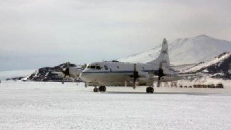
NASA's Operation IceBridge has begun its 2013 Antarctic campaign with the arrival of the agency's aircraft and scientists at the National Science Foundation's McMurdo Station in Antarctica. The IceBridge mission will be conducting daily surveys until 26 November 2013 on a NASA P-3 research aircraft from a base of operations at McMurdo Station. The P-3 is usually based at the agency's Wallops Facility in Virginia, USA.
As part of a multi-year project, researchers are collecting data on Antarctic land and sea ice. Previous IceBridge Antarctic missions were conducted out of Punta Arenas, Chile.
Flying from Antarctica will allow the scientists to survey areas that had been unreachable from Chile, said Michael Studinger, IceBridge project scientist at NASA's Goddard Space Flight Center in Greenbelt in Maryland, USA. There are many scientifically important areas they can now reach from McMurdo.
One such area is the Siple Coast on the edge of Antarctica's Ross Ice Shelf. The ice streams there are of particular interest. The scientists know from spaceborne ice surface velocity measurements that some of the Siple Coast ice streams are changing, said Studinger. But since 2009, they have had no laser altimeter measurements of ice surface elevations in this area.
In 2009, NASA's ice-monitoring satellite, the Ice, Cloud and Land Elevation Satellite (ICESat) reached the end of its life and stopped collecting data. IceBridge was started the same year and will keep an eye on changing polar ice until NASA launches the ICESat successor (ICESat-2) in three years' time.
IceBridge also plans to fly over areas of sea ice in and around the Ross Sea where there have been no airborne ice thickness measurements. The scientists also will survey beneath the Ross Ice Shelf using a gravimeter, an instrument that can detect minute changes in gravitational fields below the aircraft. These small changes help researchers determine the depth and shape of water cavities beneath floating ice.
The P-3 left the Wallops Flight Facility on 11 November 2013 carrying a suite of instruments, including laser altimeters, radars, cameras and gravity and magnetic field sensors. The IceBridge team also has set up ground stations at McMurdo to collect global positioning system data.
Mission planners worked with the National Science Foundation and the U.S. Antarctic Program for more than a year laying the groundwork for this campaign. The IceBridge project science office is located at Goddard.
For more information on Operation IceBridge, visit the project website.

Value staying current with geomatics?
Stay on the map with our expertly curated newsletters.
We provide educational insights, industry updates, and inspiring stories to help you learn, grow, and reach your full potential in your field. Don't miss out - subscribe today and ensure you're always informed, educated, and inspired.
Choose your newsletter(s)


