Getmapping Launches Maps API
Getmapping has launched its own ‘Maps API’ enabling customers to introduce interactive maps to their websites, or web-based applications. The ‘Maps API’ provides access to Getmapping’s own high-resolution aerial photography and high quality Ordnance Survey OpenData mapping, together with a comprehensive reverse geocoding service. With fast UK based servers and very competitive pricing the Getmapping ‘Maps API’ provides a really attractive alternative to Google and Microsoft.
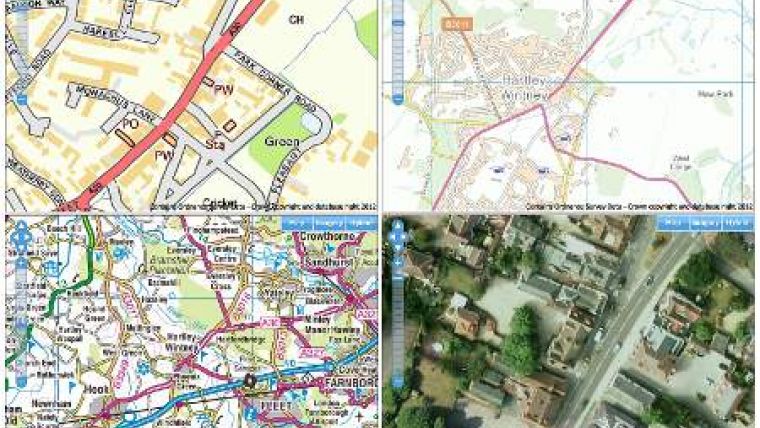
The Getmapping ‘Maps API’ is fully featured with a familiar pan and zoom interface and simple on screen buttons to choose between Ordnance Survey mapping at multiple scales, high quality high resolution aerial photography or a hybrid view. The ‘Maps API’ also boasts a comprehensive set of tools for creating map markers, for points of interest for example, plus line and polygon features. Add precise Latitude and Longitude map location and you also have the possibility for reverse geocoding to an address or place name and opportunities for geo-fencing, useful for setting predefined boundaries for neighbourhoods, catchments or designated routes.
The Getmapping ‘Maps API’ is expected to be of interest to any business or organisation where location is important, from those who simply wish to embed maps in their websites for facilities like find nearest branch, to those that wish to build fully featured web applications that track people, vehicles or assets. The increasing popularity of mobile location based applications suggests that there will be considerable interest from the burgeoning mobile app development community focused on the iOS and Android platforms.
The benefits of the Getmapping ‘Maps API’ over others include fast UK based servers, updated high resolution aerial photography for the whole of the UK, high quality Ordnance Survey mapping and a highly accurate geocoding service. Finally the Getmapping ‘Maps API’ is aggressively priced to provide a real alternative to industry incumbents such as Google and Microsoft. There are various pricing models to suit any business including annual fixed subscription, per-unit pricing and bandwidth-linked pricing.

Value staying current with geomatics?
Stay on the map with our expertly curated newsletters.
We provide educational insights, industry updates, and inspiring stories to help you learn, grow, and reach your full potential in your field. Don't miss out - subscribe today and ensure you're always informed, educated, and inspired.
Choose your newsletter(s)


