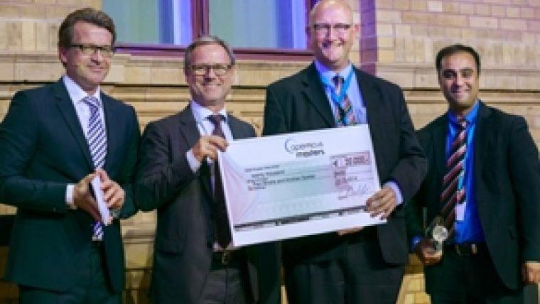
Land Stability Service Wins Copernicus Masters
The first Earth observation service for extensive and uninterrupted coverage of land stability monitoring and mapping with millimetre-precision has been named the winner of this year's Copernicus Masters contest. This year's overall winners, Dr Andrew Sowter and Paul Bhatia from the University of Nottingham, have developed a novel procedure called PUNNET.
PUNNET facilitates large-scale coverage of land deformation that occurs due to mining, groundwater extraction, or drilling. This represents a major step forward for users such as the oil and gas industry, exploration companies, and the construction industry, as well as for public authorities and environmental protection organisations.
PUNNET's innovative approach perfectly leverages the unique potential of the extensive Sentinel-1 data, the first Copernicus satellite, and the high-resolution data provided by the TerraSAR-X and PAZ satellites, stated Alexander Kaptein, Head of Future Programmes at Airbus Defence and Space. Airbus experts believe that this new method holds tremendous potential, particularly with regard to the implementation of comprehensive geohazard monitoring by various industries and public authorities.
Worldwide
Since 2011, the Copernicus Masters has recognised each year's best applications for the innovative use of Earth observation data. The 2014 edition, which was held worldwide for the first time, received more than 170 entries from 43 different countries. The application ideas submitted to the Copernicus Masters 2014 offer a glimpse into the next generation of Earth observations services in a wide array of business and societal sectors, including health, infrastructure, catastrophe management, agriculture and forestry, and environmental protection.
These new services are already demonstrating the significant value that can be attained in combining Earth observation data with other dynamic statistical information from everyday life, explained Thorsten Rudolph, managing director of competition organiser Anwendungszentrum GmbH Oberpfaffenhofen. Through their cooperation with the European Space Agency and its Business Incubation Centre (ESA BIC) programme, they offer an ideal platform for providing sustainable technical and financial support to new service models in Earth observation, Rudolph said.
Sentinel-1A
The data provided by Sentinel-1A has been publicly available since early October, which commenced the operational phase of the European Earth observation programme Copernicus. The Copernicus Masters is an outstanding platform for promoting user uptake and raising awareness of the benefits of the Copernicus data and information, declared ESA's Earth observation director Prof Dr Volker Liebig in his opening speech at the competition's awards ceremony. He said to be pleased about the high quality exhibited by this year's ideas, which reflect the potential Earth observation data and global environmental information present in countless new areas of application.
Along with the overall winner, the international Earth observation community awarded prizes worth a total of EUR300,000 in nine categories on Thursday at the Berlin headquarters of Deutsche Telekom. The winners received cash prizes, consulting services, data packages, and other incentives, as well as the chance to turn their ideas into market-ready offerings with the support of one of the 11 ESA BICs across Europe.
This year's Copernicus Masters awards ceremony was accompanied by the Satellite Masters Conference for the first time, which gave the winners the chance to present their ideas to the global Earth observation and navigation industry and share innovations in aerospace technologies and services. www.satellite-masters-conference.eu
Partners of Copernicus Masters 2014
This year's prizes were sponsored by the following partners: the European Space Agency (ESA), the German Aerospace Center (DLR), T-Systems International GmbH, European Space Imaging GmbH & Skybox Imaging Inc., CloudEO AG, Airbus Defence and Space & Hisdesat S.A., and the Satellite Applications Catapult. Copernicus Masters also receives support from the European Commission.
For more information on the Copernicus programme, please see further at www.esa.int/copernicus and www.copernicus.eu.

Value staying current with geomatics?
Stay on the map with our expertly curated newsletters.
We provide educational insights, industry updates, and inspiring stories to help you learn, grow, and reach your full potential in your field. Don't miss out - subscribe today and ensure you're always informed, educated, and inspired.
Choose your newsletter(s)


