Suomi NPP Satellite Starts Real-time High Data Rate Transmission
Broadband data transmission from the imaging equipment of the new Suomi National Polar-orbiting Partnership (NPP) satellite started successfully on 23rd February 2012. Survey results were delivered in real time on High Rate Data (HRD) radio-link. Free access can be obtained to data transmitted via HRD radio-link at 15Mbps. All the user needs is to have an X-band receiving ground station available. For the most part, the UniScan stations developed by ScanEx RDC do not require any hardware updates to start receiving data from Suomi NPP; only the software that is currently being tested needs to be uploaded.
More details about functioning and HRD radio-link are available at the web-portal of the Direct Readout Laboratory (DRL). Thanks to the DRL's public information resources, users can gain access to the Earth observation technologies and imagery data, including the information about the satellite, tools for data reception and processing, broadcasts applying the direct broadband technique, as well as data samples and templates for correct reception, processing and analysis by the users of data, transmitted in HRD mode.
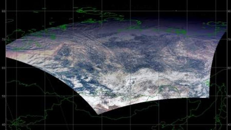
Equipment to measure air temperature, humidity and pressure are installed onboard the satellite - CrIS and ATMS, to collect data about vertical and horizontal distribution of ozone in atmosphere - OMPS and to study electromagnetic radiation, CERES. The 22-band radiometer VIIRS is of special interest for imaging of the Earth's surface, which has been designed with due account for MODIA sensors operation on Aqua and Terra satellites. This radiometer significantly surpasses the AVHRR sensors of NOAA series satellites. First images of the Earth's surface using VIIRS satellite were acquired on 21st November 2011.
The Suomi NPP spacecraft was launched on 28th October 2011 and is intended for acquiring operational information about the condition of the cloud cover and the Earth's surface, concentration of suspended particles and distribution of water vapour in atmosphere, monitoring of dangerous atmospheric events, forest fires, changes in landscape, ice situation in northern seas and for collection of other data. Initially the satellite was named NPP, but in late January NASA administration decided to rename it to Suomi NPP in honour of Verner Edward Suomi - the meteorologist from Wisconsin University who died in 1995 and who is widely regarded as the 'father of satellite-based meteorology'.

Value staying current with geomatics?
Stay on the map with our expertly curated newsletters.
We provide educational insights, industry updates, and inspiring stories to help you learn, grow, and reach your full potential in your field. Don't miss out - subscribe today and ensure you're always informed, educated, and inspired.
Choose your newsletter(s)


