SuperGIS Server Extends Map Possibilities with Various Resources
Supergeo has released the latest version of SuperGIS Server with various new functions, including related tables, an improved JavaScript print tool, and new JavaScript APIs supporting OGC layers. With these new functions, users are able to publish web maps featuring more information, and integrate rich OGC resources with their maps.
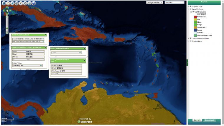
In the real world, people may separately store data with tables that are somehow intertwined with each other. When these data tables are related to each other, users can understand more about the geographic phenomenon. For example, by relating location data of weather stations to the annual temperature values, users will be able to track and visualise environmental change and comprehend more about global warming.
In addition to related tables, the latest SuperGIS Server also supports the integration of OGC layers like WMS, WMTS, and KML. In the era of data sharing, many resources are published online, so augmenting the integration of open resources helps users quickly create meaningful maps. The latest SuperGIS Server enables users to add these OGC layers to their Ultra web maps employing JavaScript APIs to effortlessly create more and more professional maps.
To learn more about SuperGIS Server see here.

Value staying current with geomatics?
Stay on the map with our expertly curated newsletters.
We provide educational insights, industry updates, and inspiring stories to help you learn, grow, and reach your full potential in your field. Don't miss out - subscribe today and ensure you're always informed, educated, and inspired.
Choose your newsletter(s)


