Centimetre-level Position Accuracy for Mobile GIS Applications
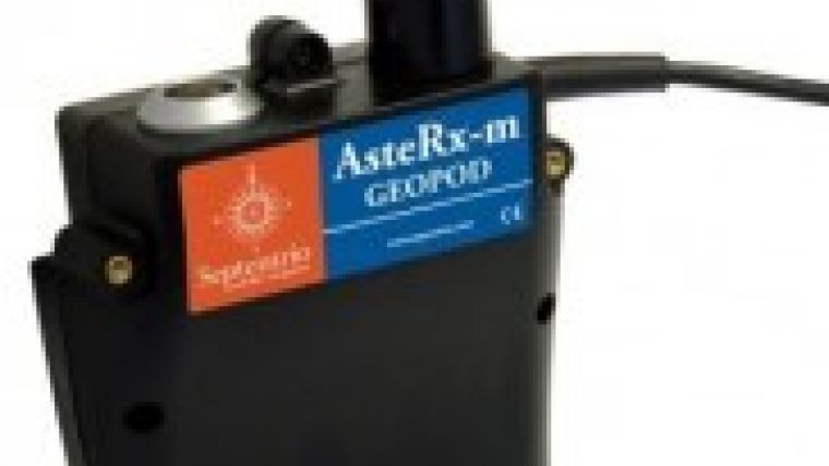
Septentrio, Belgium, has announced that it has joined forces with Esri BeLux, the distributor of Esri software in Belgium and Luxembourg, to offer a user-friendly mobile solution that is accurate up to 1 centimetre. This mobile solution combines the use of Esri ArcGIS for Mobile with a highly accurate GNSS device called AsteRx-m GeoPod.
The combination of Esri software and the AsteRx-m GeoPod operates seamlessly using standard, open interfaces on any professional tablet. Used today by a major utility company, the new bundled solution allows anyone in the organisation to accurately locate utility infrastructure and record georeferenced data on the spot.
This is an exciting new cooperation that has seen the light, commented Peter Grognard, Septentrio’s founder and CEO. It is a true example of how the company creates extraordinary value for customers and redefines the limits of a profession by combining standard available products, he added.
This newly established partnership can benefit organisations as follows:
- Field crews get the tools to easily locate assets, to accurately measure and to later enter changes into the company databases.
- The solution can be used by any operators; it becomes easy for anyone to record georeferenced information in the field.
- The IT department has the full flexibility to select the mobile devices that suit each application best.

Value staying current with geomatics?
Stay on the map with our expertly curated newsletters.
We provide educational insights, industry updates, and inspiring stories to help you learn, grow, and reach your full potential in your field. Don't miss out - subscribe today and ensure you're always informed, educated, and inspired.
Choose your newsletter(s)


