News
Interactive Map for Italian Earthquake
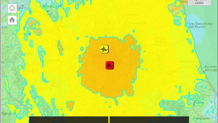
This ShakeMap is designed as a rapid response tool to portray the extent and variation of ground shaking throughout the affected region immediately following significant earthquakes in the mid-Italian region around Nordia. This Shakemap has then been enriched to show key demographic variables.
Also content from Twitter and Youtube is made available using the geo-coding and keyword options allowing to link local information about the incident.

Value staying current with geomatics?
Stay on the map with our expertly curated newsletters.
We provide educational insights, industry updates, and inspiring stories to help you learn, grow, and reach your full potential in your field. Don't miss out - subscribe today and ensure you're always informed, educated, and inspired.
Choose your newsletter(s)


