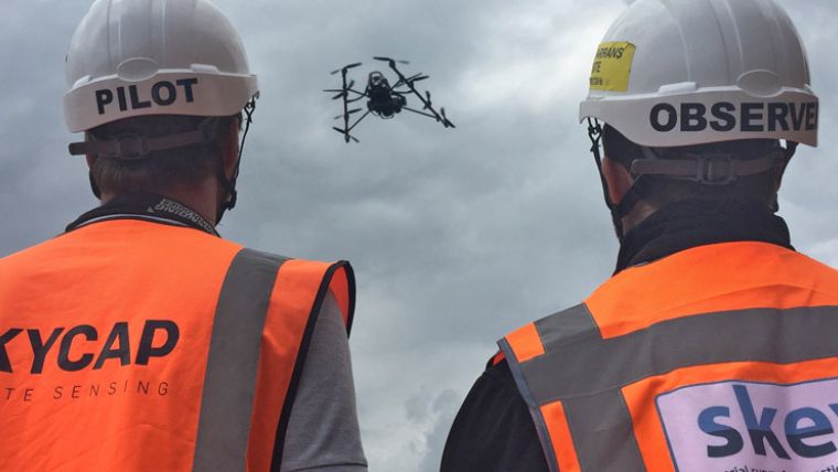
Aerial Survey Companies Skycap and Skeye Join Forces
Skycap and Skeye announced the merger of their two companies, continuing under the name Skeye. The merger results in the creation of a leading European company in aerial topographic surveys, using unmanned aircraft. In addition, Skeye will instantly enter the European market as a renowned provider of unmanned aerial inspections and extend its services portfolio with specialised aerial imagery.
Skeye will continue to grow its UK and Dutch based operations and look to enter new territories out of its Dutch headquarters. As part of the transaction, Skeye has secured significant growth capital provided by Rob Thielen, founder and chairman of Waterland Private Equity Investments.
The new company brings together the unique strengths and experience of two great companies. The merger, in combination with the provided growth capital, strengthens the position as the most reliable partner for our national and international clients, said Skeye’s managing director Pieter Franken.
The combined product portfolio will provide the clients with unmanned aerial services, which are of higher quality, safer, and more time and cost efficient than traditional alternatives in the survey and inspection industries, he added.
This merger represents the next phase of our transformation into a leading global provider of unmanned aerial topographic survey and inspection services, Franken concluded.
About Skeye
Skeye, founded in 2013, is a Dutch and UK based company specialised in aerial inspections and topographic surveys using unmanned aircrafts (UAVs). Skeye’s track record in quality and safety has enabled them to operate globally in critical environments such as the Oil and Gas sector. Skeye was the first company to be granted the general exemption for commercial aerial work with drones by the Dutch Ministry of Infrastructure and Environment.
About Skycap
Skycap, founded in 2014, is a full-service provider with unmanned aircrafts (UAVs), specialised in topographic surveys, high quality aerial imagery and 3D visualisations.
With offices in the UK and The Netherlands, Skycap has executed over 350 missions and completed several thousand hours of flying time since its launch in 2014 for organisations in Europe, Africa and East Asia.

Value staying current with geomatics?
Stay on the map with our expertly curated newsletters.
We provide educational insights, industry updates, and inspiring stories to help you learn, grow, and reach your full potential in your field. Don't miss out - subscribe today and ensure you're always informed, educated, and inspired.
Choose your newsletter(s)


