
GIM - Issue 2-2024
Presenting the latest developments in aerial mapping, products and services. Intriguing real-life projects provide insights into advanced aerial photogrammetry and Lidar in practice. Moreover, this ed...
Presenting the latest developments in aerial mapping, products and services. Intriguing real-life projects provide insights into advanced aerial photogrammetry and Lidar in practice. Moreover, this ed...
Our traditional annual Business Guide forms a vital resource for geomatics professionals. With in-depth articles and interviews, it reflects on geospatial trends and explores the business outlook for ...
Geospatial data obviously is key to sustainable land management. But what are the common success factors for land administration and cadastral systems around the world? In this issue, we will focus on...

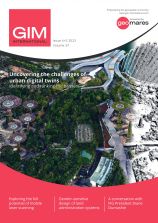
To tie in with the Intergeo event, this edition will reflect on the practical digital twin-related challenges in the geospatial domain. While the concept of the digital twin has been gaining significa...
This edition of GIM International is our annual showcase for challenging and exciting geospatial projects. Each year, we present some spectacular examples of how surveyors around the world have succes...
As robots and autonomous technologies become increasingly integrated into surveying workflows, how are they changing the way the physical environment is mapped? This edition will explore how robots ca...

Special cameras and sensors allow surveyors to acquire images and other geospatial information about the Earth and the environment. While both image-based solutions and laser-scanning methods are evol...

Welcome to the new GIM International! Our refreshed design and updated logo signal our commitment to innovation in the dynamic world of mapping and surveying. In this edition, we explore the transform...
A new design for GIM International In keeping with the evolving geospatial industry and the dynamic nature of mapping and surveying, GIM International has been revamped and now boasts a new and refre...

Analysing, distributing and visualizing geospatial data are all vital steps in the mapping and surveying workflow in order to turn geodata into a key driver of today’s information society and benefi...
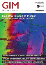
Creating extremely high-quality 3D data and models from survey data is critical for many applications, such as in the AEC industry and urban planning. This issue of GIM International enriches our read...
This site uses cookies. By continuing to use this website, you agree to our Cookies Policy. Agree