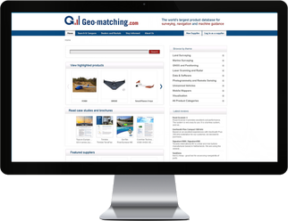
Poll

Are you considering working with an UAV for surveying?


Spacer
Product Survey
Product Survey > Terrestrial Laser Scanners, August 2010
Terrestrial Laser Scanners, August 2010

By Mathias Lemmens, senior editor, GIM International


This Product Survey (PS) on Terrestrial Laser Scanners (TLS) is the fourth in a row and marks a tradition of nearly a decade: the first PS on this subject was published in January 2001.


Two laser principles are common in TLS systems: phase shift and pulse measurements - the latter is also coined time-of-flight. The phase-shift method is considered the more accurate of the two; it allows a very narrow beam, but its measuring range is limited. The pulse method has a much wider range, but the disadvantage of poor performance at short range. Some manufacturers combine the pulse and phase approaches in one instrument to fully exploit the advantages of the two methods. 


Light produced by lasers is in general highly monochromatic, directional and coherent. A price to be paid for these beneficial properties is that lasers can harm living tissue. Since the early 1970s lasers have been subject to safety classification based on their potential for causing damage to eye and skin. The initial classification system of six classes was slightly revised and extended to include seven classes in 2002. In the old system the US indicated classes by Roman numerals, sometimes appended with letters (I, II, IIA, IIIA, IIIB and IV), whereas the EU used Arabic numerals (1-4), also appended by letter; the latter system is used worldwide in the revised version. The higher the numeral, the more injury the laser can cause: 1, 1M, 2, 2M, 3R, 3B and 4. Most TLS systems are assigned to safety class 3R; in the old system this would be IIIA, meaning ‘safe if handled carefully'. Safety depends on maximum output power, laser principle and wavelength. The output power of phase-shift scanners operating in the visible wavelengths should not exceed 5mW. Other maxima apply for other wavelengths and for pulsed lasers.


All systems listed support integration of data from different scans. They also facilitate fly around, pan and zoom. All software allows for selection of individual points and groups of Lidar points, sometimes adding up to millions. The software implemented in today's scanners allows for a wide variety of import and export formats; all support major formats.


Email: m.j.p.m.lemmens@tudelft.nl


[1] Pulsed or phase measurement or triangluation
[2] Points per second in KHz
[3] e.g. lines, planes, cylinders, spheres
[4] supported for practical, real-time visualization

Meaning of symbols and abbreviations
Ø Diameter
FoV Field of View
V´H Vertical ´ Horizontal
D Degree
# Number or Amount 


Browse or compare (max 5) the products:
3rdTech DeltaSphere-3000IR
Basis Software, Inc. Surphaser 25HSX
FARO Photon 120
FARO Photon 20
Leica Geosystems Leica ScanStation C10
Leica Geosystems Leica ScanStation 2
Leica Geosystems Leica HDS6200
Maptek I-Site 8800 Laser Scanning System
Optech Incorporated ILRIS-HD
RIEGL Laser Measurement Systems GmbH RIEGL VZ-400
RIEGL Laser Measurement Systems GmbH RIEGL VZ-1000
RIEGL Laser Measurement Systems GmbH RIEGL LMS-Z620
Trimble GX
Trimble CX
Trimble FX
Z+F (Zoller + Fröhlich GmbH) Z+F IMAGER® 5006h
Z+F (Zoller + Fröhlich GmbH) Z+F PROFILER 5006h
Z+F (Zoller + Fröhlich GmbH) IMAGER 5006EX
© GIM International
Most Popular articles Most Popular News Most Popular Jobs
Spacer


Spacer
Spacer
Spacer
 

Interactive


3D Scanning of Historic Sugar Factories

The Alliance for Integrated Spatial Technologies at the University of South Florida, USA, recently worked with the Florida Park Service on a project to document the remains of several historic sugar-mill sites in the State Parks to create as-builts to be used in preservation and conservation of these resources. The FARO LS 880, along with GPS and total station georeferencing and colour imaging, was used on these projects. 


 Last 5 items:
 3D Scanning of Historic Sugar Factories
 Road Improvement Survey with UAV
 3D BIM + money = 5D
 Setting up a survey in a swamp
 Launch of the 9th Baidu Satellite
 
Spacer
Spacer
Spacer
Spacer
Spacer