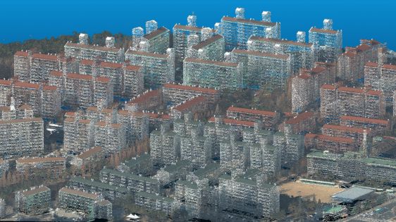
Nationwide Digital Twin Generated in Three Days with VELOCITY 5D
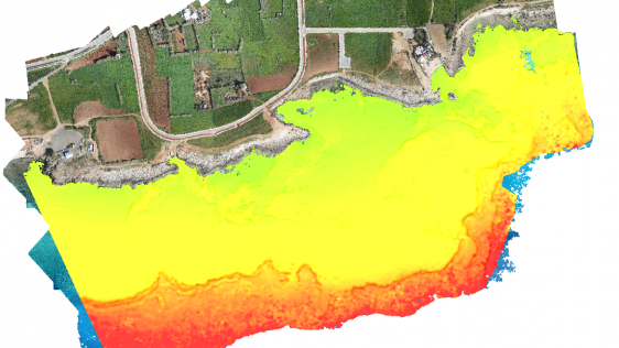
A national mapping agency in Europe needed to create a 3D digital twin of its entire country from a collection of geospatial data in varying scales and formats. A primary goal of t...
21 September - 23 October
The advancement of new technology in the geospatial industry is expanding the horizons for surveyors. At the same time, the democratization of geospatial technologies is creating new markets for the industry. Against this backdrop, GIM International proudly presents the ‘3D Modelling and Visualization Weeks’.
Throughout September and October (21 September-23 October 2020), we highlighted all the solutions that are involved in turning geodata into a finished geospatial product – with a special focus on the latest ways to process and visualize the data.
Stay informed with our weekly newsletter fully dedicated to the GIM 3D Modelling & Visualization Weeks.
...and/or follow us on your social channel of choice:
A selection of theme featured articles and case studies
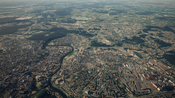
A national mapping agency in Europe needed to create a 3D digital twin of its entire country from a collection of geospatial data in varying scales and formats. A primary goal of t...
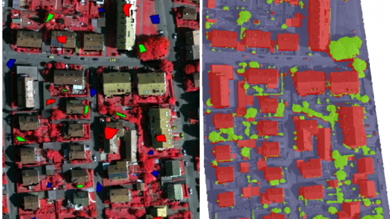
This article outlines a generic workflow for automatic buidling detection and 3D modelling using modern technologies, to support applications ranging from urban planning and cadast...
What will be the future of Lidar? To quote Abraham Lincoln: “The most reliable way to predict the future is to create it”. So what is currently being created in the geo...
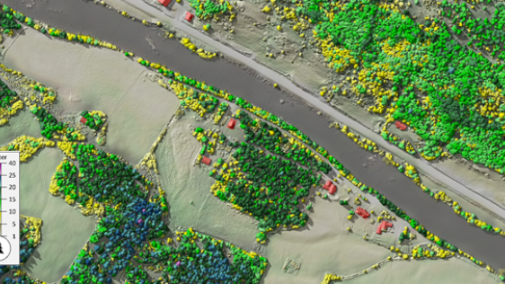
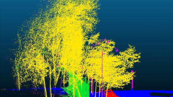
Aerial images are great for interpreting tree species, but they don’t show tree heights and structure in the forest. Blom is a supplier in the Nordic market for capturing, pr...
Accurate bathymetric mapping of shallow areas is essential for many offshore activities. Through Structure from Motion (SfM) and Multiview Stereo (MVS) techniques, images can...
How can point cloud technologies be used to create a realistic virtual environment for use as immersive and interactive surveying labs? The advent of cost-effective head-mounted di...
Working with Pittsburgh’s City Planning Department, a Carnegie Mellon University research team completed an in-depth study of the current use of 3D software for planning task...

The increasing number of solutions for developing 3D city model applications poses a challenge for developers. This article outlines key considerations that help them to create app...
Richard Cooke, director of imagery at Esri, explains all about the company's acquisition of nFrames, the innovative Germany-based developer of software for 3D reconstruction from i...
(theme sponsor)

(theme sponsor)
Must-read articles about 3D Modelling and/or Visualization carefully selected by Wim van Wegen.
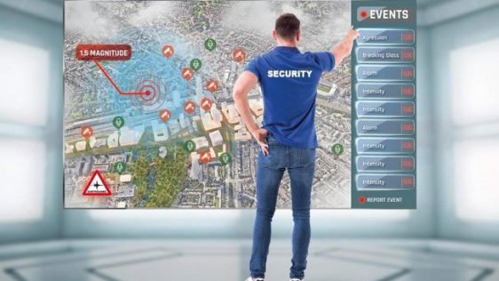
Around the world, local governments are rolling out Smart City/Digital Twin projects to support economic stimulation and tourism programmes and to improve the quality of life overa...
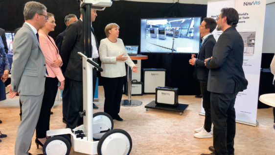
Indoor mobile mapping is well past the tipping point and is about to go mainstream. In this interview, Felix Reinshagen from NavVis shares his views on the future, including his co...
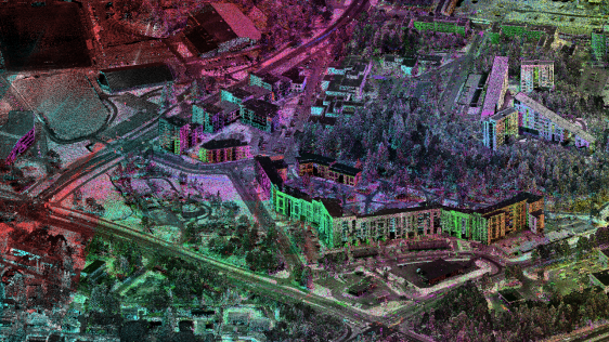
How can kinematic laser scanning support urban planning and infrastructure management? Urbanization and the development of megacities is posing critical challenges for sustainable...
(theme sponsor)
(theme sponsor)
The development of fifth-generation wireless technology (5G) is spreading rapidly around the world. The initial improvement of up to 10x in speed and 400x in latency, as well as a...
Fugro has been awarded a five-year 'indefinite delivery indefinite quantity' (IDIQ) contract with the US Army Corps of Engineers (USACE), St. Louis District, for nationwide surveyi...
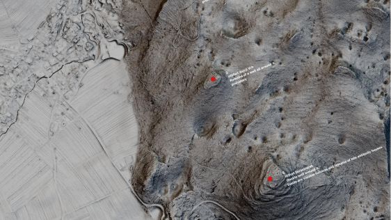
A few obstacles are making the usage of Lidar data in archaeology look exotic and perhaps even threatening, according to archaeologist Jošt Hobič from Slovenia, even though...
A unique 3D smart digital model has been developed to combine the different streams of data from cities on one common platform, and is the result of the ITEA project PS-C...
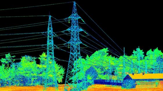
A deep learning architecture called MMCN opens up the possibility for the fully automated classification of highly dense 3D point cloud data acquired from a mobile Lidar system. Th...
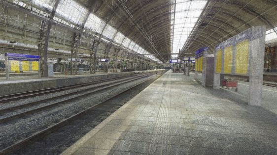
Geomaat recently performed extensive 3D laser scanning and 3D modelling for the Dutch railway organization, ProRail. ProRail is the organization that takes care of the entire...
3D Modelling & Visualization Weeks are made possible by:


This site uses cookies. By continuing to use this website, you agree to our Cookies Policy. Agree