Think Big for Coastal Mapping
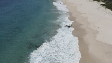
“Think big for coastal mapping” is the foremost advice that Don Ventura of Teledyne Geospatial would impress upon agencies interested in bathymetric Lidar. “It’s a matter of efficiency of scal...

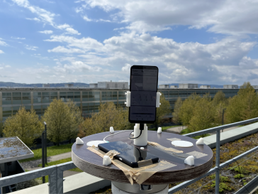
GIM International's "Case Studies" section delivers comprehensive examinations of actual geospatial projects. These studies shed light on the hands-on use of technologies and methodologies in the geospatial realm, empowering professionals to address obstacles efficiently and catalyze innovation. (Image courtesy: Christoph Holst/Technical University of Munich)
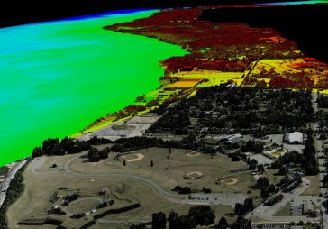
“Think big for coastal mapping” is the foremost advice that Don Ventura of Teledyne Geospatial would impress upon agencies interested in bathymetric Lidar. “It’s a matter of efficiency of scal...
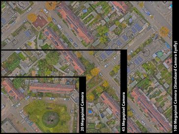
EyeFly has been working with a Phase One 100 Megapixel camera for over six years. This professional camera in combination with the company’s expertise ensures the best end product. Read more below a...
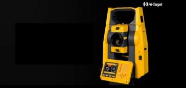
HTS-521L10 is Hi-Target's new generation high-precision long-range total station. The inspiration for its cool and refreshing appearance comes from the Bumblebee. A tough exterior provides evidence ...
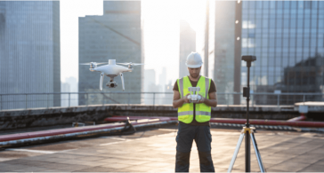
 Land Survey
Visual Positioning Technology is a Major Breakthrough in GNSS Receiver Development The GNSS Receiver has evolved over the years. Through continuous product improvements, a highly integrated RTK receiv...
CHC Navigation is expanding its reach throughout Europe and the world, with more dealers and customer support and advanced training and service points. The Shanghai-based company has been a player in...
The release of Android version 7.0 in 2016 allowed users to access raw data transmitted by the Global Navigation Satellite System (GNSS) for the first time. More recently, it has become possible to re...
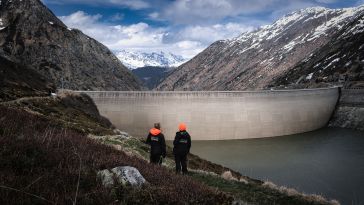
In early 2021, the Orthodrone team crowded itself and its equipment into a tiny Swiss gondola and made its way to one of two dams scheduled for water-side inspection – no easy feat, given the metres...
Innovations in Lidar technology continue to change the way we see our world – literally. There’s no denying that the Lidar sector is growing at an exponential rate. Research by Grand View Research...
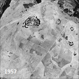
Only a small fraction of the information content in aerial films has ever been recorded on paper maps, most of which are inaccessible. The use of artificial intelligence (AI) to fully automate the pro...
The use of a Phase One iXM-100 enabled EyeFly BV to fly closer to the Buggenum rail bridge in the Netherlands for the required annual bridge inspection. This achieved a resolution of close to 1mm g...
Smart digital realities that replicate real-life geoinformation provide valuable insights and support the analysis and interpretation of infinite data inputs from the real or digital world. They can b...
 The Major Benefits
How accurate is accurate enough? If you’re like most land surveyors, the answer is “as much as possible.” With an RTK drone, surveyors and other drone pilots can expect centimetre-level positi...
This site uses cookies. By continuing to use this website, you agree to our Cookies Policy. Agree