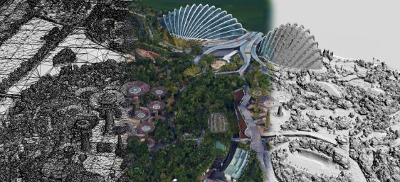
• About us
  • Contact
  • Advertise
  • Join our newsletter
  • Product Showcase
  • Intergeo special
GIM International
  • Topics
    • Land surveying
    • Cartography / GIS
    • Remote sensing
    • Positioning
    • Urban planning
    • Construction & Engineering
    • Lidar
  • Articles
  • News
  • Case studies
  • Members
  • Events
  • Videos
  • Magazine
  • Podcast
GIM International

Features

Combining multi-scale Lidar technologies to understand tropical rainforest dynamics
Lidar

Combining multi-scale Lidar technologies to understand tropical rainforest dynamics

September 30, 2025
Geospatial precision in the Stockholm Metro Expansion
construction engineering

Geospatial precision in the Stockholm Metro Expansion

September 25, 2025
Exploring the potential of fused imaging and Lidar data for seabed classification
airborne Lidar

Exploring the potential of fused imaging and Lidar data for seabed classification

September 16, 2025
Envisioning city digital twins in Indonesia
spatial planning

Envisioning city digital twins in Indonesia

September 11, 2025
Digital facade inspections take off
uav mapping

Digital facade inspections take off

August 28, 2025
DeltaDTM: mapping coastal terrain elevation
Lidar

DeltaDTM: mapping coastal terrain elevation

August 7, 2025
Who Owns Scotland: the fit-for-purpose rural land register
land administration

Who Owns Scotland: the fit-for-purpose rural land register

August 6, 2025
Supporting sky-high energy generation
digital twin

Supporting sky-high energy generation

July 17, 2025
From property to governmental digital twin: the future cadastre in Switzerland
land administration

From property to governmental digital twin: the future cadastre in Switzerland

June 24, 2025
Earth observation sensors and technology: the current state of play
satellite remote sensing

Earth observation sensors and technology: the current state of play

June 4, 2025
Innovative technology keeps surveyors safer in Dutch highway reconstruction project
civil engineering

Innovative technology keeps surveyors safer in Dutch highway reconstruction project

May 22, 2025
Rescuing land administration projects from isolation
land administration

Rescuing land administration projects from isolation

May 15, 2025
AI, digital twins and the new geospatial era
digital twin

AI, digital twins and the new geospatial era

April 29, 2025
Signals, scintillation and the solar effect
GNSS signals

Signals, scintillation and the solar effect

April 23, 2025
  • ←Prev
  • 1
  • 2
  • 3
  • 4
  • 5
  • Next→
GIM International
Geomares
GIM International is the independent and high-quality information source for everything the global geomatics industry has to offer, online and offline! We provide information about all the major topics in the business, such as mapping & surveying, geodesy, cartography, Lidar, GIS, photogrammetry, UAV/UAS, GNSS, remote sensing and more.

Themes

  • Lidar
  • GIS
  • UAS/UAV
  • GPS
  • GNSS
  • Mobile Mapping
  • Point Clouds

General

  • Advertise
  • About us
  • Contact
  • Contribute
  • Industry Showcase

Follow GIM

  • Newsletter
  • Facebook
  • LinkedIn
  • Twitter
  • News RSS Feed
  • Articles RSS Feed
  • Privacy
  • Cookies
  • Terms & Conditions
  • Sitemap
  • Contact
  • Advertise

© 2026 Geomares. Copyright reserved.

GIM International
  • Topics
    • Land surveying
    • Cartography / GIS
    • Remote sensing
    • Positioning
    • Urban planning
    • Construction & Engineering
    • Lidar
  • Articles
  • News
  • Case studies
  • Members
  • Events
  • Videos
  • Magazine
  • Podcast