About us
Contact
Advertise
Join our newsletter
Product Showcase
Browse by topic
Land surveying
Cartography / GIS
Remote sensing
Positioning
Urban planning
Construction & Engineering
Lidar
Articles
News
Case studies
Members
Events
Videos
Magazine
Features
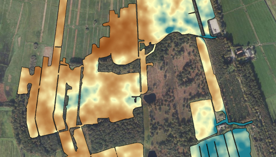
soil mapping
Soil mapping with drones
October 5, 2022
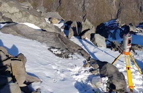
glacier monitoring
Topographic mapping for snow avalanche hazard modelling
September 28, 2022
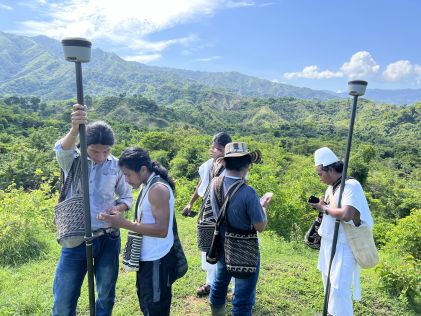
land administration
Use of GIS tools for land expansion in Colombia
August 31, 2022
digital twin
Singapore’s journey towards a nationwide digital twin
August 24, 2022
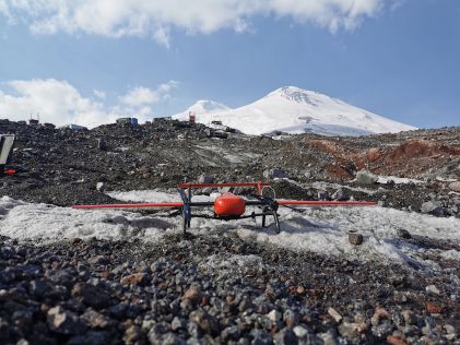
aerial mapping
Conquering Elbrus: mapping Europe’s highest peak with a UAV
August 10, 2022
land administration
Cadastre in Wartime
August 4, 2022
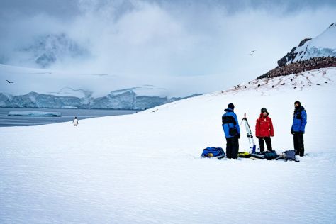
challenging conditions
Capturing the Arctic and Antarctic
August 4, 2022
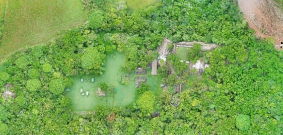
airborne Lidar
Lidar deep learning for ancient Maya archaeology
July 13, 2022
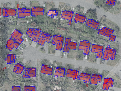
3D city modelling
Reconstructing 3D buildings using deep learning
July 6, 2022
geospatial data visualization
Representing 3D point cloud data
June 29, 2022
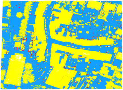
point cloud classification
Deep learning for ground and non-ground surface separation
June 9, 2022
terrestrial laser scanning
3D modelling of buildings using TLS technology
June 2, 2022
aerial mapping
Lidar survey in cloudy conditions in Cameroon
April 6, 2022
airborne Lidar
Underwater deadwood and vegetation from UAV-borne topobathymetric Lidar
April 6, 2022
←
Prev
3
4
5
6
7
Next
→
Browse by topic
Land surveying
Cartography / GIS
Remote sensing
Positioning
Urban planning
Construction & Engineering
Lidar
Articles
News
Case studies
Members
Events
Videos
Magazine
This site uses cookies. By continuing to use this website, you agree to our
Cookies Policy
.
Agree