Lidar technology for scalable forest inventory
When considering Lidar technology for forest inventory, it is essential to evaluate the trade-offs of each platform. This article provides some pointers. There is a critical n...
When considering Lidar technology for forest inventory, it is essential to evaluate the trade-offs of each platform. This article provides some pointers. There is a critical n...
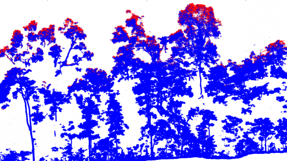
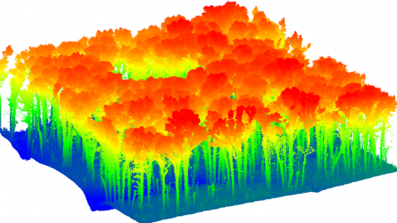
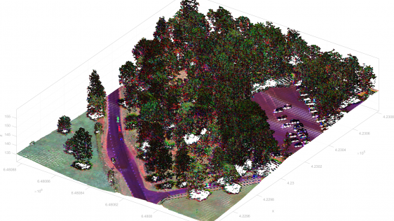
Terrestrial laser scanning is increasingly being fused with air/spaceborne Lidar to characterize vegetation structure across a range of forest ecosystems. This article explores the...
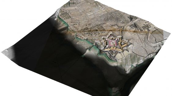
Airborne Lidar and 3D modelling technologies were used at the historic site of Fort Anne in Nova Scotia, Canada, not only as an aesthetic recreation of history, but also to help sc...
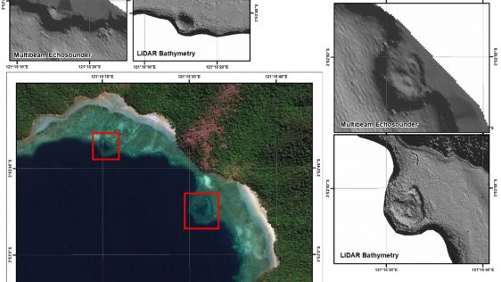
The accuracy of coastline data in Indonesia could be much improved by making use of Lidar bathymetry technology. In this article, the authors describe how Lidar bathymetry survey t...
Lidar technology is synonymous with 3D point clouds. To get the most out of 3D point cloud data, it is necessary to step back and continually consider the newest trends in Lidar te...
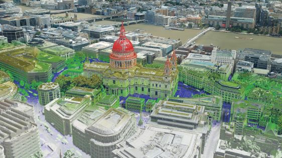
Aerial surveys conducted in the UK and Ireland demonstrate the potential of a combination of nadir camera, oblique cameras and a Lidar unit in one to meet the need for accurate, de...
The airborne market for area-wide 3D data acquisition is experiencing a noticeable trend towards a hybrid mapping concept. In the near future, most airborne data collection will in...
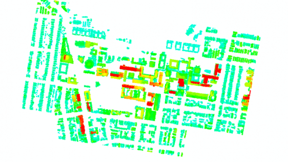
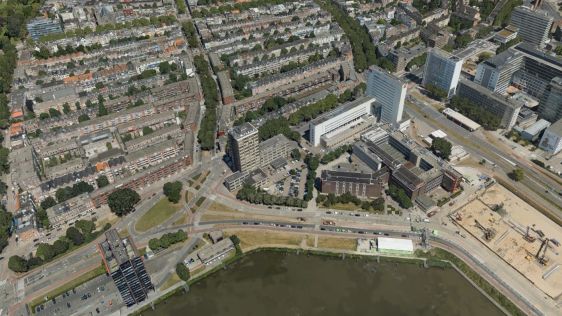
This innovative approach to measuring 3D urban growth integrates Lidar processing with machine learning. It takes account of the specific needs of urban planners, is less complicat...
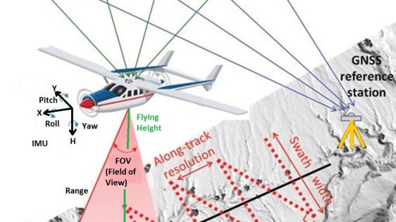
The arrival of airborne Lidar, also referred to as airborne laser scanning (ALS), has revolutionized area-wide 3D data acquisition of topography, bathymetry, vegetation, buildings...
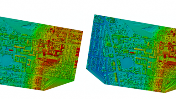
Automated measurement of the third dimension of urban growth is a crucial requirement for future urban planning and monitoring. Airborne Lidar is increasingly being used to produce...
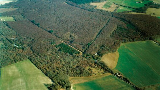
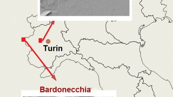
Analysis of lidar and aerial photography by Simon Crutchley and Fiona Small, both of Historic England, has led to the rediscovery of a long-speculated route in Roman times. The suc...
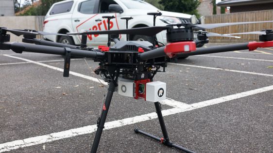
Mounting Lidar on an unmanned airborne vehicle (UAV) is regarded by many as the next geospatial frontier, but gradually the barriers are being overcome. Scientists and Lidar-...
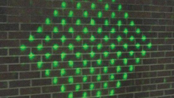
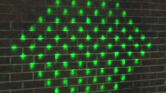
Ron Roth of Leica Geosystems and Marcos Sirota of Sigma Space Corp explain how this technology will bring benefits through faster pulse rates and denser point clouds. Current airbo...
Current airborne Lidar systems, such as the Leica ALS series, capture one million points per second. Increasing the pulse repetition rate is the best way to achieve dense point clo...
Today, automatic matching of overlapping aerial imagery and airborne Lidar are the main geodata technologies for capturing dense point clouds of the Earth’s surface. The samp...

Benoît St-Onge is a professor at the University of Quebec in Montreal, Canada. He works at the Department of Geography with a major research interest in 3D remote sensing for...

Canadian Lidar company Optech originated in 1974 as a spin-off from Allan Carswell’s research at York University in Toronto, where he had initiated one of the first Lidar res...
SPAR Europe and European LiDAR Mapping Forum 2014 was held from 8-10 December 2014 in Amsterdam, The Netherlands. The event focused on the acquisition, generation, storage and proc...
For representing terrain heights INSPIRE, which is aimed at creating an EU spatial data infrastructure, has developed specifications for digital terrain models (DTMs). DTMs are pre...
This year’s HxGN Live, Hexagon Metrology’s annual user conference, was once again held in Las Vegas, USA, from 2-6 June. Its maxim: ‘Great Stories Start Here’. From a geomatics poi...
Airborne Lidar has become a regular technology for acquiring accurate, consistent and dense point clouds. However, the constraints on specifications, available sensors and aerial p...

Compiled by editors Jie Shan and Charles K. Toth, this newly published book provides a comprehensive and in-depth treatment of Lidar as an accurate, direct method for 3D...
The first commercial airborne Lidar systems appeared on the market in the mid-1990s. This active remote-sensing technology rapidly evolved to become the laser scanners which can to...
Early in 1997 I did research on gaining insight into the error sources of airborne Lidar. As you may have read in the editorial in this issue of GIM International, 1997 was the ye...
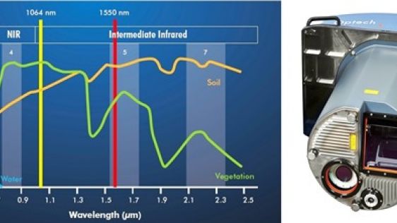
This is the second Product Survey on Airborne Lidar Sensors; the last appeared under the title ‘Airborne Laser-scanners’ in our May 2004 issue. Seven companies were willing to co-o...
Optech Incorporated focuses on the development, manufacture and support of advanced, lidar-based survey solutions. Established in 1974 as a privately held, Canadian-owned research...

Do you have an interesting idea for an article in GIM International? We are always looking for the best news and views from the geomatics industry. If you are working with the most innovative technology, have performed a challenging survey or simply want to share your perspectives on the future, please send an email to our Head of Content, Wim van Wegen: wim.van.wegen@geomares.nl. He will be more than happy to explore ways of sharing your ideas with your peers throughout the geomatics world.
This site uses cookies. By continuing to use this website, you agree to our Cookies Policy. Agree