
It is estimated that 55% of the world’s population lives in urban areas. This number is expected to increase to 68% by 2050. Studies have shown that urbanization, combined with the overall growth of the world’s population, could add another 2.5 billion people to urban areas. This growth presents a challenge to today’s urban planners – a challenge that can be partly solved by incorporating Very High Resolution (VHR) optical satellite imagery into their planning.
This rapid rate of change challenges urban planners to ensure efficient city infrastructure management whilst minimizing the impact on the surrounding environment. Satellite imagery provides urban intelligence to support urban, city and land planners in making the right decisions for sustainable urban development. It allows for detailed analysis for creating or updating Geographic Information System (GIS) maps and detecting and monitoring changes in urban and rural land use and land cover.
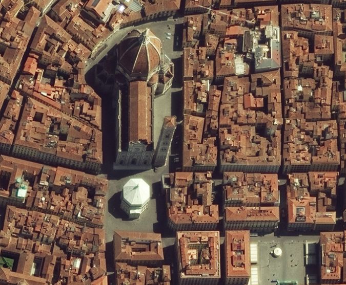
The use of remote sensing and GIS technology in urban planning applications gives enormous benefits over traditional in situ data collection methods. The data is obtained in a timelier manner, is highly accurate and reliable and can be combined with GIS to extract and classify features. Furthermore, the combination of data from optical satellites with other socio-economic data provides a crucial link in the total planning process imparting the necessary insights to make effective planning decisions.
The following article will give an overview of Urban Planning projects that have benefited from the use of VHR satellite imagery.
Arrival Cities: Classifying Urban Poor Areas
There are very few consistent empirical methods for researching and documenting urban poverty. Classified by Taubenböck et al as “Arrival Cities”, these areas suffer from enormous data gaps and have no proper classification systems.
From VHR satellite imagery, 3D building models were created of areas considered to be Arrival Cities. Using a methodology for classifying the shape and distribution of these buildings, researchers were able to create a Morphologic Settlement Type Index based on the building density, orientation, size, height and heterogeneity of pattern.
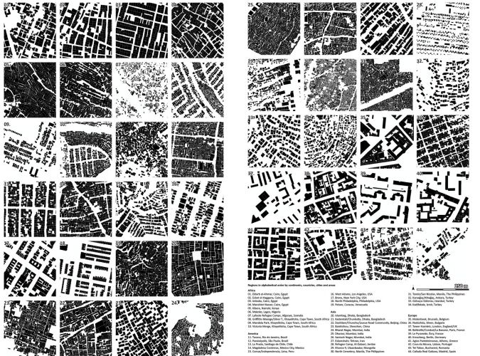
A total of three main categories of Arrival Cities were identified with transitional subcategories between them. With this classification methodology, future researchers can establish algorithms to better measure and understand the countless other Arrival Cities scattered across the planet and thereby enable urban planners to bring proper infrastructure to these unmapped and ever-changing locations.
Keyne Eye: A Tool for Smart Urban Planning
To support sustainable growth without exceeding capacity of infrastructure whilst meeting key carbon reduction targets, Milton Keynes City Council wanted to implement an automated planning management system to verify that land changes were in accordance with planning permits. Utilising very high resolution 30 cm satellite imagery bundled with 8 band multispectral, combined with artificial intelligence-based programming, Satellite Applications Catapult were able to develop a unique Urban Planning Service that allows Milton Keynes Council to intuitively track land changes and easily identify where any illegal activity may be occurring, thus making the city more efficient. The application tool, Keyne Eye, feeds directly into the council dashboard and combines eight band multispectral 30 cm very high resolution satellite imagery captured by European Space Imaging on a quarterly basis. The tool incorporates detection layers that immediately identify any changes that have occurred. These changes can then be analysed in accordance with the approved planning permits.
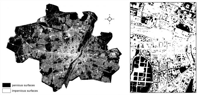
Impervious Surface Estimation: Classification and Identification*
The exponential increase of impervious surfaces for the establishment of settlements and transport infrastructure yields negative consequences in many domains. This can include increased surface runoff and flood risk, decreasing groundwater recharge, or intensification of the urban heat island effect. Thus, exact and area-wide estimation of impervious surfaces is of high value and must be repeated regularly in order to provide up-to-date information.
In urban environments, image analysis is challenging since different surface materials are concentrated in a heterogeneous and highly complex manner. In this context, VHR imagery with 50 centimeters, or better, spatial resolution enables proper recognition and identification of individual objects. This allows the classification of pure pixels with regard to imperviousness, which is realized in an object-based image analysis (OBIA) approach. Subsequent to geo-referencing, atmospheric correction as well as radiometric enhancement, spectral, textural and contextual features are calculated based on a multi-resolution segmentation via eCognition software.
These features are fed into a transferable knowledge-based classification tree in order to identify land cover with respect to different surface materials and subsequent binary classification of pervious and impervious surfaces.
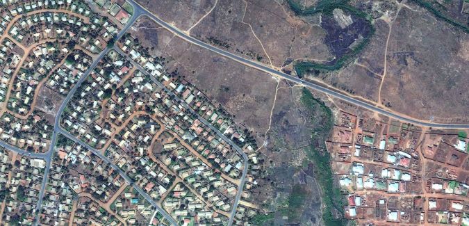
Bringing Clean Water to the City
Responding to the increasing problem of lack of access to clean drinking water in Malawi, the European Investment Bank funded a project to bring clean drinking water to recently urbanized areas of Lilongwe. European Space Imaging partnered with reseller Geoserve, in addition to the expertise of Dutch water utility company Viten Evides International, to create an accurate and current base map of the entire city in order to identify areas in need of water. Due to its enhanced feature classification and identification abilities, Very High Resolution Multispectral imagery from WorldView-2 was selected. The base map enabled the development of a plan that identified the most efficient design of a water pipe network to be built.
Madrid Rio: Identifying Green Space
Green area monitoring is a key component in urban planning around the world. The use of NDVI index from satellite imagery aids urban planners in quantifying green spaces. Monitoring these areas is important for change detection to ensure that landscape ecology principles are upheld. Within recent years, the City Council of Madrid have prioritized green area monitoring and change detection, recognizing that vegetation will help reduce the effect of the city’s Urban Heat Island (UHI), the phenomenon that causes a city and its environment to be significantly warmer than the surrounding countryside due to human activity.
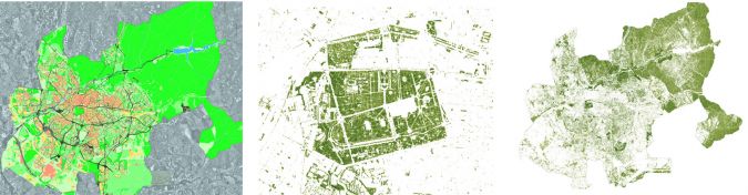
Aware that they could measure and monitor plant growth, vegetation cover and biomass production from multispectral imagery and thereby determine the city’s Normalised Difference Vegetative Index (NDVI), they turned to WorldView-2 data provided by European Space Imaging and analysed by their partner Indra, to tackle the issue. This enabled a methodology to be established that takes into account not only NDVI, but Fractional Vegetation Cover (FVC) as well. These indices helped to define structural properties of the plant canopy that are relevant for a wide range of land biosphere applications, such as environmental management and land use. Furthermore, it can provide crucial measurements as cities strive to develop green space to improve quality of life and reduce the potential hazards of climate change and human activity. The methodology created provides ongoing information for both protecting existing green space and identifying new opportunities.
European Union Strategic Environmental Assessment (SEA)
With the goal to “protect nature and strengthen ecological resilience, boost sustainable, resource-efficient, low-carbon growth, and effectively address environment related threats to health,” local governments across Europe face complex standards to meet SEA requirements. Under this directive, European Space Imaging partnered with their reseller Planetek Italia to participate in a soil loss mapping project to design value-added mapping products and standardized procedures to derive objective environmental indicators for landscape monitoring in support of decision-making processes.
Planetek Italia found WorldView-2’s ability to measure soil loss a key factor to providing the qualitative and quantitative updated knowledge of the territory to support decision makers in all phases of SEA reporting requirements. This included defining the urban plan and suitable thresholds for selected SEA indexes, as well as ensuring that land use plans are in line with the urban plan and SEA analysis.
The integration of WorldView-2 satellite imagery with existing cartographic datasets, allowed Planetek Italia to produce a geospatial product known as Preciso®. This standardized geospatial product delivers accessible and affordable reporting to assist local governments in meeting the requirements of SEA.
Conclusion
European Space Imaging have over 15 years experience working closely with a number of authorities and private companies within urban and city planning. Whether it is delivering archive data or planning fresh acquisitions, the team are available to assist a wide range of urban planning applications to ensure your planning goals are met.
*Extract from article written by Tobias Leichtle, DLR, published on European Space Imaging website.