
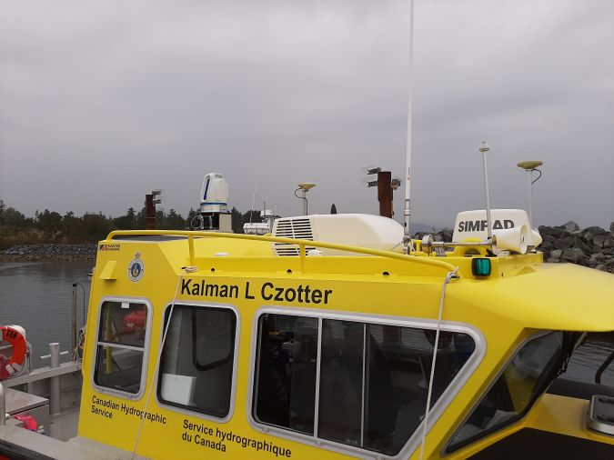
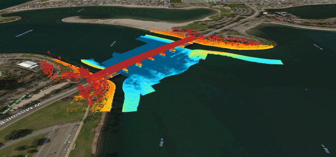
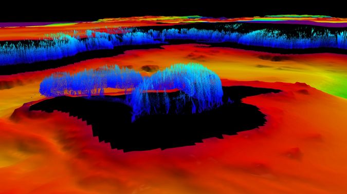
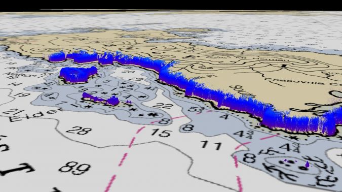
Hydrographers are increasingly aware of the added value that a Lidar (Light Detection and Ranging) scanner can bring to bathymetry survey operations. The Teledyne Optech Polaris Laser Scanner, for example, has a mobile option that enables it to be mounted to a moving platform, such as a survey vessel, to record 3D point clouds above the waterline. At the same time, the multibeam echosounder sensors collect the underwater topography. Obtaining such data simultaneously, with a seamless join between the above and below waterline point clouds, is becoming a priority for some hydrographic agencies, who need to accommodate coastal management and monitoring demands associated with factors such as climate change and sea-level rise.
“The Lidar delivers precise data that is complementary to the type of data that is usually collected by a survey boat,” says Travis Hamilton, product manager at Teledyne Geospatial. “Really, it’s combining the acoustics and the optics; both are point clouds, and the data that comes out of them is very similar, so you get a fuller picture above and below the waterline.” Looking at a bridge, for example, both above-water details and the supporting piles underneath can be brought into focus, without bringing in a new workflow and with minimal investment in terms of operator and equipment time. The result is a more efficient data acquisition overall.
Safety first
Beyond the efficiency gains, use of a laser scanner has safety benefits. Mapping near-shore features such as rocks and shoals traditionally requires surveyors to go out in a small launch with a handheld GPS. The job can be dangerous due to turbulence and rocks, and yields low-resolution results because of the limited number of points they can feasibly obtain. “Instead of having just a few GPS points around the perimeter, now with Lidar you can have a point every centimetre effectively, resulting in much higher detail.”
Range is another advantage of using a laser scanner from a survey vessel. With the Optech Polaris, the coastline can be mapped from a distance of up to 2 km. This is considerably farther than the 100-300 m offered by some systems on the market. The ability to work from afar is particularly useful where the seabed has a very gradual slope, making it hard to get close. “You can stay out in safer waters and still be able to rely on the Lidar to pick up, for instance, rocks and shoals,” says Hamilton. It’s as simple as aiming the laser scanner at the shoreline or field of interest while the vessel is conducting the multibeam sonar operations.
Workflow integration
“It’s actually quite easy to integrate into current workflows if you have a multibeam survey vessel because the auxiliary equipment you need is already there,” says Hamilton. The main external components are a Global Navigation Satellite System (GNSS) and Inertial Measurement Unit (IMU) to provide position, motion and timing information. Because that equipment is all part of a multibeam echosounder setup, the Optech Polaris can just make use of the existing sensors. For the physical setup, the operator needs only to find a suitable place to mount the Optech Polaris – usually on top of the survey vessel – and then attach the three provided cables for power, timing and an ethernet link to the ship’s network.
The Optech Polaris was originally designed for engineering measurements on land, so it is survey grade. That means it offers much greater accuracy and resolution than many systems designed for marine use, which are mapping grade. It collects 54 vertical lines of data per second – equivalent to the approximately 50 swaths per second collected by a high-end multibeam echosounder. With its unique oscillating mirror scanner, the scan rate of the Optech Polaris can be increased by reducing the vertical field of view to provide high resolution even at higher survey speeds. When integrated on a marine survey vessel, the unit is fully controlled through dialogue boxes in the data acquisition software. 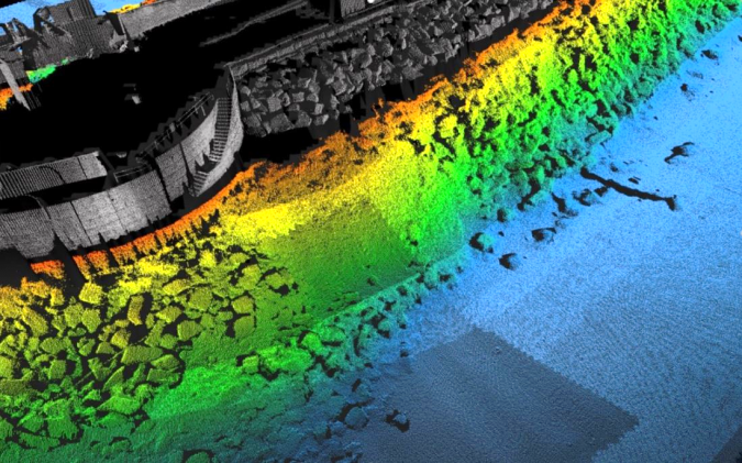
Different physics, but an almost identical end product
Though the physics of collecting the acoustic and optical data is different, the end product is almost identical. That means data from the Optech Polaris fits into the same workflows that operators are already using for the marine data. The same software and the same types of processes are applied. “The acquisition software is already running on the vessel for the multibeam data. The operator just needs to add an additional device for the Optech Polaris. There are no big hurdles or roadblocks to get up to speed on it,” says Hamilton.
Better than a drone
An alternative to the use of vessel-mounted laser scanners for shoreline mapping is aerial; for example, using a drone for data collection. However, this adds a whole other platform that has to be launched, bringing an entirely different workflow. “It’s definitely harder to manage the aerial data collection process, then try to integrate it with the multibeam data,” says Hamilton. “With Lidar on the vessel, the data is collected together and processed together. It is almost seamless.”
Teledyne Geospatial is part of Teledyne Imaging, a group of leading-edge technology companies united under the Teledyne umbrella. Teledyne Geospatial is made up of Teledyne Optech and Teledyne Caris. Travis Hamilton is the product manager for engineering survey solutions.