
Due to the wide area and complex environment, it is a challenging mission to manage important assets and protect personnel safety in power systems. With high-precision positioning technology, asset operation and maintenance (O&M) software, GIS integration and a personnel track management platform, Hi-Target provides a vast array of innovative location-based solutions and monitoring services for construction, monitoring and O&M of these vital links.
Problems faced by substations
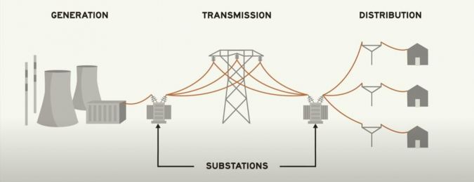
With the development of China’s economy, the scale of the power grid has continued to expand and the operation level has been greatly improved. Within China’s long-distance and large-scale power transmission system, every kilowatt-hour of electricity generated from power plants is transmitted at a speed of 300,000 kilometres per second through several or even dozens of substations over long distances before it finally arrives at the users.
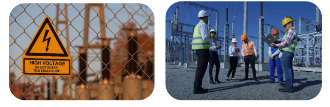
The running process of the power system consists of several parts, including power generation, transmission, transformation and distribution. The substation is a base link between power plants and users, responsible for changing and distributing electric energy. With its main function to gather, step up, step down and distribute electric power, it is the core link in the entire grid power system. The power supply plays an important role in various industries and its quality directly affects the economic benefits of the enterprises. Great importance must be attached to on-site operational safety of substations because the safe operation of substations is essential in order to provide companies and users with safe, reliable and qualified electrical energy.
Problems and risks in substations
- The number of operators in the substation is unclear
- The work area is ambiguous and straying outside of it may cause accidents
- The operators do not have a sufficiently clear understanding of the safety distance of live equipment
- The substation lacks methods to control digital precision.
Needs for substation management
- The location of operators can be tracked in real time, which is helpful for accurate control
- To manage safety and eliminate potential safety hazards
- The task flow is traceable and intelligently manageable.
The Hi-Target GIS solution
Addressing the problems and risks at their source is the most effective way to reduce the threats to people’s lives and property. To create a safe and efficient working environment, Hi-Target has developed a comprehensive GIS solution for substation management, composed of Hi-Cloud Platform, Hi-Target GIS hardware and high-precision maps.
Features
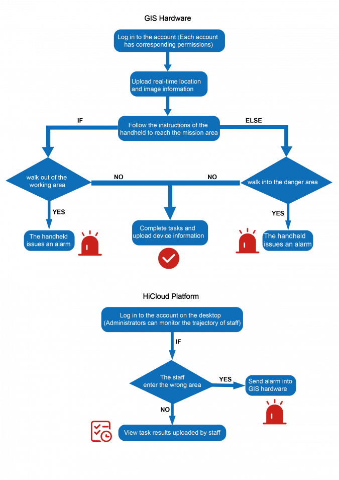
Location tracking
Combined with the high-precision maps, the solution offers the location of personnel in both real time and the past as well as trajectory information; users can refer to all this data at any time and anywhere on the Hi-Cloud Platform
Security monitoring
According to the location data, the danger area will be assigned an electronic fence. As a result, users will be warned once they enter the danger area and be accountable. Meanwhile, users can trigger the SOS alarm button on the positioning terminals and send signals to the management centre in the case of emergency.

Immediate communication
Communication between the team members ensures effective work. Within the solution, the on-site operators and the off-site managers can conduct real-time communications and release and adjust tasks.
Components
Hi-Cloud Platform
Based on Beidou high-precision technology, map visualization technology and Internet of Things technology, and using high-precision maps as the reference of time and space, Hi-Cloud Platform realizes real-time supervision of personnel and vehicles. It also provides functions such as real-time data collection and upload, intelligent inspection management, electronic fence safety warning and real-time audio and video monitoring, which can greatly streamline the workflow and improve efficiency.

Hi-Target GIS hardware
The different types of GIS hardware equipment, including a tablet, handheld, box and hat, have been self-developed by Hi-Target and designed to meet different precision requirements. This hardware also supports hardware/network dual-mode intercom and is able to send out warning signs based on sound, light and vibration.
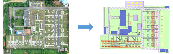
High-precision maps
To meet the operational needs, it is necessary to collect high-precision location information of all equipment in the substation range in advance, including the buildings, lawns, roads, switches, lightning rods, capacitors, transformers, terminal boxes, power boxes, etc., which are the basic data support for the realization of platform business flow.
About Hi-Target
Established in 1999, Hi-Target is the first professional high-precision surveying and mapping instrument brand to be successfully listed in China. Hi-Target provides a wide range of surveying equipment including GNSS receivers, CORS stations, total stations, 3D laser scanners, GIS data collectors, UAV/UAS and hydrographic products to offer complete commercial solutions for various industries. As the leading Chinese brand in the geospatial industry, Hi-Target invests heavily in research and development, on top of collaborating with more than 100 universities globally to bring the latest positioning technology and innovation for product development. Today, Hi-Target has approximately 3,300 employees worldwide, with an established network of 64 subsidiaries, 28 branches and more than 200 partners in over 60 countries to service and support its customers.
More information
Website: en.hi-target.com.cn/
E-mail: info@hi-target.com.cn
Tel: +86 20 2868 8296