
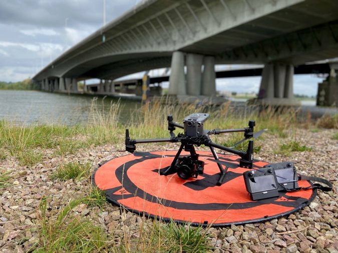
EyeFly has been working with a Phase One 100 Megapixel camera for over six years. This professional camera in combination with the company’s expertise ensures the best end product. Read more below about the benefits of this camera and how it can support inspection and mapping projects.
Map a larger area in less time
The image above shows how large the area is that can be captured with a 20, 45 and 100 Megapixel camera. As shown, a 100 Megapixel camera captures a significantly larger area in one go. This enables work to be carried out much more efficiently: fewer photos are needed to map a larger area, meaning that flying takes significantly less time.
Capture 6 times more surface area
“Compared to the most commonly used 20 Megapixel cameras, we gain an average of 6 times as much surface area in the same flight time. Because we capture a larger area in one go, this also means that we can process the images quicker and more efficiently,” says Remco Kootstra, CEO of EyeFly.
Everything for the desired final product
“High quality photos make for high quality products. For each project, we determine how we will collect the photos and with what resolution. In this way, we can ultimately deliver the desired product. A 3D point cloud is often the basis for our end products, requiring the level of detail of the point cloud to match the products that are being realised.”
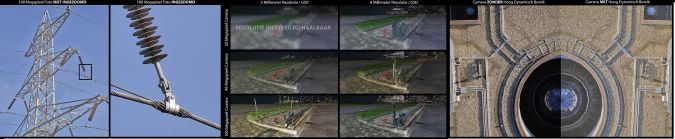
More depth and details through dynamic range
As EyeFly does not always fly in the most optimal weather conditions, there are additional challenges. In certain weather conditions; for example, if it is a dark and extremely cloudy day, or if there is a lot of sunshine, shadows can appear in the images. This significantly impacts the visibility of small details. The iXM 100 Megapixel camera from Phase One offers a high dynamic range, allowing the shadows and dark photos to be edited easily with appropriate software. This increases the depth of the image and results in substantially better visibility of important details.
About Eyefly
Founded in 2014 as one of the first professional drone companies in the Netherlands. As a pioneer in the field of drones, Eyefly has developed into one of the most versatile, innovative and professional drone companies focussing on inspections, data processing and 2D and 3D mapping.
Eyefly is fully certified to conduct commercial drone flights within Europe. This way the contractor can be certain that the flights are executed in a safe and reliable manner and that they are all carried out according to the appropriate laws and regulations.
Eyefly has extensive knowledge in every field of expertise. By having various specialists for every application, we ensure accurate and complete data to the highest standard.
One of the specialties is gathering and processing geographic data. Eyefly provides 2D and 3D models which are the basis of volume measurements, altitude readings, DTMs (Digital Terrain Models), 3D visualisations and maps for project management purposes.
Besides geographic data, Eyefly also specializes in inspections. Possible markets are oil and gas, offshore, construction, civil and installations. Gathering data in both infrared and RGB are amongst the possibilities.
Inspections of wind turbines, insulation, leakages, solar panels, power pylons, objects and hard to reach locations are the most common applications.
Learn More
Eyefly - eyefly.nl
Phase One - geospatial.phaseone.com