3D City Modelling Takes Development and Transformation of Urban Areas to New Level
A 3D city model enables city councils and urban planners to go beyond traditional city development and share their vision with their citizens and stakeholders, writes Ron Roth in a recent column. 3D city models allow the user to make informed decisions based on visual or quantitative data. Having meshes and models available promotes efficient vetting of proposed solutions to urban maintenance and development challenges. These models also allow accurate analysis of issues and simplify the evaluation of alternative solutions, offering a common base map for all stakeholders. Base data only needs to be collected once and can be used in many analytical tasks, thus reducing costs by not having to re-collect geospatial data each time different analysis is needed. In other words, it introduces a smarter workflow for urban management.
During urban development, much consideration is given to preserving sun exposure because natural daylight has a positive effect on people’s lives. 3D city modelling applications allow the study of sunlight and shadows, showing the effects of the proposed development and, if necessary, suggesting appropriate action that can be taken. The city model provides underlying information for each object, so-called ‘smart 3D objects’. The user simply needs to select the respective point at a location and the respective information is exposed. By connecting GIS Layers ,any person can access relevant data, whether for tax, risk or other analytical purposes. It merely depends on which data and subject matters have been previously tied to the city model. City visualisation enables users to rapidly explore the model at any desired location and level of detail. Thanks to streaming services, the visualisations are even available on mobile devices and can therefore serve as a personal or vehicle navigation backdrop.
Data collection and processing
The end-user application presents or analyses georeferenced information and can potentially visualise both above-ground and underground infrastructure. While the Leica CityMapper delivers the above-ground base layer, the user can add as much or as little below-ground information as needed, gathered from existing design files or from leading-edge tools such as mobile ground-penetrating radar (GPR) systems.
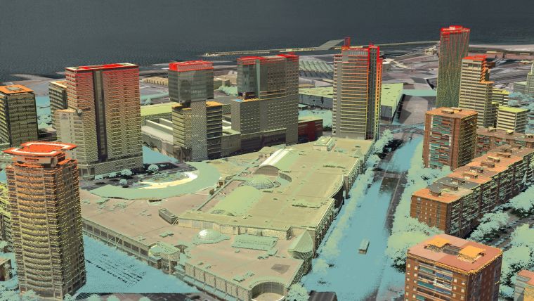
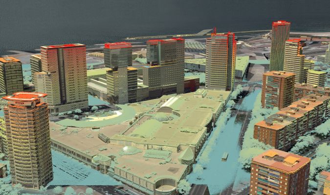
Leica RealCity is an airborne mapping solution specifically designed for smart city applications such as 3D visualisation and modelling. First, the data needs to be captured with the Leica CityMapper. After the data collection, the imagery and Lidar raw data are processed with Leica HxMap, which enables the use of a single processing application, ensuring an effective and efficient work process.
Technology applications
3D city modelling can be used for several purposes, such as urban mapping and risk management. The basic models can support asset management and emergency response planning but also add the possibility for a pedestrian-eye view. This is especially beneficial to create enjoyable experiences for tourists. Being able to proactively manage general risks – like flood risk – or more specific ones – such as security ‘viewsheds’– can be extremely valuable. Moreover, the application can be a helpful tool to see how a city has developed or will transform over time. The mesh visualisation output makes the changes readily visible. The analysis is not limited to the city structures alone, however, but can also be used to evaluate the environment such as wind patterns, solar loading and storm water drainage. These are the areas where the availability of true 3D building models is an enabling technology. Transportation planning is fundamental in every city and has traditionally been analysed in 2D. However, the 3D city modelling application further enhances the analysis and can improve the quality of life for many residents.

Value staying current with geomatics?
Stay on the map with our expertly curated newsletters.
We provide educational insights, industry updates, and inspiring stories to help you learn, grow, and reach your full potential in your field. Don't miss out - subscribe today and ensure you're always informed, educated, and inspired.
Choose your newsletter(s)


