3D Model of Zagreb
Real and Virtual
Presented here is the process of making a virtual 3D model and a scale model of the Croatian capital, Zagreb. The virtual model was made using photogrammetric mapping of rooflines, together with a Digital Terrain Model, aerial photography and digital true-orthophotos. A scale model of the city was also made using 3D print technology.
A 3D city model is a digital representation of the Earth's surface and associated built objects in the urban area. Digital city models are usually classified by level of detail (LoD). There are five different categories of urban area presentation, from LoD0 to LoD4 (see for detailed description of LoDs page 27). Various LoD categories also imply difference in accuracy and minimal dimensions of modelled objects/object details. The general decision in this case was that the 3D city model of Zagreb should be LoD3.
Optimising Data
The aim of the entire project was to produce a high-quality and updated geodetic survey map which would contain all the topographic data, including a digital terrain model (DTM), 3D model of buildings, and a true orthophoto map. To collect and produce all this data Geofoto carried out an aerial photo survey with its own Cheyenne Piper aircraft in September 2008, capturing 4,000 aerial images (GSD=8cm) with 80% intra-strip and 60% inter-strip overlap, using Vexcel UltraCam X. After image capture, various methods of data extraction were tested. The automatic creation of digital surface models (DSM) resulted in disappointing accuracy and produced surfaces which did not corresponded with those wanted. Moreover, alternative methods to photogrammetry, such as automatic DSM creation or airborne Lidar, provide only geometry of the Earth's surface and no semantic information about objects; when triangulated this results in so-called ‘polygon soup'. Additional data enrichment with semantic attributes is time consuming. In contrast, manual extraction of information from photos enables assignment of predefined attributes to object elements while the operator collects data.
Orthophotos
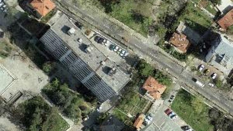
One of the products to be delivered by this project was true orthophotos. So a choice was made of 60% side overlap between adjacent image strips and an intra-strip overlap of 80%. Apart from delivering true orthophoto maps, true orthophotos were used for application on the terrain of the 3D city model. Buildings and other tall objects are not transferred from central to orthogonal projection on traditional orthophotos, so they appear to lean, rendering invisible part of image content around them (Figure 1 (top), left). This effect has been removed in the case of the true orthophoto by rectifying building pixels (Figure 1, right). Scale 1:1,000 DTM data was collected for the whole city using digital photogrammetry stations (Intergraph Image Stations). DTM with 8cm grid and planimetry mapping specifications were prescribed by the State Geodetic Administrations.
Structural Elements
Roof structures were defined by photogrammetric mapping of roof lines. When creating a 3D model, the most important roof element is the eave line (blue line in Figure 2, left) which defines a building as a unit in both geometric and logical terms. Building facades are also generated when this line is orthogonally projected onto the terrain surface (green lines in Figure 2). The minimum size of the roof element should be at least 5m by 5m; this is the size that can be printed by 3D printer without being destroyed in production.
LoD3
Once measured and classified, structural elements have first to be joined to make one structural and logical unit: the building. This is done by computational means using CityGRID Modeler, which derives 3D faces from roof structure lines (Figure 3). Facades are generated by projecting the building eave line onto the terrain. All vector data was imported using standard XML (Extensible Mark-up Language), which has the clear advantage of being readable by people. Orthoimages and aerial images were imported too to create LoD3 representations of buildings (Figure 4) and finally to generate the complete 3D city model together with the DEM. Each building model is defined by its line structure and textures. The software features tools for efficient and simple line editing. Once the change is made on the unit, software archives an old version of it and creates a new one. All the data is stored in a relational database which provides efficient data versioning, archiving and general 3D-city data manipulation.
Modelling
To create real scale models two in-house Z510 Spectrum 3D printers were deployed, from Z cooperation, headquartered in Burlington, Massachusetts, USA (Figure 5). Three-dimensional printing is a form of additive manufacturing technology in which a three-dimensional object is created by collating successive layers of material. The technology allows for full colour printing and is fast: two layers per minute. Three-dimensional models represent reality using a collection of various geometrical entities, in this case the collection of triangles organized into shells and solids. The first postulate of transferring virtual reality to the material world is that the model has to be represented by one solid geometric body. Once the geometry of the virtual model is fixed the 3D printer software slices it into horizontal layers and sends them to the printing device. Each layer is printed by deposition of a fine powder material, subsequently fixed by the binder deployed in standard inkjet technology. The printing of each of the 527 blocks of maximum size 25.4 x 35.6 x 20.3cm, together constituting the scale model of Zagreb (Figure 7), took approximately three hours.
Concluding Remarks
Both 3D city model and scale model have already proven a very accurate and trustworthy 3D data base, especially for city planners; several datasets have been provided to Zagreb City Bureau for Strategic Planning, and the feedback has been more than good. Some strategic infrastructure projects were also presented to the City Government based on this 3D model. Its potential is indeed great, but it will depend on City Government services to what extent this potential will be realised and how much impact it will have on the development of urban infrastructure. The scale model drew much public attention when it was exhibited in the Town Hall in May 2009. Audiences saw it as new attraction, and experts were impressed by the detailed overview it provided with its authentic roofs, terrain structure and textures.

Value staying current with geomatics?
Stay on the map with our expertly curated newsletters.
We provide educational insights, industry updates, and inspiring stories to help you learn, grow, and reach your full potential in your field. Don't miss out - subscribe today and ensure you're always informed, educated, and inspired.
Choose your newsletter(s)


