3D Solutions to View Cities from Different Angles
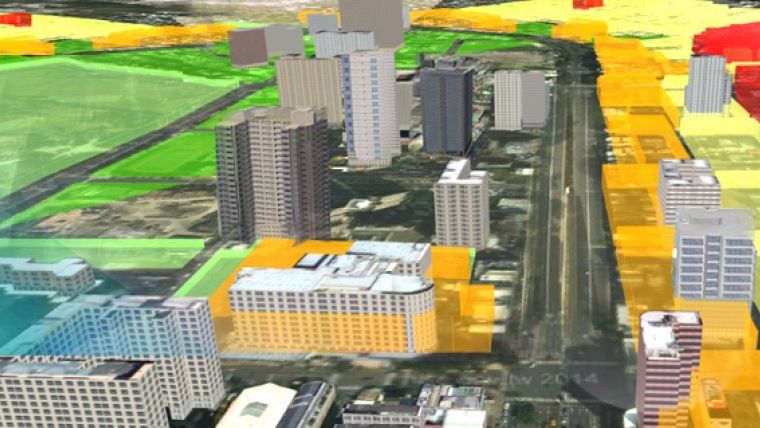
Due to the progress of information technology and hardware, many organisations are seeking to use advanced 3D technology to display their spatial data. In line with this trend, Supergeo has come up with a 3D solution. With SuperGIS 3D tech, users are able to simulate any viewing angles that may previously have been difficult to achieve with 2D GIS software. The SuperGIS 3D solution will help people to grasp the overall information of a particular area effectively, making policy formulation and discussion easier.
Currently, Supergeo provides 3D tech in SuperGIS Desktop and SuperGIS Server respectively. Desktop GIS users can use the extension SuperGIS 3D Analyst for 3D visualisation of spatial data. It also includes two commonly used features, SuperGIS Globe and SuperGIS Cube, which both allow users to load image data, vector data, or elevation maps in the 3D environment. Also, they can help users identify surface changes, query the information of specific points, and calculate the viewshed in the 3D environment.
Policy-making
Furthermore, image data, vector data, and surface data can all be overlaid on the map by 3D Analyst to simulate the landscape of real world or to build a surface model. Other than the desktop version, Supergeo also offers a 3D solution for server users. It will assist to publish data to the server end so that users can share them with people around the world. Users may check the map published by SuperGIS 3D Earth Server through various types of browsers (should support HTML5), desktop software and mobile apps, which might accelerate the process of policy-making.
GIS professionals who would like to know more about SuperGIS 3D solutions, a global webinar was just held by Supergeo recently. In this webinar, the Supergeo product team has demonstrated how the land management authority can benefit from web-based 3D cadastral management. The webinar recording of SuperGIS 3D cadastral management is available here.

Value staying current with geomatics?
Stay on the map with our expertly curated newsletters.
We provide educational insights, industry updates, and inspiring stories to help you learn, grow, and reach your full potential in your field. Don't miss out - subscribe today and ensure you're always informed, educated, and inspired.
Choose your newsletter(s)


