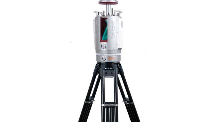
A Closer Look at the RIEGL VZ-2000i Terrestrial Laser Scanner
Based on a future-oriented, innovative new processing architecture, internet connectivity and RIEGL‘s latest waveform processing Lidar technology, the RIEGL VZ-2000i Long Range 3D Laser Scanner System combines proven user friendliness in the field with fast and highly accurate data acquisition. The terrestrial laser scanner was launched at Intergeo 2017 as the company's latest innovation for mapping and surveying professionals in the mining industry.
Further applications include topography, construction site monitoring, natural hazard surveying, archaeology & cultural heritage documentation, city modelling, tunnel surveying and civil engineering.
Background tasks in parallel to data acquisition
Its new processing architecture enables execution of different background tasks (such as point cloud registration, geo-referencing, orientation via integrated Inertial Measurement Unit, etc.) on-board in parallel to the acquisition of scan data. A full documentation of the scanner’s software components – directly accessible on the RIEGL VZ-2000i – provides a sound basis for creation of your own Python apps to enhance the scanner functionality.
Automatic On-board Registration
Matching point clouds of different scan positions (registration) has always been one of the most time-consuming tasks during the post-processing of 3D scanning projects. With two processors on-board, the RIEGL VZ-2000i carries out some post-processing tasks in real-time such as automatic on-board registration in parallel to the scan data acquisition. Find here some examples on how this feature may be utilised to fasten the registration process in open-pit mine surveying.
The system provides highest flexibility by supporting numerous peripherals and asccessories such as the integrated GNSS unit for high accurate RTK solution, a SIM Card slot for 3G/4G LET, WLAN, LAN, USA, and different other ports of external units.
RIEGL’s Waveform-Lidar technology enables such high speed, long range, high accuracy measurements even in poor visibility and demanding multi-target situations caused by dust, haze, rain and vegetation.

Value staying current with geomatics?
Stay on the map with our expertly curated newsletters.
We provide educational insights, industry updates, and inspiring stories to help you learn, grow, and reach your full potential in your field. Don't miss out - subscribe today and ensure you're always informed, educated, and inspired.
Choose your newsletter(s)


