A Cross-border 4D Project Reinforcing a Shared History
Trans-media Storytelling Made Possible by Geomatics
The Terra Mosana project is reinforcing the shared history in the territory where Germany, Belgium and the Netherlands meet. Today’s official country borders are relatively new, and geomatics can be used to show not only former geographic relationships, but also cultural ones. Bringing the region’s countless stories to life in interactive 4D experiences helps people to understand how previous inhabitants moved around for work, marriage, faith and fun. Professor Roland Billen, a geomatics expert from the University of Liège, is coordinating the project.
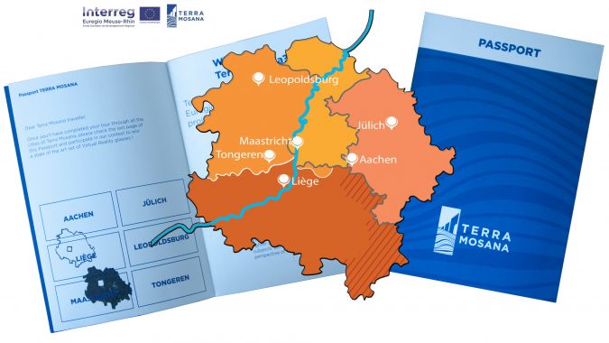
The Terra Mosana project is a collaboration between 20 partners – municipalities, heritage sites, museums and universities – spanning three neighbouring countries: Germany, the Netherlands and Belgium. The goal is to increase tourism by providing on-site multi-media 3D models of the cultural heritage past and present, including the use of virtual reality (VR) and augmented reality (AR). Once they have experienced one site, visitors are expected to want to see all the digital narratives related to the shared history in the other five cities, which are all within an hour’s drive of each other. This four-dimensional digital project, combining time with positioning, could even boost the sense of a common cultural background among the region’s four million inhabitants. Phase 1 has just been completed at a cost of €4.2 million, 75% of which was funded by the EU under an Interreg arrangement. The funding discussion is currently underway regarding a possible follow-up later this year.
Coordinating 20 different institutes was a sizable challenge, according to Roland Billen, especially since many of them had limited IT knowledge, let alone an understanding of spatial IT. “Many partners now have new knowledge – about how to acquire data, how to best visualize it, how to store it and share it, intellectual property rights – that they can use in the upcoming digital evolution in the heritage sector. And we geomaticians learned a lot about history, the world of museums and archaeology. History offers context for the here and now,” comments Billen. He represents the Geomatics Faculty of the University of Liège (Belgium) and was appointed lead partner of Terra Mosana: “13 cross-border storylines, mainly written by the historians, were selected and cropped with the help of civilians in participatory design workshops. Then the digitalization could start.”
Integrating Digital Products
Besides the governance aspects, another challenge during Terra Mosana lay in integrating the digital elements into 3D models. The geodata acquisition itself was no problem, recalls Billen: “Laser scanning and photogrammetry were the most used techniques, so nothing new. The technical partners from the universities of Liège and Aachen had a clear view of the type of 3D data quality that could be produced. We helped historians and archaeologists to select the right techniques and write their specifications to get a good quality project. One important way we added value as geomatics professionals was by assisting the other partners, not only in visualizing but also in integrating spatial data and models in the AR and VR applications.”
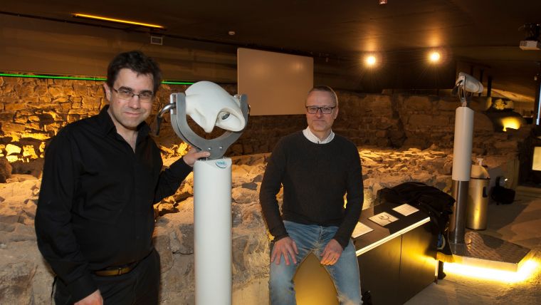
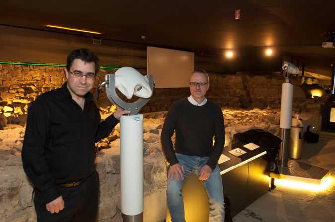
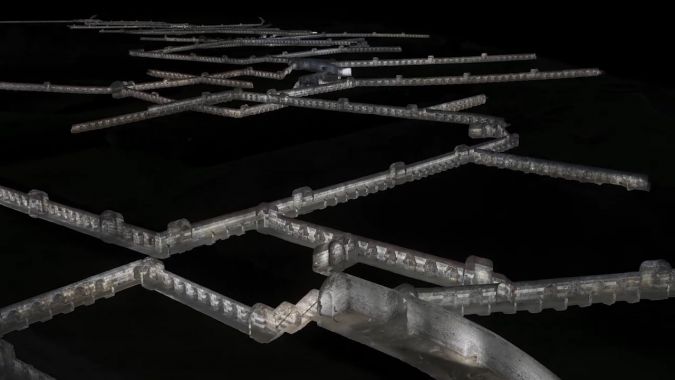
The images have been combined into videos and can be played on screens, tablets, smartphones and/or VR headsets at the sites. Visitors can see towns, cathedrals, landscapes and interiors change over time in the cities including Tongeren, Liège, Jülich and Aachen, plus a World War II conflict zone in Leopoldsburg and an 18th-century 11km underground defence network in Maastricht. Sometimes a short movie featuring actors has been added, such as at the underground Archéoforum in Liège: the site of the remains of the enormous cathedral in the city centre. The cathedral was built on top of a house where the bishop who ruled over a large part of Terra Mosana territory was killed around 1,300 years ago. As visitors look at the actual ruins of his bedroom, they simultaneously see interactive VR images of the murder, and they can move around to explore the room ‘virtually’. “‘It wasn’t easy to get the geometrics right within the constraints – not only of the virtual room, the roof and the moving objects such as the deadly spear, but also to make sure that the actors behaved as if they were in that exact room. It all had to fit in the same 3D model. And especially because 3D modeling itself was new for most partners; they just saw it as a ‘video’!”
The partners wanted to create an interactive app for smartphones that combined attractive visuals with a geometrically correct environment, but that presented several other challenges. For example, scanning of the inside of the cathedral in Aachen, where many emperors ruling the territory were crowned through the ages, resulted in a massive amount of points. The level of geometric detail had to be reduced without negatively impacting on the image quality for the users. Points were substituted by approximating polygons and then the images were projected into the polygons. The resulting mesh does not have extremely accurate positioning, but the images look realistic. On Apple devices, augmented reality is automatically added as visitors walk through the cathedral, following their position.
Governance
When 20 cross-border partners are involved, good governance makes or breaks the project. Therefore Roland Billen asked specialist Joep Crompvoets from the University of Leuven for help with establishing the rules and processes. Professor Crompvoets comments: “It was a successful journey for the partners, during which they built up an interesting personal network. According to our latest survey, most partners intend to continue working together even if the Interreg funding is reduced. They recognize that continuing with Terra Mosana will provide added value to them.” Among the projects that the partners would like to continue are the storylines, the 3D experiences and the implementation of co-creation with the public. Although the project was hindered by COVID-19 restrictions which affected workshops, exhibitions and public engagement, he explains that some valuable lessons were learned: “The complexity of the Interreg project management has been a serious burden. For a possible follow-up, it is essential that the administrative workload drops significantly in order that more time can be invested in effective project outcomes. We also concluded that it is important to engage people from marketing and tourism in the follow-up. A stronger communication plan and stronger engagement with the public are recommended too.”
Whenever cultural heritage sites are digitized, legal questions arise relating to copyright protection of the original work, ownership of the generated digital products and access regimes to such content. “This aspect of dissemination of the output was an interesting topic for us, since cross-border jurisprudence is sparsely available,” adds Crompvoets.
Licensing
EU member states are required to make publicly funded research data available for commercial and non-commercial purposes free of charge. Since the research carried out as part of the Terra Mosana project has been publicly funded, such open access policies will partly apply which may lead to Creative Commons licences. However, data products for which third parties hold intellectual property rights are excluded in the EU directive. This is certainly the case in the Terra Mosana project, where commercial parties are involved in the realization of the experiences. The Creative Commons tool and flowchart have enabled the Terra Mosana partners to determine which licence is best suited to them, and the conditions under which they want to share their creative content.
In projects such as Terra Mosana, it can make sense for partners to consider signing non-exclusive intellectual property licence agreements for some or all of the output generated. Given the potential complexity, it is highly recommended to seek legal advice when negotiating licensing agreements. The specific terms depend on the work at issue, such as images, 3D models, maps and database rights. In a multi-regional context such as the Terra Mosana project, multi-territorial licences will be likely. It should also be made clear who owns the intellectual property: all Terra Mosana partners jointly, or individual partners? The rights granted can be limited so the licensee can use the right only in the defined field (e.g. cultural or touristic services), while Terra Mosana partners themselves retain the exclusive right to exploit it in a different field (e.g. gaming, apps). Crompvoets and Billen agree: “We have to constantly create awareness that Terra Mosana partners should ask for ownership of all the data collected by third parties, not only of the resulting video or app. They must be able to re-use the point clouds or photogrammetry data in other digital projects without having to pay for their own data.”
Next Phase
This intellectual property rights issue will resurface in the next phase, when the currently rather locally oriented experiences will be extended using parts of each other’s projects to create new ones together. The existing presentations will be upgraded to cross-border storylines. Roland Billen: “We have a platform at Liège University that stores all the data. This year, we can capitalize on what we have and connect.” There’s one small problem: not all partners used the same 3D model. “It wasn’t appropriate to keep pushing for that, although it would have made life much easier. Working with three different countries introduces an element of an identity struggle. No one wants to be forced to work with some standard that they are not used to, and every discipline has a different vision on standardization. So we will have to make the formats and models technically interoperable."
In the first phase, the attitude was pragmatic; the partners needed to achieve local success in exchange for additional funding. In Joep Crompvoets’ view, this was “almost inevitable, but we also see that today they know better what to expect and how it promotes the territory they are part of, and proud of. Now it is time for them to reap what they have sown. They’ve seen that topology can be used to show not only geographic relations, but also cultural ones.”
His colleague from Liège confirms: “Terra Mosana is a spatio-temporal concept: this is where the things happened. Geomatics or territory is the ‘glue’. Modern cartography has even more added value in territory without official borders. Additionally, the EU Commission is becoming interested in the effect on sustainable development and social cohesion. For academia, the impact of location-based digital experiences on the public’s interaction with cultural heritage is a theme worth researching. Trans-media storytelling and gamification will be the norm. But don’t forget about paper,” he adds with a broad smile. “There’s already a Terra Mosana ‘passport’. It’s a gimmick, but even adult visitors are keen to get them stamped.”
Further Reading

Value staying current with geomatics?
Stay on the map with our expertly curated newsletters.
We provide educational insights, industry updates, and inspiring stories to help you learn, grow, and reach your full potential in your field. Don't miss out - subscribe today and ensure you're always informed, educated, and inspired.
Choose your newsletter(s)


