A Little Innovation Goes a Long Way
The Netherlands’ Cadastre, Land Registry and Mapping Agency, was the first mapping authority in the world to fully automate the production of multiscale maps and data. This was a huge accomplishment, because although the mapping community had buzzed about the potential of automating multiresolution geospatial map production for decades, many were still sceptical that it could even be done. The feat is even more impressive considering that it was carried out by a small, motley team that was in a bind.
(This article is brought to you by Esri, the global market leader in GIS)
In 2010, the government in the Netherlands legislated that the Netherlands’ Cadastre had to update the nation’s topographical maps more frequently – every two years instead of every four to six years. At the same time, however, the geoinformation department at the Netherlands’ Cadastre was facing staff and budget cuts as a result of the ongoing global recession. The department was going to have to produce more information at a quicker clip with fewer people.
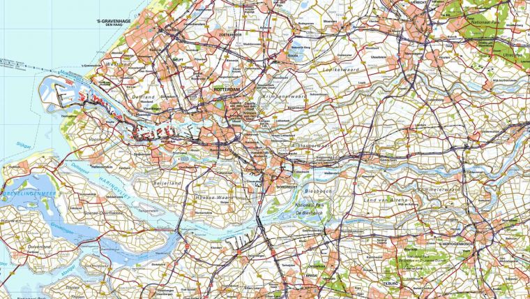
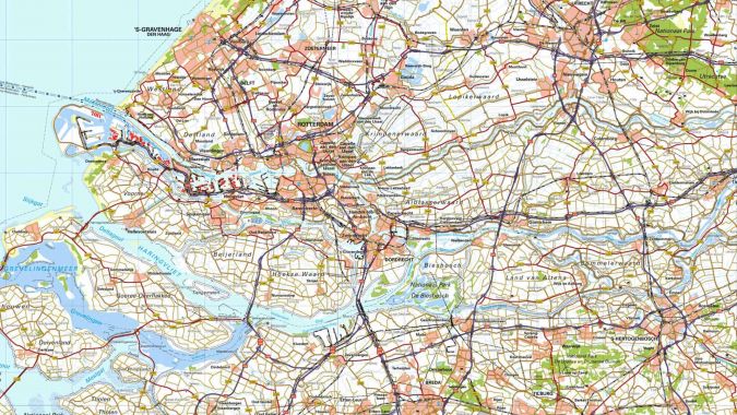
Multiresolution geospatial map production
Ben Bruns, the manager of the Netherlands’ Cadastre’s GIS customer solutions department, knew that his team was going to have to innovate. He had received a tip from Jantien Stoter, a professor at Delft University of Technology who was also a consultant at the Netherlands’ Cadastre that Esri had some automation technology that was ready to use. Bruns took that information and ran with it. “Within half a year, we had accomplished automatic generalisation,” said Vincent van Altena, a senior GIS specialist at the Netherlands’ Cadastre, referring to what would become multiresolution geospatial map production. “It wasn’t perfect, but it was fully automated. Even the most severe critics were amazed at what we had done.”
“The system takes the Netherlands’ Cadastre’s best-scale data, which is TOP10NL, and automates the process from beginning to end, using that data to automatically produce the map products it needs,” said Mark Cygan, Esri’s director of national mapping and statistics solutions. “The system encapsulates the production process in 400 geoprocessing models, which are aggregated into three big geoprocessing models. The team can then push what Ben calls the make map button to generate maps for the whole country in one pass.”
Automatic generalisation
Now, the Netherlands’ Cadastre delivers updated and higher-quality topographical maps of the Netherlands in less than two years. And, according to Cygan, the organization keeps improving.
“The last I saw, the Netherlands’ Cadastre was able to do all the 1:50,000-scale maps for the country in two weeks with one operator,” said Cygan.
But the innovation didn’t stop there. After automating the Netherlands’ Cadastre’s 1:50,000-scale maps, the team was soon able to automate the Netherlands’ 1:100,000-scale maps, as well as the country’s basemap, which has 15 different zoom levels. Then the geoinformation division automated all its maps with scales ranging from 1:25,000 to 1:1,000,000.
“This was Ben’s vision from day one, when he started with automatic generalisation,” said Iris Reimerink, a senior GIS specialist at the Netherlands’ Cadastre. “The day we did it was a milestone for him. I remember him saying, ‘I knew this was possible long before we started it.’”
Once the Netherlands’ Cadastre had figured out how to automate its own map products, Bruns and his team set out to share what they did with other mapping agencies around the world. In the ensuing years, the team hosted four workshops that national geospatial authorities from at least 25 countries attended. The group not only taught these agencies about the technology that makes automation work, but it also shared how it handled the change management part of the process.
“Mapmakers from Ordnance Survey Ireland (OSi) attended the workshops, and there’s a direct correlation to the incredible automation work they have done over the past few years,” said Cygan. “Same with Great Britain’s Ordnance Survey (OS) and many other mapping authorities around the world.” While all this was accomplished by a skilled team of people working both at and with the Netherlands’ Cadastre, “it was Ben’s leadership, and the belief of Cadastre’s executives in his leadership abilities, that made it all possible,” added Cygan.
Testing ground
Bruns, who has a master’s degree in geoinformation technology from Vrije Universiteit Amsterdam, began his career at the Netherlands’ Cadastre as a cartographer. He quickly progressed into management roles, including the head of one of the cartography division’s sections, the product manager for topography, and the manager of GIS customer solutions. According to several colleagues, he’s always found ways to innovate.
Around 1995, he was commissioned to lead the Dutch contribution to the Vector Map (VMap) program, an international project that encouraged countries to digitize and share their map data. In addition to being project leader, Bruns was an active developer on VMap, cooperating with both IT and production staff. When VMap was replaced by the Multinational Geospatial Co-production Program (MGCP), a defence initiative aimed at digitizing and sharing high-resolution vector data for places dealing with humanitarian or military crises, the Netherlands’ Cadastre’s topographic service (which is now the geoinformation department) became a testing ground and quality control centre under Bruns’ leadership.
Bruns was also closely involved in the development of TOP10NL, a 1:10,000-scale topographic geodatabase of the Netherlands. “Ben was one of the originators of this,” said van Altena. “He designed the data model along with his colleagues and led the technical implementation. That’s really important because if there was no TOP10NL, automatic generalisation would not have been possible.”
It also wouldn’t have been possible without Bruns’ imaginative leadership style. When his team suddenly had to accelerate map production, he came up with a concept called HIGH5, which brings people from different departments and backgrounds together for five weeks to solve a problem. “This was one of the first times we used HIGH5,” recalled van Altena. “The results were so promising that we got the green light to keep using it.”
Customer-oriented approach
As the Netherlands’ Cadastre waded deeper into automation, Bruns and his boss, Ulrike Schild, head of geoinformation at the Netherlands’ Cadastre, also adhered to the lean management philosophy. “The philosophy is, you have a lot of spillage in a production process, so you need to try to eliminate that. The best way to do that is to evaluate all individual production steps, and if it does not add customer value to your end product, it has to go,” explained Marc Post, who’s also a senior GIS specialist for the Netherlands’ Cadastre. “This customer-oriented approach was something completely new within the Netherlands’ Cadastre, and it took a lot of effort and courage to introduce that into a world of traditional cartographic work.” “This had a huge impact on production acceleration,” added van Altena.
Another management philosophy that Bruns abides by is having a heterogeneous team. “The members of his teams must have different expertise,” said van Altena, whose background is in theology. “If people from different backgrounds are able to communicate with each other, they can come up with different ideas.”
“In his quest for a team, Ben is looking for unique characters, not copies or clones,” said Reimerink, whose training is in conservation and GIS. “Each member of my team is creative, tenacious, independent, and stubborn,” said Bruns. “Incredible innovations arise from the energy that comes from giving these distinctive people space and direction.” “He also truly believes that everyone on his team is doing their best and is being honest about what’s going on,” added Post, whose background is in conservation as well. “Without that trust, the innovation doesn’t happen.”
New rules
In the same vein, Bruns trusted the Netherlands’ Cadastre’s customers to tell his team what they wanted to see in their maps and involved them directly in the automation process. “Cartographers have a traditional way of doing things, according to a list of specifications, but to automate our map production, we had to create new rules,” Post explained.
“Ben’s team members said, these maps aren’t going to look like they did in the past, but they’ll meet customers’ needs,” said Cygan. “They then went directly to users and asked, is this map going to meet your needs and do everything you need it to do? All of the Netherlands’ Cadastre’s major customers were happy with the results, and many said they couldn’t tell the difference from previous maps. Other mapping agencies, including OSi and OS, are finding the same thing.”
Now that the Netherlands’ Cadastre has a handle on automatic multiscale mapping, Bruns’ team is in the process of developing an automatically constructed 3D topographic dataset for the Netherlands, taken from point clouds and 2D base data. The geoinformation division is also exploring using machine learning techniques for topographic data. It seems that the innovation will never stop.


Value staying current with geomatics?
Stay on the map with our expertly curated newsletters.
We provide educational insights, industry updates, and inspiring stories to help you learn, grow, and reach your full potential in your field. Don't miss out - subscribe today and ensure you're always informed, educated, and inspired.
Choose your newsletter(s)


