A Truly Photogrammetric UAV
AviSystem/Taxus SI
The AviSystem UAV was made on the assumption that it was intended to be a photogrammetric system. Hence, when designing the AVI, it was created for long, stable, precise and efficient flying – photogrammetric flying.
| AVI right before take-off. |
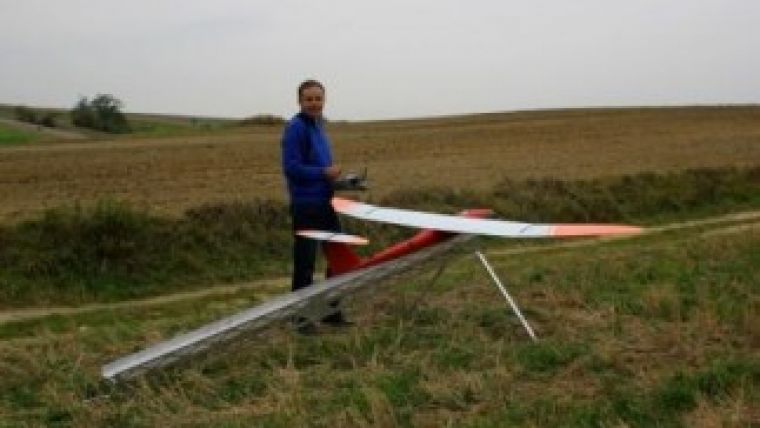
The Polish company Taxus SI Ltd. embarked on the AviSystem project in 2009 with support from the European Regional Development Fund. Poland’s best specialists in the field of unmanned aircraft construction were invited to join the project. Design of the entire system, of which the main element is the AVI drone, was completed within two years.
The AVI is an electrically powered sailplane with a span of 3.5m. The construction is made of carbon fibre which is lightweight, durable and resistant to damage as well as ensuring a high-quality surface finish. The airframe is very well integrated with the autopilot which precisely retraces flight routes and at the same time controls the photographic module. Two types of non-metric digital cameras are used: a DSLR Canon 550D and SIGMA DP2 compact cameras (one for RGB and the second is modified to capture near infrared), both with fixed focal length lenses. The current battery capacity allows a flight time of one hour and is adapted to the conditions of UAV missions in Poland (flying with visual sight). The battery can be enlarged if necessary.
Standard photogrammetric missions provide images for areas of several square kilometres (from one flight), maintaining a 5-15cm ground resolution from the altitude of 250-400 metres AGL. Several flights can be integrated to cover areas that are dozens of square kilometres wide. The AviSystem team uses EnsoMOSAIC desktop software for image processing since it allows for full process control, although other software brands can also be used. During 2011 and 2012, AVI carried out hundreds of test flights and orders covering a total area of approximately 250 square kilometres. This
| A small part (0.52 sq km) of one flight over Gluchow forest in RGB, the same part in Infrared channel middle) and in Color Infrared (under). |
article provides some interesting examples.
Głuchow – CIR Imagery
Gluchow forest is situated in central Poland and is surrounded by agriculture land and several villages. It belongs to the Warsaw University of Life Sciences – SGGW, the Faculty of Forestry. It was also one of the test polygons for AviSystem.
In 2010, flights were performed over a 1.6 sq km section of Gluchow forest. Images were acquired by two Sigma DP2 cameras which registered the RGB and NIR ranges. A 15cm ground resolution was achieved from the altitude of 350m AGL. Images were processed in the aerial triangulation and orthorectification processes into RGB and CIR orthophoto maps using EnsoMOSAIC software. The CIR material was used to evaluate the health of spruce stands: sick, weak or dead spruce trees are visible in the bluish-green colour, in contrast to the red or pink colour which indicates healthy individuals.
Czajka – Industrial Infrastructure
The Czajka sewage treatment plant in Warsaw is in the final stages of construction. It is situated in the north-eastern part of Poland’s capital city and occupies the area of 0.5 sq km. It is a modern facility which will provide a wastewater treatment for a large area of the city and improve the environment. Together with the Warsaw Geodesy Enterprise (WPG S.A.), it was decided to prepare the orthophoto map for documentation and inventory of the construction phase. In December 2012, AVI performed one flight at an altitude of 250m AGL. RGB images were taken with a Canon 550D camera with 28mm lens. Using EnsoMOSAIC, the orthophoto map was prepared with 5cm resolution. It was used to present a detailed infrastructure of the area around the Czajka plant.
Road Construction Monitoring
There has been considerable investment in Poland’s road infrastructure in recent years, and photogrammetry is useful for many purposes in this industry. The test performed with the AVI photogrammetric UAV reveals that aerial images can serve to document the status and monitor the progress of work.
The A2 motorway connecting Warsaw and Poland’s western border is one of the country’s key projects. The AVI fitted with a Canon 550D camera performed a flight above the Wiskitki (near Zyrardow) junction at 250m twice: in September 2011 and August 2012. The area of the site was approx. 1.6 sq km and the resulting orthophoto achieved 5cm ground resolution. The second flight, conducted after the 2012 UEFA European Football Championship, perfectly illustrated the progress in the construction phase within the space of a year.
Forest Monitoring and Border Verification
In Poland, forestry management is based on 10-year forest management plans. Silviculture activities and natural disasters (hurricane, fire, flood, etc.) make it necessary to monitor the state of the forest and to update forestry maps and databases. The AVI was of particular benefit in a 2.5 sq km forest area where storm had randomly broken down fragments of pine stands. A quick analysis performed on the orthophoto map (15cm resolution) allowed the cause of pine weakening to be detected (unsuitable for the habitat conditions) and a species composition for renewal to be well chosen.
| An example of an orthophoto map of 12.25 sq km out of a total of 88.5 sq km of the S7 express road. |
In another case, AviSystem was very useful in verifying the borders of silviculture and harvesting operations and for updating forest numerical maps. In July 2012, the AVI UAV carried out several one-hour flights over the Krasnystaw forest complex (in the south-east of Poland) in order to provide up-to-date images for orthophoto map creation. At over 20 sq km, the area was notably wide. Images were taken with a Sigma DP2 camera from 250m altitude. The whole orthophoto map was integrated with layers of the forest numerical map and GPS measurements.
Performance Challenge Test
The S7 express road connects Warsaw and Krakow. The southern part is scheduled for modernisation, which is currently in an early phase of design. In September 2012, the regional office of the General Directorate for National Roads and Motorways ordered the preparation of an orthophoto map and vectors of building silhouettes within a 1km buffer along variants of S7 route, which amounted to a total area of nearly 140 sq km. This task was undertaken using a manned aircraft equipped with a Hasselblad H3DII-39 camera. The orthophoto map was prepared using EnsoMOSAIC PRO software, as also used for the photogrammetric UAV-acquired data.
This represented the ideal opportunity to test the performance capabilities of the AVI airframe. It was equipped with a Sigma DP2 camera and flight routes were prepared for the altitude of 350m AGL, maintaining ground resolution of 15cm for the images. Good weather conditions allowed several days of missions to be performed for consecutive segments of S7. The AVI achieved an excellent result: in the period between 11 September and 20 October 2012, the UAV conducted no less than 83 successful flights, acquiring 31,340 images for an area of approx. 88.5 sq km. Mission operations were agreed with the FIS office and Krakow airport flight control (part of the area lies within the CTR). The test is being continued – within free resources, orthophoto maps are being prepared for the successive
| A good impression of AVI's size. |
flight routes. It is worth emphasising that data quality (images and flight log data) and EnsoMOSAIC features allowed trouble-free image processing.
The extra effort involved in the test aside, a comparison of quality between the images acquired from the UAV and those from manned aircraft shows that images captured by a UAV are of higher quality, producing clear, high-contrast and vivid colours. The flight altitude of the manned aircraft certainly had an impact, since the air photos were taken through a thick layer of autumnal air.
AviSystem has now been in active operation for two years, and it was exploited particularly intensively in 2012. The company has two working AVI units, although one is predominantly a reserve. A visual and technical assessment of the condition of the aircraft shows that the number (nearly 300) and intensity of missions (the AVI has had to fly in winds of over 15 m/s yet still provided images which produced good-quality ortho) has not had any great impact. At a similar level of exploitation, the AVI can withstand many more years of service. In summary, it can be concluded that the initial assumptions on which the AVI was based have been entirely confirmed during service.
In the future, AviSystem is destined for true photogrammetric missions in which quality of data matters, the performance (predisposed to relatively large areas) and repeatability of the mission are important, and durability of the structure is appreciated.

Value staying current with geomatics?
Stay on the map with our expertly curated newsletters.
We provide educational insights, industry updates, and inspiring stories to help you learn, grow, and reach your full potential in your field. Don't miss out - subscribe today and ensure you're always informed, educated, and inspired.
Choose your newsletter(s)


