Advanced Image Processing in Browser
New GIS Platform for Satellite Image Search, Storing, Analysis and Visualisation
Most image analysis tasks that required ENVI or Erdas Imagine software are now available online thanks to EOS Platform, a new cloud service launched by Earth Observing System (EOS). It provides GIS professionals with a one-stop solution for search, analysis, storing and visualisation of large amounts of geospatial data.
EOS Platform is an ecosystem of four mutually integrated EOS products, which together provide a powerful toolset for geospatial analysts. Image data obtained from LandViewer or uploaded from a user’s computer is stored in cloud-based EOS Storage and is instantly available for remote sensing analysis or image processing.
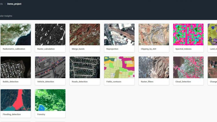
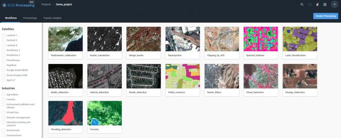
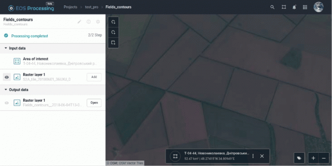
EOS Processing offers a special experience with its sixteen processing workflows that run online. They include the popular raster tools (merge, reprojection, pansharpening), remote sensing analytics, photogrammetry, and proprietary feature extraction algorithms designed by EOS engineers and data scientists to address the main challenges of agriculture, forestry, oil, gas, retail, city planning, defense and other industries. Such pre-processing tasks as cloud detection or radiometric calibration refine raw data for further analysis: images can be corrected for atmospheric effects in order to obtain the real ground radiance or reflectance values.
On top of that, users can get the best cartographic features of EOS Vision for vector data visualisation and, as announced for the future, its analysis. Among other features announced for the upcoming updates are Lidar analysis and 3D modelling.
Data agnostic platform
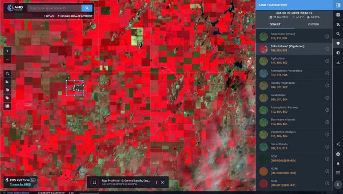
When it comes to raster data, users can work with a variety of satellite and airborne datasets in EOS Processing, EOS Storage, and LandViewer, which enables quick and intuitive search of images within collections of Sentinel-1 and 2, Landsat 8 and 7, MODIS, NAIP, CBERS-4, Landsat 4 and 5. Other than downloading images from public datasets, users can also upload their own GeoTiff, JPEG, JPEG 2000 files and apply GIS data processing algorithms via API or from the web interface. EOS Vision is a tool for vector data operations with multiple formats support (ESRI Shapefile, GeoJSON, KML, KMZ).
Object detection, change detection, and classification
The convolutional neural networks, pre-trained by EOS to extract features from imagery, let you apply the latest methods to detect objects and track changes from space.
- Having only a set of multi-temporal images and change detection workflow, users can track how illegal deforestation progresses over time.
- Edge detection can show the exact boundaries of agricultural lands down to the last pixel.
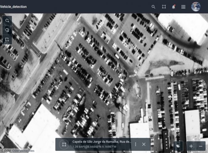
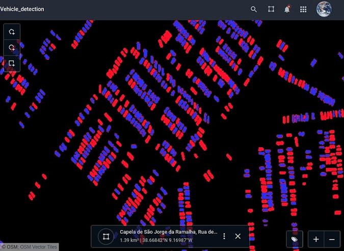
- It is possible to estimate the parking lot traffic of largest shopping centers with car detection algorithm.
The best of spectral analysis
Products within EOS Platform support almost all remote sensor types and the user can choose from a long list of spectral indices to calculate on the fly. Aside from the complete set of vegetation indices (Normalized Difference Vegetation Index, NDVI; Red-Edge Chlorophyll Index, ReCI; etc.), there are also indices to outline landscape features (Normalized Difference Water Index, NDWI; Normalized Difference Snow Index, NDSI) and burned areas (Normalized Burn Ratio, NBR). One of the most useful features is the ability to experiment with spectral bands: users can create custom band combinations and indexes on top of the default ones.
Customise and analyse
The user-friendly interface of EOS Processing makes it easy to manage processing workflows depending on the user’s business needs. You can set the parameters for processing and repeatedly use such customised workflow to automate high-frequency analytical tasks. The coming updates will add an ability to create custom algorithms from the available data processing operations.
Agriculture, forestry, oil and gas, and more industries
A tandem of EOS products form a comprehensive toolbox both for general use and for industry-specific cases. With vegetation indices and crop classification feature, agronomists can continuously monitor crop conditions to detect plant diseases, pests, and droughts. Forestry specialists can assess fire damages, monitor forest health, track and enforce logging restrictions.
EOS Platform is a great choice for regional and urban planning. It helps users identify land cover classes to generate a vegetation map and can also make a complete list of urban features like buildings, roads, or other major features in the region.
The platform can tackle disaster management by measuring flood extent and finding fire boundaries. When it comes to oil and gas, it is capable of identifying oil rigs and assessing the environmental impact.
Unlock the full potential of Earth observation data with EOS Platform, directly in your browser: https://eos.com/platform
Authors
A collaborative work of EOS Data Analytics team.

Value staying current with geomatics?
Stay on the map with our expertly curated newsletters.
We provide educational insights, industry updates, and inspiring stories to help you learn, grow, and reach your full potential in your field. Don't miss out - subscribe today and ensure you're always informed, educated, and inspired.
Choose your newsletter(s)


