Airborne photogrammetry: still going strong after 100 years
Today, after 100 years of continuous innovation in airborne photogrammetry, entire countries can be mapped faster than ever before. Which advancements and trends have dirven the demand for geospatial imagery, and where does the future of photogrammetry lie?
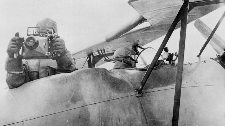
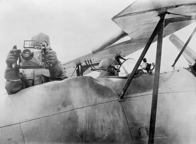
Airborne photogrammetry has been around for more than a hundred years. As early as 1851, the French inventor Aimé Laussedat began imagining the possibilities of using the newly invented camera to capture reality through pictures for mapping purposes. Some 50 years later, the technique was successfully employed, and photogrammetry emerged as a long-range landscape measurement technique through analysis of analogue photographs. In the 1920s, Heinrich Wild took professional photogrammetry to the sky with WILD’s first aerial camera, the C2. In the following 80 years, the industry progressed from analogue to digital cameras, fulfilling the dream of photogrammetrists to quickly create detailed maps.
Photogrammetry today
Today, after 100 years of continuous innovation in airborne photogrammetry, entire countries can be mapped faster than ever before. The exponential technological advancement since the digital era has led the industry to evolve, grow and excel. Developments in cloud computing and artificial intelligence (AI) on the processing side as well as sensor miniaturization and chip technology on the hardware side have opened up new opportunities. Every IT innovation propels the industry to new heights.
Several industry trends have led to the increasing demand for geospatial imagery in recent years. With our world changing faster, more frequent refresh rates are required and mapping cycles have accelerated. Customers now want to capture larger project areas at increasing measurement density, while budgets decrease. Other considerations are open data policies and growing interest in monetizing the captured data. As geospatial data becomes more important, more and more stakeholders are involved in the procurement process. All these trends drive the need for increased productivity and new, creative business models.
Innovations in technology
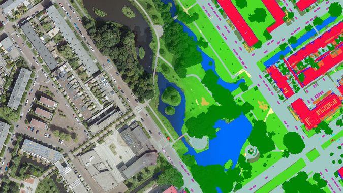
The fast evolution of complementary metal oxide semiconductor (CMOS) sensors is delivering higher resolutions. Advancements in cloud technologies and GPUs result in greater processing power and capacity. AI and machine learning (ML) enhance data extraction capabilities. The miniaturization of components means more and more features fit into one instrument. The Leica CityMapper-2 hybrid oblique imaging and Lidar sensor is one example of how miniaturization has enabled what was not possible previously. It contains a Lidar system, data logger, GNSS/INS system and six cameras in one compact package. This enabes it to fit in the same space as past cameras, while its all-in-one package design improves reliability. The same concept applies to software: multiple apps with unique functionality have become part of a unified high-performance multi-sensor workflow platform: Leica HxMap.
Big IT is driving the photogrammetry revolution on the data and processing side. Customers now have the ability to process data in the cloud using platforms like HxMap, spinning up between 2,000 and 20,000 machines to accelerate processing and scale their capacity as needed. With AI and ML unlocking analytics, automatic feature extraction and object detection, we can put geospatial data to use in different ways. For instance, instead of trying to understand natural disasters after they happen, we can start mining information in advance to create contingency plans. Cloud services enable the hosting and streaming of geospatial data in one central place, providing an easy method for consumption, distribution and access for all.
The future
The future of photogrammetry lies in hybrid sensors which capture imagery and Lidar data simultaneously. In fact, at Hexagon we believe in this so strongly that we do not envision imaging-only systems to remain viable as customers’ expectations exceed the capabilities of such systems. Instead, hybrid systems enable the capture of more data from every flight, allowing digital twins to become more efficient and affordable for a larger customer base. While the past 100 years of photogrammetry have been exciting, I have no doubt the next 100 years will be even more remarkable.


Value staying current with geomatics?
Stay on the map with our expertly curated newsletters.
We provide educational insights, industry updates, and inspiring stories to help you learn, grow, and reach your full potential in your field. Don't miss out - subscribe today and ensure you're always informed, educated, and inspired.
Choose your newsletter(s)


