Ask the Specialist: GPS Signal Tracking
Have you ever wondered about the GPS signal-tracking capabilities ‘L1P, L2E'? One of our readers asked our specialist for an explanation, and this is what he replied.
We received the following question from one of our readers: “While researching GNSS receiver specifications for various survey-grade products, I’ve observed that some of them list the following GPS signal-tracking capabilities: ‘L1P, L2E’. I have not been able to find a reference to these specific signal frequencies. Are they brand-new frequencies that may not be listed in the various signal specifications available online and/or could they be just ‘window dressing’ that really has no bearing on the signal tracking and performance of the product?”. We passed this question on to Huibert-Jan Lekkerkerk, contributing editor at 'GIM International' and an expert on GNSS and positioning, to solve the issue. This is his answer:
Without further details, this is a tricky question to answer. L1P usually refers to the P code transmitted on the L1 frequency (and the L2 frequency). This is a regular code that is reserved for military use. In the early days and especially during the Gulf War, the P code was plainly transmitted. Older and/or military-capable receivers may list this as a code which can be received. However, it cannot be used because the code as such is not transmitted anymore; it has been replaced by its encrypted version, the Y code. By the way, Glonass also has a P code with the same functionality on the L1 and L2 frequencies.
The L2E code is a bit of a mystery. I assume it was found in the documentation for a slightly older receiver, perhaps dating from the early 2000s. In those days, the signal modernization plan for GPS had not yet been completed and different frequency designations were ‘created’ to indicate future possibilities. There is currently no L2E signal that I am aware of. However, the E could also refer to the ‘Enhanced L2C’ which functions essentially the same as the L2C code but is available on the GPS Block III satellites (which were probably only in the design stage when the specifications for the receivers you found were drawn up).
Then as now, it’s not unusual for some marketing departments – depending on the manufacturer – to promise the reception of signals that are essentially worthless in real-word navigation. One example is the long-promised reception of Galileo even when the only satellites in space were Giove-A and Giove-B. The specifications for Galileo were not even definitive until 2010, but most receivers were fully capable of using it according to the marketing departments (and only if you checked the small print would you see: “With a future firmware update…”). Often, what is meant is that the receiver is capable of obtaining the frequency but not of actually using the signal.
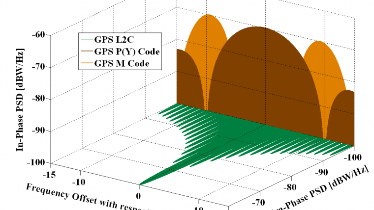
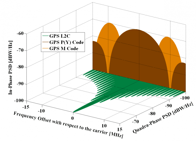
The full frequency/signal plan can be found in the Interface Control Documents (ICD) and Interface Specifications for GPS: https://www.gps.gov/technical/icwg/. If it is not in the ICD, it does not officially exist! In this case, the document does list a set of L2C codes including L2CM, L2CL and two enhanced versions. Essentially, they are all normally designated as L2C in receiver specifications as they form part of the same signal.

Value staying current with geomatics?
Stay on the map with our expertly curated newsletters.
We provide educational insights, industry updates, and inspiring stories to help you learn, grow, and reach your full potential in your field. Don't miss out - subscribe today and ensure you're always informed, educated, and inspired.
Choose your newsletter(s)


