Be Part of the Solution, Not the Problem!
FIG Working Week, Rome, Italy
Are surveyors relevant in today’s rapidly developing world? Do they take responsibility? Surveyors have a mandate to acquire and record data and information on people’s relationships to land, thus providing knowledge to governments for decision-making – but do they actually deliver? FIG president CheeHai Teo invited participants to discuss and analyse these and other issues during the FIG Working Week in Rome, Italy, held in May 2012.
Many of today’s challenges are land-related: food security, poverty eradication, impacts of climate change, resource and disaster management, protection of ecosystems and rapid urbanisation. All these developments have a spatial dimension, and surveyors have a responsibility when it relates to sustainability of developments.
During the Working Week, it was repeatedly stated that some 70 percent of the people-to-land relationships are either not properly documented or not documented at all. Globally, this amounts to between 4 and 5 billion cases, ranging from customary lands, informal areas and state lands to marine environments near coastal areas. To change this, radical and unconventional approaches are needed.
Continuum Paradigm
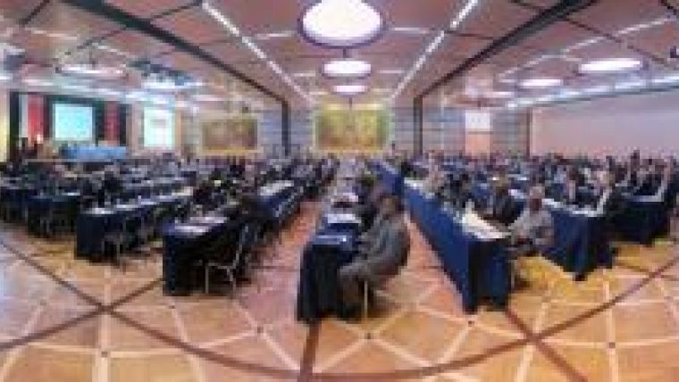
In his opening address, president CheeHai Teo stated that the profession is now firmly in the continuum paradigm: “The Continuum of Land Rights from UN HABITAT is embraced, and now we must adopt a continuum of approaches, a continuum of technologies and technological sophistication, and a continuum of accuracies. It should be understood by the profession that progress has to be made beyond securing tenure rights for all, into land valuation and taxation, land development and construction and the land market.” President CheeHai Teo further stressed that surveyors need to become inclusive and innovative. This requires open standards to be embraced, and interoperability not only between systems but also institutionally and legally, he said. Conditions are a culture of collaboration and sharing, and avoidance of duplications in activities. Platforms must be created that enable knowledge, information and data to be delivered from different scales and origins and for different purposes. The surveyor 2.0 is a measurer, a modeller and a knowledge-manager (Figure 1).
Interoperability with Pro Poor Systems
During the special session with the Global Land Tool Network and UN Habitat, the continuum paradigm was discussed further. The plurality of tenure systems and land rights requires interoperability between pro poor land recordation and conventional systems, to allow a step-by-step upgrading of land rights. Gender issues – women’s access to land – remain critical. The continuum paradigm is valid for recording approaches. Highly rigorous and accurate methodologies as practised by registered or licensed surveyors are not pro-poor approaches. Instead, they are costly and time-consuming and often focus on protecting land rights for the elite – resulting in less than 10% coverage in some countries. This issue demands further discussion by the International Federation of Surveyors, in particular during next year’s FIG Working Week in Nigeria to encourage surveyors, especially in Africa, to consider alternatives. Meanwhile, less accurate but participatory approaches require an enormous capacity for data collection.
Voluntary Guidelines
The Voluntary Guidelines on the Responsible Governance of Tenure of Land, Fisheries and Forests in the Context of National Food Security were adopted by FAO immediately after the FIG Working Week 11 May 2012. Land and natural resources are under threat worldwide. Good and non-corrupt governance is essential to ensure economic growth and proper land tenure systems. It has become clear that FIG’s expertise can make a valuable contribution to the implementation of the voluntary guidelines.
Future of Cadastres
GIM International and FIG collaborated on organising a special session on the future of cadastres, in follow-up to a previous discussion in GIM International. Experts from around the world provided their opinions as the basis for discussion. Topics ranged from the problem of land with services (including a step-by-step move to formality: from public transport, to pavements and utilities, to titles) to the sheer number of unregistered land parcels. There was general agreement on the need for transparency, and that approaches must be participatory. The importance of new technologies was discussed, along with alternatives for data acquisition such as crowdsourcing, and the quality challenges were examined. It became clear that some colleagues prefer an accurate approach while others see benefits in starting with unconventional and less accurate approaches which can be improved later. The session also discussed Africa’s role in solving the world’s food problems – the continent’s current contribution is minimal, but a proper arrangement of land rights would improve the situation. A lot of work still has to be done, and there is no single solution. While existing bureaucracies are not succeeding in benefiting citizens, more standards like the Land Administration Domain Model can stimulate change; such standards encourage the software industry and the open-source community to develop systems, and support the development of land administration in a de-central environment with spatial data infrastructure links offering national perspectives.
Keynotes
The professional input from Italy was provided by Franco Maggio, Director, Agenzia del Territorio who spoke about the Italian Cadastre and the Real Estate Taxation. The ‘hidden buildings project’ was particularly interesting: a massive extraction of more than 1 million buildings unknown to the cadastre using high-resolution aerial images (Figure 2). One could see this as the opposite of crowdsourcing. Prof Orhan Altan, president of ISPRS and also representing the FIG sister organisations, spoke about the use of geospatial information in disaster management. This was also one of the main sub-themes of the conference, including a special session on the Japanese earthquake and experiences from New Zealand, Italy and Turkey. Prof Altan explained that it takes a lot of effort to establish what information exists, where to find it, how to access it, what the costs are, how current it is, and its quality. Alexander Mueller, Assistant Director General, Natural Resources Management and Environment Department, FAO spoke about the Voluntary Guidelines. Norbert Lantschner, Past Director, Clima Haus discussed the ‘New Goal of Building Sustainable’ and Prof Karl-Friedrich Thöne, President of DVW addressed surveyors in his speech ‘Meeting the Environmental Issues – A Challenge for Surveyors and Surveying Associations’. He also started the series in which the presidents of major FIG member associations had the opportunity to address the international audience. Mario Resca, General Manager, Evaluation of the Cultural Heritage spoke in his presentation entitled ‘Enhancement of Cultural Heritage through the Public Awareness’ about projects to increase visitors to, and awareness of, Italian cultural museums. Fabio Remondino from FBK, Italy held a presentation on using technology in 3D surveying and modelling technologies for the digital preservation of cultural heritage. The last speaker was See Lian Ong, president of RICS (2011-2012), who provided an insight into BIM in his presentation ‘Preserving the Built Environment: Importance of Building Information Modelling’.
Technical Sessions
The technical programme included more than 100 technical sessions, forums and workshops. At the event’s peak, there were 12 sessions running in parallel, and there were nine presentation slots during the three conference days. The technical sessions included normal papers, shorter flash presentations mainly on case studies, and some 40 peer-reviewed papers that passed the double-blind peer review process. The technical programme covered all ten FIG technical commissions. In addition there were sessions organised by three task forces: FIG Africa Task Force, Property and Housing, and Surveyors and Climate Change. In addition, there were special sessions on preserving cultural heritage, history of surveying and sessions for the FIG Young Surveyors Network. There were three platinum sponsors of Working Week 2012: Esri and Trimble, who have both been the major conference partners of all FIG conferences in the current period, and CNGeGL (Consiglio Nazionale Geometri e Geometri Laureati, our colleagues from Italy) who largely sponsored the opening ceremony and dinners as well as accommodation at the conference hotel. Esri and Trimble were also the main sponsors of the FIG Young Surveyors Conference and the IAG/FIG Commission 5/ICG Seminar, which were also sponsored by Cassa Geometri and CNGeGL. Featuring 20 exhibitors, the exhibition filled the foyer area outside the technical session rooms, which allowed an excellent flow of visitors to the stands during the three days of the event. A particularly interesting part of the exhibition was the display of the Cavaliere family’s old surveying instruments, details of which were also presented in a special book.
Conclusions
Based on the number of participants, the FIG Working Week 2012 was the biggest FIG Working Week ever: more than 1,500 participants attended from 96 different countries. The overriding conclusion was that a mindshift is needed. All surveyors need to contribute to finding solutions to today’s challenges, and surveyors with protected positions supporting only a segment of society do not contribute in a sustainable way. In his impressive closing speech, FIG’s president CheeHai Teo said, “We have to communicate and advocate, to develop and deliver, and to be inclusive and innovative. We have to enhance significance and relevance towards betterment.”
The message is clear. Surveyors are encouraged to become part of the solution by bringing innovative, unconventional, cost-effective and participatory approaches, especially in their main activity of land administration. Inflexible, costly and time-consuming approaches favouring the elite are not expected to have a future. Land administration is for the benefit of all.

Value staying current with geomatics?
Stay on the map with our expertly curated newsletters.
We provide educational insights, industry updates, and inspiring stories to help you learn, grow, and reach your full potential in your field. Don't miss out - subscribe today and ensure you're always informed, educated, and inspired.
Choose your newsletter(s)


