Borough of Poole Makes a Splash with MapThat
This article was originally published in Geomatics World.
Borough of Poole local authority has upgraded its mapping capabilities, both within its intranet and on the website. The new technology has improved information access for Council employees and the public alike, while simultaneously reducing costs and enhancing efficiency.
Borough of Poole previously had 30 licences of a desktop GIS (geographical information system), but identified several shortcomings in the accessibility of information and in the way Council facilities were mapped. “Our desktop GIS enabled our employees to do only basic data capture,” explains Steve Campbell, Borough of Poole’s GIS manager (Corporate Strategy & Communications). “And because it did not extend to our intranet, many employees did not have access to this data at all.”
Exact locations
With over 66,000 households and a long-standing reputation as a successful tourism destination, Poole already provided a website search tool for locating facilities closest to an inputted postcode. This still exists, but is somewhat cumbersome and temperamental. The local authority also recognized that many people looking for municipal services (such as the nearest car park) would be tourists and, therefore, unlikely to know the postcode of their own location. The only other alternative was to view a list of service locations as text.
Another area in need of improvement was the way in which residents reported problems such as potholes, litter or a broken streetlight. The vast majority phoned their reports into the customer services department, who entered the information onto a database. Taking details this way invariably used up a sizeable chunk of customer service time, particularly as people were not always able to give the precise location of the issue. Some residents did log onto the website to report a problem but had to give a description on an e-form which, again, often resulted in rather a vague description of the spot.
“Our engineers would often have to drive up and down the street, looking for the problem,” says Steve, “which was obviously not an efficient use of internal time and resources. We needed to be able to channel residents through a fully self-service system which would enable exact locations to be pinpointed by the customer. These issues, plus the expense of our GIS annual maintenance, prompted us to source a more sophisticated but cost-effective solution.”
Understanding spatial elements
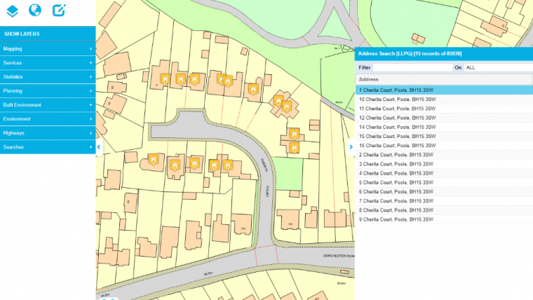
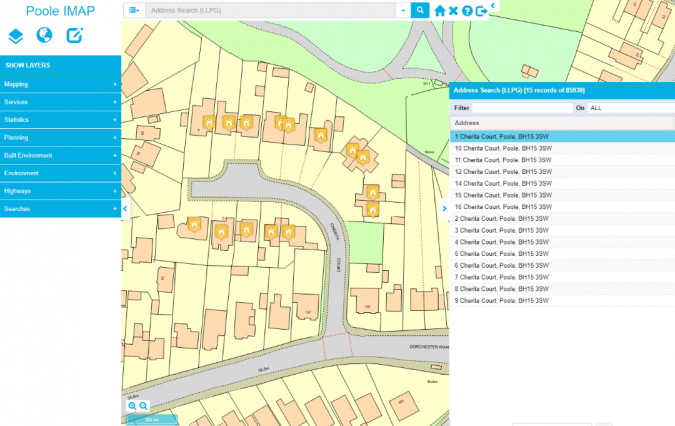
Borough of Poole selected Cadline to supply and implement their new content-specific mapping. Three pieces of software were installed. MapThat, the Cadline-developed interactive mapping webGIS, was implemented on the Council’s intranet so that all employees would have access. Cadline’s GML (Geography Mark-up language) Translator was essential. This allows the system to understand spatial elements by translating Ordnance Survey MasterMap data into oracle, PostGIS or sql format. Thirdly, MapThat’s Report It platform was installed for Poole’s public-facing website, allowing residents to report incidents on a map. This self-service platform integrates to the back office where reports are disseminated to engineers for action. Significant time and money is now saved due to the accuracy of service reports which have been conveyed with a precise map location. SOCITM’s publication Better served: Customer access, efficiency and channel shift (February 2011), stated that the average phone call costs a local authority £2.90 and a face-to-face contact is £7.40, whereas each web contact costs just £0.32.
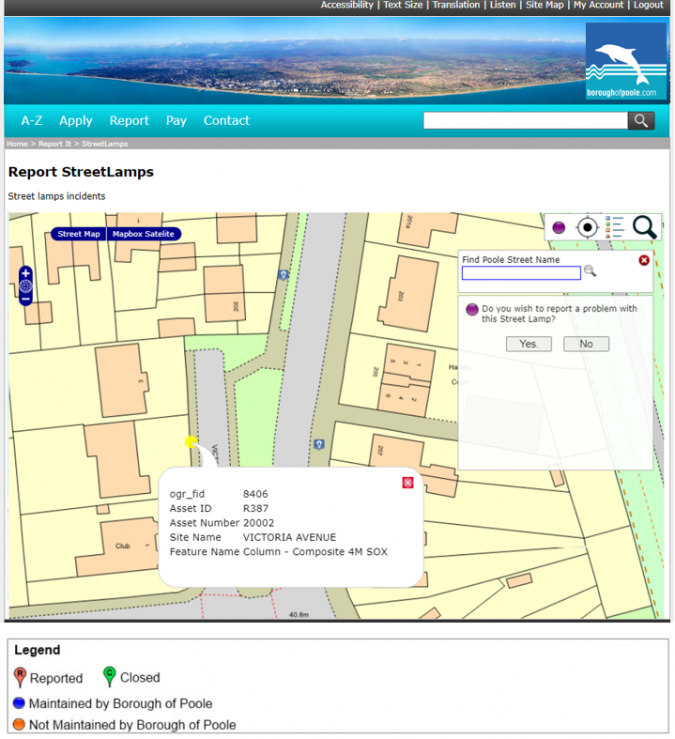
Since Borough of Poole’s new system went live, there has been a marked increase in service reports made online. “Approximately 40% of reports were previously made on our website, compared to over 50% now,” says Steve. “Feedback from residents indicates that Report It is much simpler to use too. One resident had tried multiple times to describe the position of a faulty streetlight, but our engineers had been unable to locate it due to the vague details given. When the person used Report It after it came online, this streetlight was finally found and fixed.”
Map pins
By hovering over map pins representing individual service reports, members of the public can view notes added by the engineers to show, for example, whether a report has been dealt with, closed or is still open. This helps to reduce the number of duplicate reports and follow up phone calls.
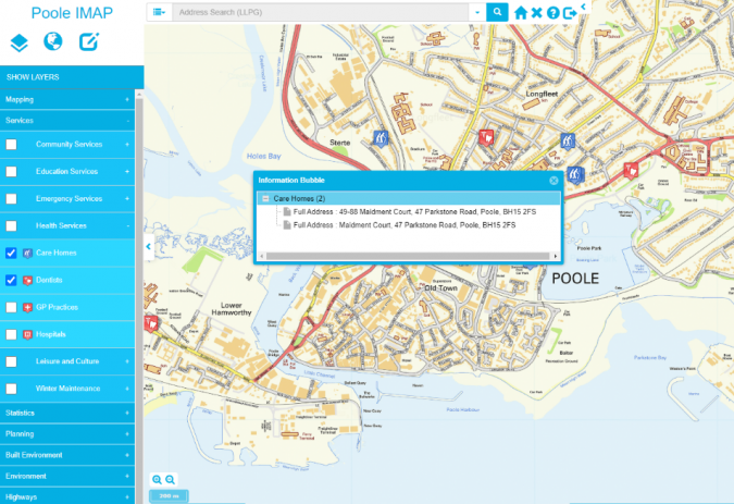
In addition, the authority is using the technology to make it much simpler for residents and tourists alike to quickly locate the services they are looking for. Currently, only available for Car Parks and Public Toilets, an embedded map pinpointing the locations of these services is displayed on the relevant information page of the website. Clicking on a map pin generates a box giving further details. In the case of public toilets, for example, the user can view information such as opening times, charges, whether there is a family room and facilities for disabled people, and whether a RADAR key is required.
Within Borough of Poole, all employees now have instant access to maps showing the locations of Council facilities, which are dynamically linked to datasets behind the scenes. Planning applications, too, are now instantly viewable to all staff, cutting out the need to request information from the Planning Department.
There has been an unexpected benefit for the Finance Department, who previously had no cause to use the Council’s rather primitive maps. The new sophisticated mapping feature allows the Department to identify any issues relating to the amount of spend in care homes.
Street maps and aerial views
All MapThat maps use beautifully clear graphics and are straightforward to navigate by panning up, down, left and right, clicking and dragging, and zooming in and out. Both street maps and aerial views are available to help users easily recognize specific localities.
Steve describes his organization’s relationship with Cadline as ‘very good’. “This is a very beneficial partnership,” he says. “It really has made geographic information available to everyone.”
Borough of Poole’s future plans include extending the range of community services viewable on a map, and enabling residents to report a greater variety of issues on the Report It function.
Solution Overview
Client Profile
Poole Council, on the south coast of Great Britain, supports 67,000 dwellings, 150,000 residents and a thriving tourist industry.
Service Delivery
- Cadline deployed its own DynamicMaps MapThat intranet webGIS and internet (public facing website) web mapping solution
- Cadline’s webGIS solution allowed the Council to dramatically reduce its reliance on expensive desktop GIS applications
- Cadline’s applications allowed all 6,000 Borough employees and 150,000 residents access to accurate and up-to-date Council data (subject to security permissions) in an easy to use and affordable system
- Cadline’s Report It application has been deployed on Poole’s public facing website, allowing residents to report incidents. This has a huge saving in time, money and resources, providing a self-service function that can save up to £7 per reported incident
Technical Capability
- Cadline’s combined GIS and software development background allowed a detailed understanding of the project and business requirements
- “Feedback from residents indicates that Report It is much simpler to use too. One resident had tried multiple times to describe the position of a faulty streetlight, but our engineers had been unable to locate it due to the vague details given. When the person used Report It after it came online, this streetlight was finally found and fixed.”
- “Our engineers would often have to drive up and down the street, looking for the problem, which was obviously not an efficient use of internal time and resources. We needed to be able to channel residents through a fully self-service system. These issues, plus the expense of our GIS annual maintenance, prompted us to source a more sophisticated but cost effective solution.”
Benefits
Steve Campbell, Borough of Poole’s GIS Manager, describes his organization’s relationship with Cadline as ‘very good’. “This is a very beneficial partnership,” he says. “It really has made geographic information available to everyone.”

Value staying current with geomatics?
Stay on the map with our expertly curated newsletters.
We provide educational insights, industry updates, and inspiring stories to help you learn, grow, and reach your full potential in your field. Don't miss out - subscribe today and ensure you're always informed, educated, and inspired.
Choose your newsletter(s)


