Bridging the Culture Gap
FIG Working Week, May 2011, Marrakech
The exotic city of Marrakech in Morocco, with its historic medina, was the meeting place for FIG Working Week 2011. This event was held jointly with the national congress of our colleagues in Morocco and organised under the patronage of His Majesty King Mohammed VI of Morocco. With about 1,500 participants from more than ninety countries, and the largest exhibition ever accompanying a FIG Working Week, it may be considered a success story.
A Wide Welcome
Cultures were certainly bridged. Meetings with young surveyors, a specific China forum, meetings with Moroccan, Mediterranean and Arab surveyors, and a gathering of the ‘francophone' world - as well as huge participation on the part of Africa - it was a big mix, resulting in dynamic and multi-linguistic sessions.
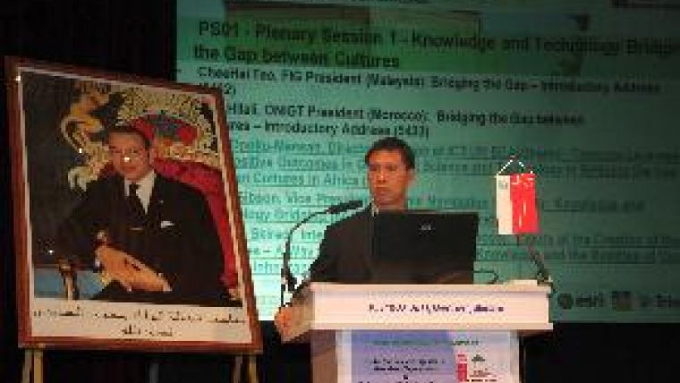
Participants were welcomed by FIG president CheeHai Teo and Aziz Hilali, chair of the Moroccan Association of Surveyors. Aida Opuku-Mensah of the UN Economic Commission for Africa talked about concrete leverage of Information and Communication Technology: take into full consideration "where you are now" where ICT is concerned, she advised, because there are varying degrees of ICT literacy and there is no point in aiming too high too soon. If necessary, start simple. It is not only about the technology, but also acceptance of ICT and capacity building. As far as GPS is concerned, Chris Gibson of Trimble made very clear that there was no longer any need to learn conventional survey approaches; you could now "step in" directly. Still, education in the use of GPS tools was of course needed. The same technology may be used in various contexts.
Exhibition
The exhibition accompanying Working Week boasted 54 stands, twelve of which graced the Chinese Pavilion. FIG and Working Week platinum sponsors Esri and Trimble organised a pre-conference workshop with a presentation of latest developments.
China
During the China forum entitled ‘China Surveying and Mapping Serves the World' great attention was paid to the comprehensive set of contents of MapWord, the own Chinese website with geospatial data. The latest survey instruments were presented.
Africa
The technical programme focused a good deal on ongoing developments in Northern and Sub-Saharan Africa, with many representatives from the continent presenting papers and joining in discussions, and the FIG Africa taskforce organised two round table sessions in Marrakech. The focus is on the African surveying profession and how it can best contribute to meeting the key challenges of poverty alleviation, economic growth, and environmental sustainability. One issue that came under the microscope in Marrakech was the development of a handbook on peri-urban planning, with a main theme of slum prevention.
UN Habitat gave an overview of the latest developments in the Social Tenure Domain Model: an OpenSource Pro-poor software tool for unconventional support in Land Administration. More than clearly expressed here was the need for attention to the needs and requirements of poor people.
Disaster and Climate
Another hot topic was disaster management and climate change and the surveyor's role in this regard. The recent earthquake in New Zealand, with its terrible impact, also has consequences for cadastral maps: a part of the Earth's surface has disappeared, but is still represented on maps. There was a discussion on the situation in Haiti. The contribution of the profession will be required for many years here, as in other post-disaster areas. FIG has also established a taskforce on surveyors and climate change that will also address these issues over coming years. Prof Stig Enemark presented the options and strategies for the road ahead.
Survey Accuracy
It should be recognised in relation to the accuracy of surveys that (very) high accuracy is in many cases neither required nor demanded. In many countries it is most important to get the cadastral map finalised and accessible. A very good approach can be to start with a lower accuracy, and even imprecision, and to perform quality upgrades later. Approaches aiming for high-accuracy results (e.g. 10cm) fail in many cases to result in complete cadastral coverage.
Future of Cadastres
During a special forum with international experts on the future of cadastres (Cadastre 2034) it became very clear that there was a need for open debate on this issue. Quality management is a very important task for surveyors; it is important to know how accurate a map is, but very accurate maps are not always needed. This discussion was based on an ‘Invited Reply' to a paper by Rohan Bennett et al of Australia, both published in GIM International. Some outcomes: cadastres provide a sustainable basis for integrated (land) information systems. Given that cadastre is indispensable for tax and land-market purposes, it may be considered a fundamental need. This requires changes in business models: land registries and cadastres should cooperate in unison, or even merge to provide a steady, predictable and sustainable business model underpinning land administration and SDIs. Cadastres are the basis for integrating spatial information at large scale. In 2034 interoperability will be about processes, interests and organisations. Collaboration in chains and networks will be the dominant way of working, and sharing the name of the game. Cadastre 2034 should be fit for purpose, and that will depend on the context within which you are operating: organisations will (still) be in different stages of development.
New Infrastructures
The Working Week also threw some, at first slightly reluctant, light on possible future options for the use of infrastructures such as Google Earth, Open Street Map, Facebook, Wikipedia etc for our work. Can people, for example, build their own land administration using participatory and community-based input? Will people themselves be determining the boundaries of their land with that of their neighbours: ‘user dominance'? This is already happening on the demand side, but in the future many processes will be initiated and enriched by processes and information provided by users. Also relevant is access to so-called ‘free data'... and an early-warning system for financial crises, after the US mortgages experience. The development of so-called authentic or key registers, without data duplication, remains an issue. Global Navigation Satellite Systems will be used more and more; there are more and more infrastructures with permanent reference stations.
Optimism
President Teo, addressing the Federation's General Assembly, expressed optimism that together we can be a profession, armed with knowledge and best practices, extending the useful-
ness of surveying for the benefit of society, environment and economy, increasingly positioned in significance and relevance and next door to everywhere.
Also see the photo album of the FIG Working Week in Marrakkech.

Value staying current with geomatics?
Stay on the map with our expertly curated newsletters.
We provide educational insights, industry updates, and inspiring stories to help you learn, grow, and reach your full potential in your field. Don't miss out - subscribe today and ensure you're always informed, educated, and inspired.
Choose your newsletter(s)


