Capturing Geospatial Data from Vehicle Platforms
Jacobs’ Journey
Jacobs Geomatics provides support and consultancy to the company’s wider design and engineering services. In recent years Jacobs’ UK geomatics team has been involved in increasingly large infrastructure schemes, typically supporting preliminary and detailed design phases of projects. This requires advising on solutions and the subsequent provision of suitable geospatial data. As the projects have grown in scale and complexity, the company has increasingly sought to supplement traditional topographical survey capture techniques with rapid data techniques such as terrestrial laser scanning, aerial photography and Lidar. Over the past three to four years, Jacobs has also become increasingly involved in vehicle-mounted scanning methodologies, commonly referred to as 'mobile mapping'.
To date Jacobs’ experience has largely been within the highways environment, using a combination of in-house resource and supply chain partners to deliver topographical survey data for motorway and trunk road improvement schemes, but the firm is now also working on projects using mobile mapping technology within the rail environment.
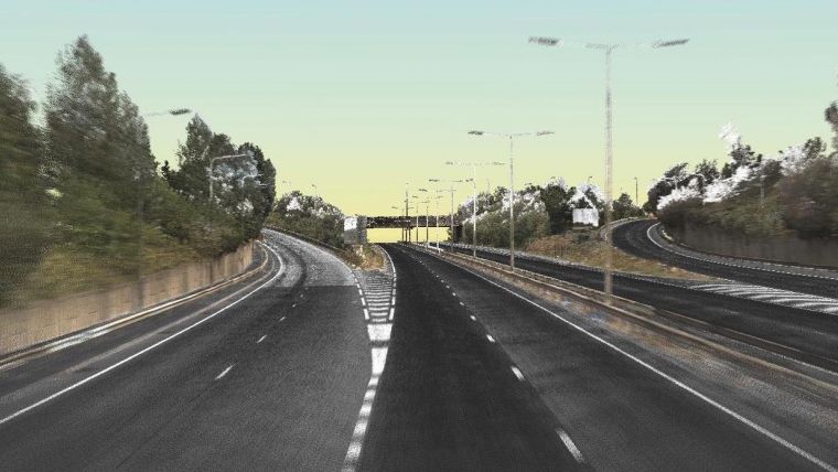
M25 Junction 30
Jacobs’ first significant involvement with mobile mapping came in late 2013, whilst working on the M25 Junction 30 (J30) improvement scheme. The scheme required preliminary and detailed design for elements of the junction, and detailed topographical survey was required for approximately eight kilometres of the M25 motorway, six kilometres of the A13 trunk road and the junction itself, extending into adjacent private property along the highway boundary. The data available to the design team was limited, both with regards to accuracy and detail. More accurate data, particularly of the carriageway, was considered an urgent requirement to support the critical path activity of determining the 3D alignment of the new design.
Need for speed
Based on the scale of the project and the urgent requirement for data, Jacobs proposed the use of mobile mapping, which it was envisaged would provide rapid data capture. An additional benefit was that this would eliminate the need to access the site on foot, removing exposure to the risks of working at night within temporary traffic management and the associated disruption to the highway network. However, following further discussion with the project team, some concerns were raised. A key member of the team had previous poor experiences of using mobile mapping when working for another company, and had particular concerns over the accuracy of the data provided. There was also limited understanding by the team as to what would be provided and in which formats. Finally the design requirements were extended to include detailed and accurate survey of the heavily vegetated verges and motorway embankments in order to adequately complete the works.
Hybrid approach
Based on discussions with the team and consideration of the programme and safety implications of the work, a combined approach was employed. Mobile mapping was commissioned to capture carriageway levels and features. This was initially controlled using positions from the vehicle-mounted global navigation satellite system (GNSS) only, without the use of ground control, with an estimated accuracy of ±30mm root mean square error (RMSE), which was sufficient to complete the preliminary alignment design.
Whilst this activity was ongoing, ground-based topographical survey was conducted of the site. This was undertaken under the protection of temporary traffic management, with the team establishing high-order survey control using static GNSS observations, and then using total station and GNSS network RTK data capture techniques to survey off-carriageway detail. A series of mobile mapping control points were also surveyed, which allowed the mobile mapping data to be re-processed to a higher order of accuracy. This was estimated to be in the order of ±15-20mm RMSE, and was verified through sample survey and check measurements using total station observations, and then undertaking statistical analysis of the data. This approach enabled the design team to fully understand the accuracy of the data they were working with, and make suitable assumptions and allowance within their design. The approach also allowed the survey team to focus their efforts within the constraints of available road space and the limited programme, capturing off-carriageway details critical to drainage and geotechnical design.
Did it work?
Overall, Jacobs’ approach to the survey was seen as a success. Survey data was provided at an early stage which enabled programme milestones to be met, and the use of mobile mapping also provided cost savings and minimised traffic management and network disruption. The project also provided greater opportunity for engagement between the survey team and the multi-disciplinary engineering team undertaking the design. This led to a greater understanding across the team, of both the constraints of undertaking survey work within this environment and also the design team’s requirements, particularly with regards to accuracy at specific phases within a project.
Evaluating costs and benefits
One of the key lessons learnt from the M25 J30 scheme was the need for earlier geomatics engagement within the team. This led to involvement in a new project, which required topographical survey to support preliminary and detailed design for a new bypass scheme and improvement works for approximately 30km of existing dual carriageway and motorway.
Initially this appeared to be a very similar project, but through the experience gained on the M25 J30 scheme Jacobs advised against the use of mobile mapping. This advice was based on cost benefit analysis which reviewed the cost impact of the design assumptions used on the M25 J30 and compared them with the additional cost of carrying out a survey using traditional means.
- As with the M25 J30 scheme, ground survey would be needed to provide details of drainage features running parallel to the highway, and this would require traffic management for safe access.
- Traffic management would also be required to establish ground control points for mobile mapping.
- As such, the only additional cost incurred to survey the carriageway using a total station would be for additional survey crews to work with the planned lane closures whilst the control and drainage survey work was being undertaken.
- The greatest impact was for the pavement and highway design elements. By surveying carriageway levels more accurately using a precise total station, the amount of material used for the new road surface could be calculated more accurately.
Given that the scheme required re-surfacing of over 100 lane kilometres of motorway and dual carriageway, the cost savings achieved by using higher-accuracy data for design far outweighed the cost of undertaking survey using a total station, with survey costs being less than a tenth of the potential savings.
Client-supplied data
Since 2012 Highways England (formerly Highways Agency) has been commissioning mobile mapping data acquisition across its network of motorways and trunk roads. Initially this data was acquired for asset management but Highways England also makes the data available to engineering consultancies to support design activities. Jacobs has been using this data to support work on several smart motorway schemes including the M56 and M60.
The data is supplied is raw 25m² tiles in LAS format and requires the user to merge the data and model or extract the features they require. The Highways England specification states that data has been captured to ±30mm RMSE, with a minimum of 500 points per m². This data has been particularly useful for supporting preliminary design activities, where it enables the design team to have access to current data within the project programme, without the need to carry out time-consuming site surveys. This in turn enables a more informed design, reducing the risk and cost of assumptions that are often required at this stage of the design process.
Need for QA
Jacobs employed its in-house geomatics capability firstly to advise on the use of the data, and then to ensure that its design teams are informed with regards to accuracy and suitable applications. The company has also managed the process of feature extraction.
Through the management of this data, and its work on the M25 J30 scheme, Jacobs has established robust quality assurance procedures and has been able to apply these to the use of third-party data. These include site checks, by surveying a sample of data to gain confidence of the stated accuracy of the data. Typically, for projects where clients have supplied data this has been limited to non-contact total station observation from overbridges, rather than undertaking work within traffic management on motorways. Whilst there is a trade-off with accuracy when using this methodology, it provides a reasonable check whilst minimising health and safety risks and the additional costs that would be incurred to access the motorway.
In addition to site checks of the raw data Jacobs has adapted its topographical survey quality assurance (QA) procedures to check any extracted data. This includes modelling of extracted data to check for spikes and rogue levels.
One of the key lessons learnt through this work is the need to manage expectations with regards to timescales for extracting data and undertaking quality assurance. The sites are typically long sections of motorway stretching tens of kilometres. Extraction of features is still a largely manual process and to apply rigorous QA procedures is also time-consuming.
Mobile mapping in urban areas
Based on Jacobs’ experiences using mobile mapping for motorway projects the organisation has more recently started to utilise the technology for local authority projects, where it is often requested to carry out topographical surveys for significant stretches of urban areas to support highways improvements and new cycle schemes. For the first phase of a recent project, it commissioned mobile mapping of a 12km survey of two trunk roads in London. Based on the survey extents, a demanding programme for early data to support preliminary design and there being no requirement for traffic management to establish survey control, mobile mapping was proposed.
Filling in gaps
Survey control (all established within publically accessible locations) and the initial mobile mapping data capture was undertaken swiftly. However, due to the site environment it was found that it was far more challenging to capture the required data. In an urban environment, the number of obstacles such as parked cars meant that – even with several passes during the data capture – there were significant gaps in the collected data. Given that the site was publicly accessible it was relatively simple to go back to site and infill the dataset (largely undertaken using terrestrial laser scanning to maintain a rich dataset), but this still meant a site revisit and a programme delay.
Tried-and-tested technology
In addition, the time allocated for feature extraction was underestimated. Compared with a motorway environment, an urban site is busier with a more features such as street furniture, manhole covers, changes in surface and so on. This led to further programme challenges. Therefore, when Jacobs was asked to provide a proposal for the second phase of the project, a further 4km of survey work to the south of phase 1, the firm needed to carefully weigh up the use of mobile mapping and the use of traditional survey techniques. On assessment of the programmes for both methodologies, and also the distorted mobilisation costs of the mobile mapping system to survey a relatively short site, Jacobs opted for survey using a total station. Whilst lessons were learnt during the first phase which would no doubt have made for a smoother phase 2 survey, the client required a reliable programme and it was considered this could be better provided using the more tried-and-tested methodology.
Accuracy versus rich data
However, by not undertaking mobile mapping of the phase 2 site Jacobs was not able to capture the rich dataset that was surveyed during phase 1. The additional data surveyed in phase 1 may prove useful in later stages. This project will provide interesting comparison of the longer-term benefits of the phase 1 dataset with the benefits gained through a reliable programme, and slightly better accuracy provided during phase 2. Furthermore, much of the insight gained is proving useful across a number of projects Jacobs is working on.
Reinforcing quality
All of the company’s experiences have reinforced the need for strong and robust quality assurance procedures, applied at regular milestones in the same way as would be done for a traditional survey. For the design team to develop an informed design which can be taken to construction, it has been essential that Jacobs verifies that the accuracy of the data captured meets the accuracies specified. To date the experiences have generally been good, but mobile mapping data – particularly when provided without ground control – has been typically towards the limits of expected accuracies.
Secondly, the manual nature of feature extraction opens itself up to human error, and it has been important to check deliverables, both with regards to the correct level of detail and that levels have been picked correctly and in locations that generate an accurate digital terrain model. It is also important to allow adequate programme time to thoroughly undertake this task.
Level of detail
One of the common issues Jacobs found is ensuring that the correct level of detail is extracted from the captured data. Typically the company has been using mobile mapping technology as a tool to safely and more quickly deliver a 3D topographical survey model, in a format that its engineering teams are comfortable with. It has been important to clearly specify what information is extracted and at what density. In addition, good communication is required with the team undertaking the extraction element, so that the client’s requirements are fully understood. As clients demand more complex 3D models for building information modelling (BIM) projects, ensuring that requirements are fully documented will become even more key to successful project delivery.
What is accuracy?
Jacobs’ experiences have also highlighted the different ways surveyors and engineers define accuracy: particularly regarding the surveyors definition of accuracy using RMSE and normal distribution. RMSE arguably becomes more relevant and measurable when using mass datasets such as those captured using mobile mapping, but Jacobs’ design teams have often been a little disappointed to learn that, having specified ±20mm accuracy, potentially only 68.3% of the data provided will meet this requirement. Open and honest discussion within the teams has led to greater understanding on both sides. The use of the accuracy banding table in the new RICS Measured Surveys of Land, Buildings and Utilities (3rd edition) when preparing specifications has also allowed the firm to clearly set expectations at an early stage in the project.
Horses for courses
In summary, Jacobs’ experience in the use of mobile mapping to date has been challenging at times but the added benefits that this has provided has been worth the effort. The technology is not suitable for every job, and being better informed of the limitations of the data and its end use will assist in providing better solutions. It is also essential to maintain focus on good surveying practices and procedures.
To date the company has achieved the best results when combining mobile mapping with other more traditional survey methods. As the technology develops – mobile mapping could be described as fast-moving technology in more ways than one – higher accuracy with less reliance on ground control will allow greater realisation of the safety and high-speed data-capture benefits mobile mapping can provide.
About the author
Ian Coddington graduated from the University of Newcastle Upon Tyne in 1999 with a degree in surveying and mapping science. He is now a senior consultant working for Jacobs UK Ltd, specialising in the management of geomatics works for large-scale infrastructure design projects. Ian is a member of RICS and supports the institution as an APC counsellor and assessor.
This article was originally published in the September/October 2016 issue of Geomatics World under the title Mobile Mapping: Jacobs' Journey.

Value staying current with geomatics?
Stay on the map with our expertly curated newsletters.
We provide educational insights, industry updates, and inspiring stories to help you learn, grow, and reach your full potential in your field. Don't miss out - subscribe today and ensure you're always informed, educated, and inspired.
Choose your newsletter(s)


