China 30m-resolution Global Land Cover Map in 2012
On 23rd July 1972, the Earth resource technology satellite, ERTS-1, later renamed as Landsat-1, was launched by the United States. Ten years later, the US launched Landsat-4 carrying onboard the new sensor, Thematic Mapper (TM), with a ground resolution of 30m. The Landsat series of satellites have acquired approximately 2.9 million scenes of images across the globe. Although successful applications of Landsat data have been reported in tens of thousands of papers and various governmental reports, so far not a single map has been produced on a specific theme for the whole world using Landsat data.
Led by Professor Chen Jun, ISPRS secretary general and chief scientist of the National Geomatics Centre of China, China is mapping the global land cover based primarily on Landsat TM data. The plan is to use Landsat images for circa 2000 and to use data from China's HJ-1 and Beijing-1 satellites in addition to Landsat images for circa 2010. The map product is expected to better serve the needs in Earth system modelling efforts.
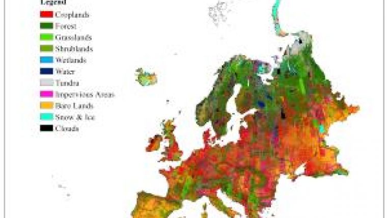
The project will produce a series of land cover maps with specific themes - water bodies, wetlands and human settlements - as well as a general land cover map for the world. At present, the global water body map is near completion. Over 90,000 training samples and nearly 40,000 test samples have been collected so far in support of the global land cover mapping project. Five algorithms are being assessed to map the world, continent by continent. The five algorithms include the conventional maximum likelihood classifier, the J4.8 classification tree algorithm, as well as random forest, AdaBoost based on J4.8, and support vector machine (SVM). In addition, a classification system that is flexible for expansion, cross-workable to existing ones, has been developed. The current Level I classes contain 10 categories with over 30 Level II subcategories. Initial experiments only involving the use of the six bands of spectral data of TM have been conducted for China, Europe and Africa. SVM, the best performer, achieved an overall accuracy of 66.4%, 60.8% and 68.5%, for China, Europe and Africa respectively, for Level I categories. The image above shows the land cover classification results for Europe.
The massive classification for the whole world except Greenland and Antarctica is being implemented on Tsinghua's 120 Tflops supercomputer.
The expected completion date of the initial mapping of the land cover of the world with Landsat data is the middle of 2012. This product will improve the current global land cover products by one order of precision from 300m to 30m. It will be a unique way to mark the celebration of the 40th anniversary of the Landsat programme, humankind's first land-oriented satellite remote-sensing programme.

Value staying current with geomatics?
Stay on the map with our expertly curated newsletters.
We provide educational insights, industry updates, and inspiring stories to help you learn, grow, and reach your full potential in your field. Don't miss out - subscribe today and ensure you're always informed, educated, and inspired.
Choose your newsletter(s)


