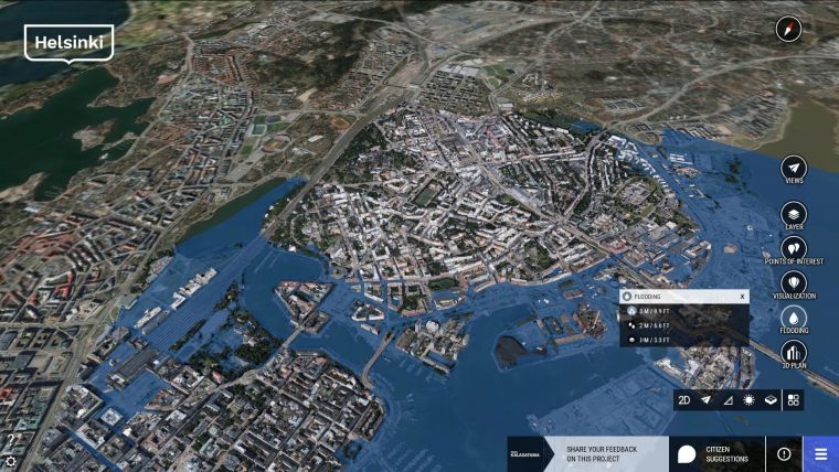
City-scale digital twins for flood resilience
Digital twins can help cities plan for disasters and better respond to weather events that can cause flooding and widespread damage.
Extreme weather events and rising populations are straining existing (and often inadequate) drainage infrastructure in cities around the world. The result is flooding that damages property and infrastructure, impacts human safety and weakens economies. Digital twins can help cities plan for disasters and to better respond to weather events.
In 2015, the United Nations reported that over the previous decade, floods accounted for 43% of all documented natural disasters around the world, affecting 2.3 billion people and causing US$662 billion in damages. And this number is getting worse. The Organization for Economic Cooperation and Development (OECD) reports that the number of flooding disasters worldwide almost doubled from 2000-2009 relative to the previous decade.
Climate change – due to its role in extreme weather events and rising seas – is exacerbating flood risks, especially in coastal and low-lying areas. At the same time, populations in flood zones and the coastal regions continue to increase – worsening an already deadly and costly situation. There are projections that, by 2030, around half the people in the world will be living within 100 kilometres of a coastline.
In response to these threats, cities are striving to improve their flood resilience with data-driven planning, development and operations. Some cities are accomplishing this through the use of digital twins to improve the resilience of current infrastructure and to support ongoing development and future planning.
Digital twins
A digital twin is a virtual representation of a physical asset, process, or system. Digital twins of cities provide accurate and reliable data to city agencies involved in flood risk assessment, preparedness, response, recovery, and mitigation. They contain information that enables users to perform analysis and make informed decisions for a range of activities, from long-term urban planning to time-critical emergency response.
Digital twins are created from (and continuously updated with) data from multiple sources, which is what differentiates them from static, 3D models. Also, cities are now taking advantage of cloud services, the IoT, sensors, RFIDs, and smartphones to update digital twins to almost real-time status of city conditions. These updates enable cities to use digital twins to better manage and optimize infrastructure assets.
Creating flood-resilience models
Creating a digital twin to enable flood resilience entails the integration of city-scale reality modelling, 3D mapping, and flood modelling. The resulting flood resilience model can be used for analysis, simulation, visualization, and communication.
To start, reality modelling and 3D mapping software are used to generate a high-resolution, city-scale 3D reality mesh by using overlapping photos from drones and ground-level imagery, supplemented by laser scans where needed. The reality model/mesh is spatially classified, meaning that the individual buildings, parcels, and other elements of the meshed cityscape are tied to underlying, applicable GIS data. The reality model is also natively engineering-ready, with sufficient resolution and scalability to zoom into an area and perform engineering work directly off the mesh. And crucially, the reality model includes digital terrain data, which is fundamental for any hydrological simulation.
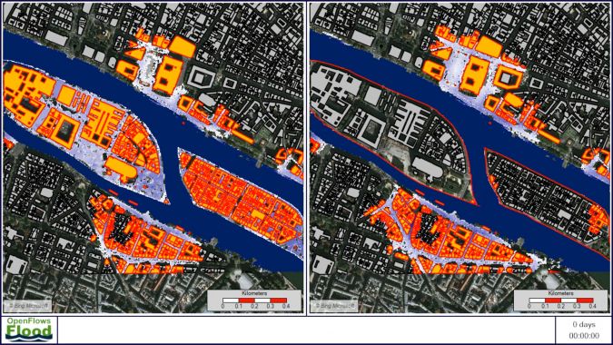
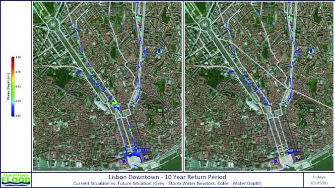
Next, a flood resilience model is created by setting up a computational mesh for the area of interest, be it the whole city or just a fraction of it. This computational mesh is then populated with data used for flood simulations. Digital terrain data can be taken directly from the reality model to provide accurate surface data for the flood modelling software as well as a visually realistic context for viewing flood simulations. The reality model can also be used to identify streets, pavements, green spaces, trees, and other information required by the flood resilience model. The flooding software uses numerical models to simulate a range of hydraulic and hydrological processes, including rainfall, infiltration, surface runoff, channel flow, and groundwater flow. This flood resilience model can be integrated with sewer and stormwater network models to dynamically simulate urban stormwater flow and drainage, as well as flooding in coastal areas due to storm surges.
It can also incorporate real-time feeds relating to new meteorological data, current hydrological conditions, and operational statuses from existing infrastructure assets, for example. These feeds might include recent rainfall amounts, current river flow rates, working status of pumps, and so on. And, given the ubiquitous nature of mobile phones and social media, there could even be live feeds documenting localized street and tidal flooding to support flood-related crisis management. The model is continuously refreshed from multiple sources – such as sensors, continuous surveying, or GIS updates – to represent current conditions.
Using flood-resilience models
Flood resilience models support a wide variety of activities related to the evaluation, prevention, and response to floods. The models can be used to assess the extent of river or coastal flooding, calculate river conveyance capacity, test infrastructure resilience, or assess current land-use strategies in flood zones.
One of the primary uses of flood models is the simulation of what-if scenarios that show the impact of flooding on homes, properties, streets, and infrastructure. These simulations can be used to determine flooding risks for existing conditions and to evaluate proposed mitigation strategies.
For example, cities can simulate river flow during a flood event and analyze losses based on extent of flooding compared to building data such as property value. With this feedback, planners can use the software’s built-in modelling tools to develop mitigation measures (such as higher levees, increased capacity of a stormwater system, or greater use of green roofs and permeable paving) and rerun the simulation to test the effectiveness of their proposed mitigation measures.
For ongoing operations and emergency response, agencies can use operational flood models that run continuously to anticipate and mitigate the impact of floods. These operational models are updated with the latest information from observed and forecasted weather conditions, water levels in reservoirs, data from hydrological stations, and radar and satellite images. Bundling this information into a single system and using the flood resilience models allows cities to estimate with accuracy the conditions in the upcoming hours or days. Flood risk mitigation can then be achieved using the information produced by these operational systems to:
- Take proactive actions such as increasing the storage capacity in reservoirs by draining them before the flood wave arrives
- Take preventive measures such as installing temporary flood protection devices
- Transmit early warning messages
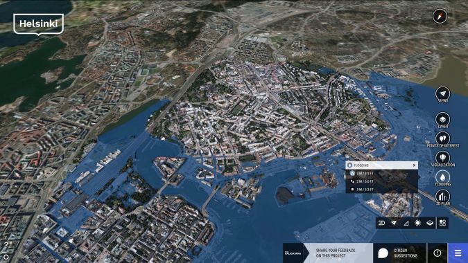
Flood resilience models that show simulations in the context of city surroundings also help better convey information. Communicating and visually presenting this information in an easily understandable way can help stakeholders make decisions regarding city planning and infrastructure proposals, and also engage citizens for public outreach efforts.
Conclusion
Digital twins represent a comprehensive environment that supports flood resilience planning, as well as ongoing management and operations of the city infrastructure. And, visually communicating actionable information helps stakeholders make more informed decisions prior to costly design or construction efforts. Digital twins represent a golden opportunity for cities to optimize the performance of municipal infrastructure assets and take proactive steps for flood resilience planning.
For more information regarding Bentley solutions for implementing digital twins and developing flood resilience, see here.

Value staying current with geomatics?
Stay on the map with our expertly curated newsletters.
We provide educational insights, industry updates, and inspiring stories to help you learn, grow, and reach your full potential in your field. Don't miss out - subscribe today and ensure you're always informed, educated, and inspired.
Choose your newsletter(s)
