Connecting Citizens - Smart Cities and Communities 2017
This article was originally published in Geomatics World.
The concept of smart cities is not always understood. Richard Groom reports from a conference on the topic and tries to make sense of the idea and what it can do for communities and citizens.
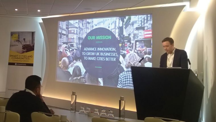
2017 seemed to be the year of the Smart City and the second conference in as many months took place in London, UK on 9 November. Smart Cities and Communities: Connecting Citizens seemed rather more relevant than the Smart Summit, reported in GW Nov/Dec. At least it certainly started on the right path, ably guided by the chairman Joe Dignan from consultancy, Kintechi Ltd. The reason for uplifted spirits was his opening comment: "Smart City is a misnomer – it means nothing"! He meant that the term is yet another buzzword, the meaning of which seems to depend upon one’s viewpoint. If you are a utilities engineer, it is all about smart metering, if you are a transport planner it is all about autonomous vehicles and management of road congestion, and so on. Having said that, we are looking at a market worth trillions, and is starting to coalesce which will affect everyone.
Planning in the Smart City
The keynote address was given by Stefan Webb who leads the design, development and delivery of projects across the Future Cities Catapult. He stressed that Smart Cities are multidisciplinary in nature and that it is this that encourages creativity. His talk centred around the planning system and some user research carried out by the catapult. His thesis was that by using tools created through digital technology, involving the use of maps, planning could be more efficient and hence cities become smarter.
Firstly Webb considered how data could be presented in a better manner. He showed a web page for a planning application. It consisted of about 200 words of text with thirty or more PDF files, the contents of which were unclear from the file name. Surely there had to be a better way to unlock data buried in these appendices than to have to open each one to find out if it was relevant. He presented a number of options, all of which were map based and said that this could be planning in the future. When quizzed at lunchtime, a delegate from Esri reckoned that it was possible, using their StoryMaps tool, to do just this. It provides the high-level summary, maps and links to the more detailed documents in an intuitive user-friendly manner.
1D Versus 2D
But, the delegate from Esri said, developers still have to produce voluminous paper documents to satisfy planning authorities. Perhaps the real problem is that with text, which you read in a serial (1D) fashion, there is no excuse for not reading all the information available and also, that information cannot be hidden. It is relatively safe. But in a 2D 'navigate and click world', as we know from the scourge of the unintuitive website, it is easy for readers to miss something and equally easy for those who have to present information, which they do not want to be read, to hide it in places where it is unlikely to be clicked. How do we guard against manipulation whilst making life easier? Web design could learn a lot from cartography.
Looking to future trends, Webb suggested making wider use of the data which will be produced by the laser scanners which will be on all autonomous vehicles. “But who owns it?”, he asked, suggesting that those who had been sensed might have rights to the data! Only in a topsy-turvy world could this surely be conceivable.
Returning to Earth, he then considered how we plan and said that planning applications can take five years to be decided, by which time the data upon which the justification had been built could be five or more years out of date. He sees 3D city information models as the future, which can engage decision makers and citizens. Local plans, he suggested, could be digital simulations.
Review by Bots
Webb suggested that planning applications currently overly rely on experts, who have poor communication skills, and who are too complex for the community. A large proportion of planning applications are for extensions to buildings. For these, the revenue in fees is way exceeded by the cost for councils to review them. In the future he foresees pre-applications being reviewed by software robots, known as bots, and the application itself being entirely digital.
Communication of plans to the public comes too late in the process, which makes citizens feel disengaged and is also unhelpful for developers who may encounter opposition at a late stage when it is most expensive to make changes. Most people now have the technology to handle digital data and could be involved in the process by looking at options interactively. But, he pointed out, ‘saying no’ has consequences for the council as well as the developer – for example loss of business rates. Citizens should be given a balanced view and recognise the consequences of their actions.
The digital (smart) approach results in greater transparency and access to all the underlying data. It also leaves the ‘experts’ with nowhere to hide. For the part of the citizen, it assumes an ability to interpret the data correctly, and that demands an adequate general education. It also assumes that each individual has the same right to comment, whilst we know that those who have most time to devote to a cause and who shout loudest actually grab greater influence. So before we go down that path, perhaps we should be looking carefully at the nature of our democracy.
Citizen Centric
Calum Handforth is a Winston Churchill Fellow who has been studying the softer side of the subject. He stressed the importance of connecting with the citizens. He sees a number of challenges in the policy-making environment – increasing expectations, silo working, ‘something must be done’ reactive behaviour by the government, a lack of evidence-based policy-making and clashes between generalists and specialists. Policy, Handforth said, should be ‘citizen-centric’ and that ‘the system’ should work for citizens, by which he meant that data should be truly open and exchangeable and citizens should play a key role in government. It felt as though we were wavering off the subject.
Smart Communities
Paul Clarke from Esri also stressed the need for people to come first. He came up with a definition for a ‘smart community’: “A smart community must connect people, places and technology to deliver outcomes that improve people’s lives whilst maximising the efficient use of resources. The common factor is location and the common need is for data-driven decision making, sharing and collaboration”.
Perhaps the key word is ‘efficient’ – minimising duplication and waste by getting every ounce of value out of the data and ensuring that it can be used for multiple purposes.
Clarke sees the objectives as cost-effective and efficient delivery of services, a desire to enhance and widen services, to engage citizens in decision-making and to demonstrate that key initiatives have been delivered. All this has to be achieved with fewer resources by being ‘smart’. He sees the objectives in terms of high-level aspirations: the city has to be safe, well run, ‘liveable’, healthy, prosperous and sustainable. And to get it to that state demands initiatives, for example, reduce traffic congestion, increase recreational opportunities and so on.
There were talks in the afternoon about digital health London and Spacehive, neither of which seemed very relevant to the conference theme. Digital health London is an ‘accelerator programme’ which is intended to modernise health service provision the capital. It has made impressive progress. Spacehive is a crowdfunding website, which was a sponsor of the conference. Their aim is to provide a portal to bring together project ideas, community support and funding.
Autonomous Vehicles
The final session of the day covered smart mobility and intelligent infrastructure. This was presented by Paul Copping, who is chief innovation officer for ‘Digital Greenwich’. He has autonomous vehicles firmly in sight, but earlier than most – five to six years away. Autonomous electric pods for travelling down the towpath from the O2 arena are already on trial in Greenwich. However, he also asked “why travel?” and pointed to a company in Greenwich which is using hologram technology to ‘transport’ people to meetings. Teleconferencing for a new age.
The message from this is that smart city development should not assume that we will simply replace manually driven vehicles with autonomous vehicles, there has to be the imagination to foresee disruptive alternatives.
This article was published in Geomatics World January/February 2018

Value staying current with geomatics?
Stay on the map with our expertly curated newsletters.
We provide educational insights, industry updates, and inspiring stories to help you learn, grow, and reach your full potential in your field. Don't miss out - subscribe today and ensure you're always informed, educated, and inspired.
Choose your newsletter(s)


