Conquering Elbrus: mapping Europe’s highest peak with a UAV
Inspecting and capturing cable car routes
Mount Elbrus, with its peak of 5,642m, is the highest mountain in Europe. This makes it a remarkable attraction for adventurers, hikers and skiers from around the world, which calls for safe and permanent infrastructure. The main task of the aerial mission described in this article was to inspect the existing cable car route around the station of Garabashi and to create an accurate map of the area for the potential future extension of the cable car all the way up to the Priut station (4,050m).
Challenges of mapping at high altitude
Aerial photography in mountainous terrain has a vast number of specific features and limitations. For example, flights over mountainous regions are unpredictable due to the thin air and rapid changes in weather, as sudden storms and extremely cold weather are common even in the summer season.
The unmanned aerial vehicle (UAV) operators needed to prepare themselves and their equipment carefully. For example, the altitude at Elbrus is high enough to require acclimatization, and increased liquid intake is required during the time spent in the mountains. From an equipment perspective, the main challenges lie in unspecified or incorrect terrain maps, which may cause a drone to crash. Limited altitude configurations may lead to poor quality data or even the loss of the drone, and magnetometer sensor malfunction in the zones of magnetic anomalies may lead to the loss of control of the drone or even the loss of the drone as a whole.
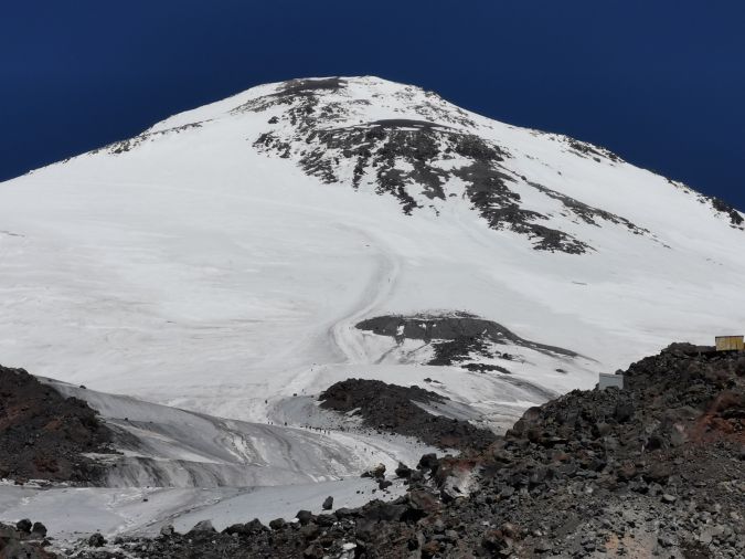
The other challenge is the terrain itself; for example, the team noticed that the take-off location had changed since they were previously in the area. The most suitable choice for an accurate and safe mission is vertical take-off and landing, as landing with a parachute will probably result in the loss of the aircraft due to wind drift and the inability to locate the device in mountainous terrain. Elbrus is a glaciated stratovolcano that is rich with iron, and areas above 3,000m are heavily glaciated, presenting an additional challenge as the surface tends to change due to melting ice and shifting stones. The high volume of iron also interferes with radio signals.
Time sensitivity was an additional challenge as weather changes can disrupt the mission and a one-day mission can stretch into a week. In this particular case, the team was able to execute all the mission flights within one day.
Choice of equipment
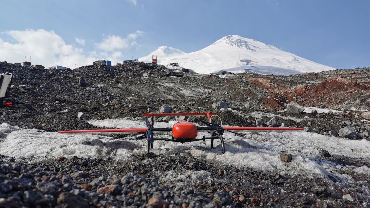
The aerial mapping team investigated the location features and set up equipment that is able to withstand the challenges of working at high altitude, as several previous takes by other teams proved not to be up to the task. For example, copter drones suffered from GPS losses and interference from geomagnetic anomalies, which led to magnetometric sensor malfunction. This resulted in the drone landing somewhere in the mountain area or returning to the start position and aborting the mission. Another fixed-wing solution with a launch catapult system was tried, but was also unsuccessful as the drone landed with its parachute system in an inaccessible area, plus it could only be used up to 3,600m, which is not high enough.
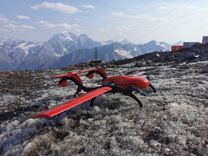
The team chose the fixed-wing autonomous vertical take-off and landing drone FIXAR 007 equipped with a Sony A6000 camera for photo image capture and a post-processing kinematic (PPK) sensor for precise positioning for post-processing. This solution was chosen as it is resilient to geomagnetic anomalies as it has no magnetometer sensors onboard, it has a proprietary autopilot system, and it is designed to fly above 4,000m. The drone is equipped with special propelling systems for missions above 3,000m to ensure operations in thin air conditions. Additionally, an aerodynamic design and wind resistance of 12m/s made it suitable for use in the mountainous area.
The drone system allows altitude changes within a single mission and ensures landing with 2m precision, avoiding equipment damage or loss. The default terrain tracking of the unit made it possible to execute flights safely and with high precision.
The team also required additional equipment such as a diesel power generator to charge the mission planner computer, as the lithium-ion batteries in the computer discharge significantly faster at high altitudes, limiting the mission planning software running time to 20 minutes. Performance of the UAV’s Li-po batteries was not affected by the high altitude.
Data collection
To collect high-quality data, an autonomous approach was chosen as this ensured stable and safe flights. The mission was split into four flights which were designed in the mission planning software xGroundControl before arriving at the flight location, reducing the time spent on-site. As the drone had to change altitude during the mission, it experienced temperature changes which could result in water build-up in the equipment. In this case, no build-up was identified, even after a temperature change from below to above 0°C.
The default terrain tracking provided additional safety and precision in the mountainous terrain. As a result, detailed images of the terrain with a total area of 8.2km2 were captured with a resolution of 5cm/pixel for a total period of four hours, operating a FIXAR 007 with an onboard equipment weight of 1,000g.
The PPK technology was used for mapping as RTK (real-time kinematic) technology is limited in mountains due to the GPS signal interference.
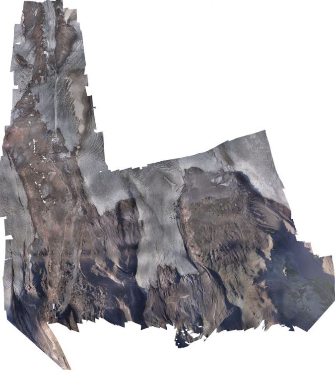
3D model for cable car route
In changing weather conditions in high mountainous terrain, high-quality photographic material was gathered to inspect the planned cable car route and to be used later for the design and construction of the new cable car.
Metashape software was used for the post-processing to build detailed orthomosaic and 3D models for further area examination and construction evaluation.

Value staying current with geomatics?
Stay on the map with our expertly curated newsletters.
We provide educational insights, industry updates, and inspiring stories to help you learn, grow, and reach your full potential in your field. Don't miss out - subscribe today and ensure you're always informed, educated, and inspired.
Choose your newsletter(s)


