Digital Technology as Leitmotif
In his latest column, Wim van Wegen reflects on digital technology as the leitmotif in Germany's role as a powerhouse within the geospatial industry.
Traditionally, Germany is the heart of the geospatial industry at this time of the year, with Intergeo taking place in either September or October. The annual trade fair and conference is a major gathering of mapping and surveying professionals from all around the world. Due to the coronavirus outbreak, everything is different this year, and Intergeo was being held digitally from 13-15 October. For me, it felt almost surreal to not be travelling to Germany for the industry highlight of the year, not be meeting with experts from so many different companies and hearing about their inspiring contributions to innovate the industry, and not be raising a glass with fellow members of the geospatial industry at many of the informal get-togethers and side events.
However, as you already might have noticed while reading the bumper-packed September/October issue of GIM International, Germany remains a powerhouse within the geospatial industry. Recently, Esri announced the acquisition of nFrames, a company that started as a spin-off of the University of Stuttgart. Today, nFrames has become a high-end developer of photogrammetry software technology for large-scale mapping applications, and Esri will now integrate its SURE software into the company’s ArcGIS platform. We couldn’t let this moment pass unnoticed, and so we did a Q&A with Richard Cooke, Esri’s director of imagery.
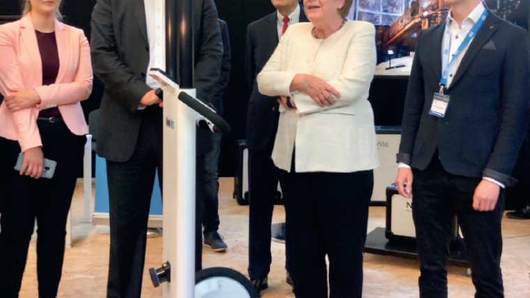
Another German company that was established as a spin-off (of the University of Munich) is NavVis. Within just a couple of years, NavVis has evolved into a leader in digital twin technology. Its mobile and wearable mapping systems have changed the indoor mapping landscape. Although the company’s technology was originally designed for indoor use, its mobile mapping solutions are now also being used outdoors on a large scale. We had the opportunity to interview Felix Reinshagen, co-founder and CEO of NavVis, and I strongly recommend that you read the resulting article in which he shares his vision. “Sophisticated 3D scanning devices can produce point clouds and images which are so realistic and so easy to implement that they eliminate the need for modelling altogether,” is just one of the many forward-looking excerpts from the interview. Even Chancellor Merkel seems to be impressed by the multi-sensor mobile scanning technology!
Yes, digital technology is the leitmotif here, simply because the future – needless to say – is digital! From that perspective, a virtual meeting place bringing together geospatial experts from all over the world makes perfect sense. But let’s be honest… the importance of face-to-face contact – also in business life – should not be underestimated. Technology simply can’t replace some human interactions. Therefore I sincerely hope that Intergeo 2021 can be held physically – perhaps in a hybrid form – in the future, in the country that can safely be described as the cradle of many innovations in the surveying and mapping profession.

Value staying current with geomatics?
Stay on the map with our expertly curated newsletters.
We provide educational insights, industry updates, and inspiring stories to help you learn, grow, and reach your full potential in your field. Don't miss out - subscribe today and ensure you're always informed, educated, and inspired.
Choose your newsletter(s)


