Drowning Maldives
Rising Sea Level Threatening Island Inhabitants
Comprising 1,192 coral islands with an average height above sea level of just 1.5 metres and maximum 4 metres, the island Republic of the Maldives is dispersed across 900 kilometres of the Indian Ocean. The islands are famous for their ‘bounty': white sandy beaches, world-class snorkelling and scuba-diving facilities, and luxury holiday resorts.
However, a gloomy future awaits this paradise. The Intergovernmental Panel on Climate Change (IPCC) reported that global average sea-level rose at an average rate of 1.8mm per year over the period 1961 to 2003. The rate was higher from 1993 to 2003, at about 3.1mm per year. Increasing temperature results in the sea level rising through thermal expansion of water and ocean water being augmented by melting continental ice sheets and glaciers. Values for predicted sea-level rise over the coming century range from 18 to 59cm. Increased ice flow from Greenland and Antarctica could add another 10cm to 20cm.
Rising sea level is measured by the Ocean Surface Topography Mission (OSTM), a joint effort by four organisations: the US National Oceanic and Atmospheric Administration (NOAA), the National Aeronautics and Space Administration (NASA), the French Centre National d'Etudes Spatiales (CNES) and European Meteorological Satellite Organisation (EUMETSAT).
Tasked with measuring sea level, the Jason-2 satellite was launched on 20th June 2008 and is stationed at an altitude of 1,336km following a circular, non-sun-synchronous orbit. The main instrument on the mission is its Poseidon-3 radar altimeter, which emits pulses at two frequencies, 13.6 and 5.3GHz, to measure the distance from the satellite to surface (range) with an accuracy of 2.5cm. Another important instrument is the Advanced Microwave Radiometer (AMR) which acquires measurements via three separate frequency channels to determine altimeter radar path delay caused by atmospheric water vapour.
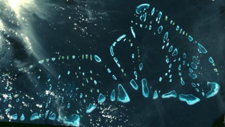
The rising sea level poses a major threat to the inhabitants of these beautiful islands, the government of which is considering unorthodox steps, such as migration of the entire population to the continent, thus leaving the islands to the elements. This photo shows the Malosmadulu atolls as captured by the Advanced Spaceborne Thermal Emission and Reflection Radiometer (ASTAR) onboard NASA's Terra satellite.

Value staying current with geomatics?
Stay on the map with our expertly curated newsletters.
We provide educational insights, industry updates, and inspiring stories to help you learn, grow, and reach your full potential in your field. Don't miss out - subscribe today and ensure you're always informed, educated, and inspired.
Choose your newsletter(s)


