Earth Observation Evolved - Engage Conference 2018
This article was originally published in Geomatics World.
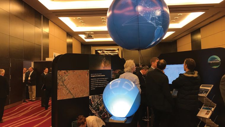
The Engage conference, organised by DigitalGlobe has become a fixture in the Earth observation (EO) calendar in London. Engage 2017, reported in GW July/August last year, detailed new uses of EO data, for example in businesses such as insurance and health, and the wide use of products such as DEMs; the increasing use of data analytics was also a major topic. This trend was continued in 2018 where presentations emphasised the development of platforms: the use of data from many sources in combination with EO data and tailoring services to customer requirements and partnerships.
The event attracted a large international attendance. Perhaps the biggest partnership at the centre of the proceedings was MAXAR, a combination of four companies, SSL, involved in space systems, MDA best known for Radarsat, DigitalGlobe and Radiant Solutions dealing with analytics, together covering most aspects of EO in commercial and government markets. The CEO of MAXAR technologies announced that a new constellation was being developed to replace Worldview, known as Worldview Legion, to start operation in 2021 with higher revisit times.
Pacome Revillion, CEO of Euroconsult, gave an overview of the current market situation. Future solutions will be based on constellations, whilst there is argument on whether to have revisit to any or every point on the Earth. There is also discussion on whether to design taskable or non-taskable satellites, and comparing on-demand with subscription services. He argued that because more than 90% of the world's population live in ±55o, which is also the most cloud persistent area, emphasis should be placed on increasing revisit in these areas, possibly by combining orbital planes. Revillion also stressed the importance of free data increasing usage, particularly mentioning Copernicus.
Platforms
One of the most noticeable features of the meeting was the presence of large corporations such as Allianz, SAP, AWS (Amazon Web Services), PwC and Vodafone. These companies are realising the important role EO has in providing information to decision makers and are developing platforms which incorporate ingestion of data from EO and third parties, data processing and data analytics, and are offering services tailored to customer needs; all of course using artificial intelligence and machine learning, and the cloud.
Hinnerk Gildhoff from SAP spoke of 'Spatial Processing Redefined' and was encouraging companies to use EO data in their business, combining EO data with business data and using components such as change detection, classification, risk prediction and anomaly detection. Vodafone concentrates on the use of low power narrowband IoT with EO data for agriculture, particularly in wine production. Yandex, a Russian company works with PwC on the Space Data Lab and makes use of crowdsourcing.
Jed Sundwall from Amazon Web Services (AWS) showed how making Earth observation data available in the cloud allows scientists, researchers, start-ups and GIS professionals to innovate without worrying about limitations of bandwidth, storage, memory, or processing power. He also talked about the processing of data lakes (unstructured data), by providing software to make it easier to find wanted data. He noted that a great deal of time is wasted in cleaning data and talked of cloud optimised Geotiff and use of the Landsat-tiler from Mapbox. Other talks emphasising similar themes came from e-GEOS and Allianz.
Tools
A number of developments in processing were mentioned. One of the more interesting was the combination of optical and radar data. This has been coming for some time and the OptiSAR constellation from Urthecast is an indication of the potential of this. MDA presented work done which has been used for cross-cueing of Radarsat and Worldview data for maritime surveillance and ship identification. Change can be identified from amplitude data and interpreted with optical data to find new buildings and mining. There will also be a Radarsat constellation mission.
UK Activities
Beth Greenaway, Head of Earth Observations and Climate at the UK Space Agency talked about EO in the UK. The Space Industry Act has been passed and an EO technology strategy defined. 'Space for Smarter Government' has set the scene and identified climate, polar, SDGs, air quality and marine as key areas. She noted that EO was moving from the public to public/private domain and saw Copernicus as a long term commitment and a game changer.
New Companies and Applications
A quite small exhibition gave space to companies to demonstrate their activities on computer screens. Geospatial Insight and Terrabotics are relatively new UK start-ups offering geospatial intelligence, DEMs and change detection to a number of businesses. FATMAP, also present at Engage 2017, has been developing its suite of DEMs.
Another UK SME is IMGeospatial which has developed a product called AIMEE which uses multiple data sources, including Unique Property Reference Numbers, for carrying out building surveys, claiming accuracy within 5% of a physical survey. This is used for insurance purposes in collaboration with Allianz and will be available on GBDX for trial. They use a tool called Feature Manipulation Engine (FME) developed by Safe Software which connects different formats. No detail was given of the methods used.
Some new takes on applications were discussed. EO used for humanitarian applications included refugees, particularly related to Syria, and mapping slavery, a project being developed at the University of Nottingham. The industries where slaves are forced to work, such as mines, kilns, quarries and in agriculture, can be identified and future work will look at combining EO derived information with other data from phones, the dark web or financial data. Crowd-sourcing is used to validate information. Imagery is being used to provide information to pilots about airports and their environments and to identify and counter fake news.
Conclusion
Engage 2018 provided a useful snapshot of the state of Earth observation in terms of trends, new applications and expectations. The status of EO was summed up by Sha Har-Noy, Vice President of DigitalGlobe in charge of their Unified Platform, as 'extending the reach of our industry'.
This article was published in Geomatics World July/August 2018

Value staying current with geomatics?
Stay on the map with our expertly curated newsletters.
We provide educational insights, industry updates, and inspiring stories to help you learn, grow, and reach your full potential in your field. Don't miss out - subscribe today and ensure you're always informed, educated, and inspired.
Choose your newsletter(s)


