Fast Survey of a High-speed Railway Line
Surveying a 140km Corridor with a UAV for Railway Planning
Large corridor surveys, such as roads and railroads, used to be the domain of airborne photogrammetry or Lidar using conventional aircraft. In Turkey, it has been demonstrated how a 140km corridor can be efficiently surveyed using a fixed-wing UAV. Streamlined operations and a large number of ground control points are essential to achieve results suitable for railway planning purposes.
The Turkish government is planning the construction of a large, nationwide high-speed rail network. A high-speed rail connection between the cities Ankara and İzmir is currently in the planning phase. Thanks to an intended speed of 250km/h, the journey between the two cities will take a little more than 3.5 hours. As part of the preparations, Turkish State Railways requested a vector map of the area around the planned rail corridor. This work was tendered in three sections to reduce turnaround time and risk, and to adhere to the Turkish tendering regulations. For the section between Manisa with Uşak, Turkish State Railways explicitly requested the use of a UAV for the survey.
Difficult terrain conditions
The corridor segment that was contracted for UAV survey measured 140km in length and 600m in width. This involved surveying plains, hills, mountains and urban areas under all types of weather conditions within a 2-month time frame. With classical techniques it would not have been possible to map the entire area. The mountains at the eastern end of the region, for example, cannot be reached by car and sometimes not even on foot. Especially in those locations, the use of airborne systems is very valuable. The particular advantage of a UAV over regular aerial photogrammetry is the low flying height which eliminates the dependence on clear weather conditions.
Data acquisition
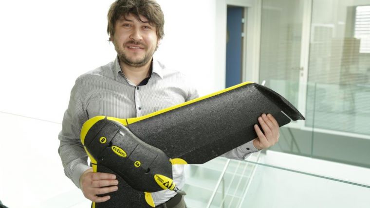
The corridor was surveyed using a senseFly eBee UAV by the Turkish company Artu Harita. The eBee is a fixed-wing system with a wingspan of 96cm and a 16MP camera (Figure 1). SenseFly’s eMotion planning software was used to plan the flight lines for the project. As this program is not capable of automatically planning corridor surveys, all flight lines had to be defined manually. The average flying height was set to 320m above the ground, which would result in a pixel resolution of approximately 10cm. The 140km-long corridor was subdivided into 16km segments, with a start and landing location selected in the middle of each one. The UAV pilot then flew the eBee along the corridor for 8km, turned it around and flew back for a second parallel flight line before landing at the take-off location. There the battery was replaced and the data offloaded before a new flight was started for 8km in the opposite direction (Figure 2). On average, 300 photos were taken during each flight.
Ground control
While one or two staff were busy planning and flying the UAV missions, two other survey teams of four engineers each were responsible for setting the ground control points (GCPs) required to georeference the images. The first team was typically positioned 20-30 kilometres ahead of the UAV, while the second team worked a further 20-30 kilometres beyond that. Initially, a single string of GCPs was planned along the proposed railway line. During processing it soon became apparent that this would not be enough. Although a minimum lateral image overlap of 50% and a minimum forward overlap of 80% were used, it was not possible to correctly orient all the images. Therefore two extra strings of ground control points were set parallel to the first central string, towards each edge of the corridor. This allowed each image to be oriented by using at least one GCP per image from the central GCP string, and one GCP from one of the two new GCP strings (Figure 3). Approximately 900 GCPs were set in total with an average interval of 450m. In addition, check points were set up to allow for independent quality control. The GCPs and check points were surveyed with GNSS RTK using the Turkish CORS network (Figure 4). Each point was measured twice with an interval of at least 2 hours to achieve a better accuracy.
Turnaround time
The survey teams spent 60 days in the field, including 20 flying days. The images were continuously transferred to the office where 10 engineers were dedicated to processing them towards the final data products. This included the computation of point clouds from the images and the vectorisation of buildings, roads, street lights, power lines, vegetation and existing railway lines. The processing and product creation took approximately 40 days. Overall, it took three months from the project’s kick-off to final delivery to the client. In contrast, the traditional survey techniques employed by companies on the other two tendered sections required up to a year to complete.
Results
Over 9,000 images were captured during the course of the project. They were used to create orthophotos and a 3D model with 10cm resolution and an average height accuracy of 15cm. The height error behaves as a function of the distance to the closest GCP. Close to the GCPs, the error was typically small but further away measurement errors of up to 30cm were observed. Overall, the client’s 20cm accuracy requirement was achieved. The UAV products are now being used by Turkish State Railway to plan and engineer the railway route.
Figure Captions
Figure 1, The eBee ready for take-off.
Figure 2, Launching the eBee for the next flight.
Figure 3, The eMotion planning software showing the control point locations and the two parallel flight lines.
Figure 4, Measurement of ground control points.
Author
Diner Yılmaz is a computer engineer with a master's degree in remote sensing & GIS from Anadolu University in Eskişehir, Turkey. He is the general director of geomatics engineering company Artu Harita Bilişim GIS Mühendislik, based in Ankara, Turkey. Yılmaz has experience of flying several types of UAV for GIS and surveying projects, and processing UAV and classical terrestrial datasets.

Value staying current with geomatics?
Stay on the map with our expertly curated newsletters.
We provide educational insights, industry updates, and inspiring stories to help you learn, grow, and reach your full potential in your field. Don't miss out - subscribe today and ensure you're always informed, educated, and inspired.
Choose your newsletter(s)


