5 Challenges When Selecting Drones for Mapping
The Importance of Working with the Right Equipment
Every mapping project is unique; even within the same industry, each project will have its own distinct challenges. Selecting the right equipment is therefore key to getting the job done. Unmanned aerial vehicles (UAVs or ‘drones’) have emerged as a solution for many mapping and surveying projects. This article elaborates on five important challenges that should be considered when finding out which type of drone is the best fit. The article includes practical examples based on a recent mapping project on Silhouette Island in the Seychelles.
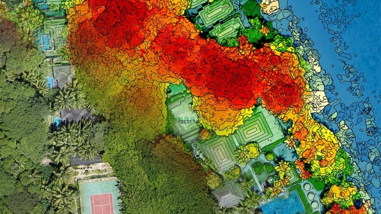
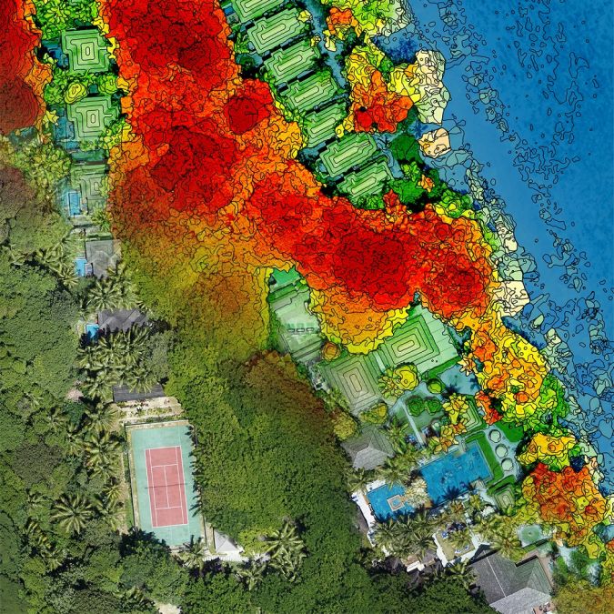
Silhouette Island is the third-largest island in the Seychelles, located in the Indian Ocean. The interior region of Silhouette is a national park, with a biodiversity that is one of the richest in the entire Indian Ocean. It is also home to several critically endangered plants and animals. In order to keep track of the different species on the island and gain insights into the unique ecosystem, an up-to-date map is an essential tool. However, the most recent map of the island was made by a manned flight back in the 1970s.
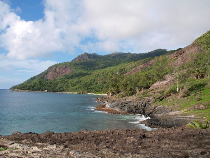
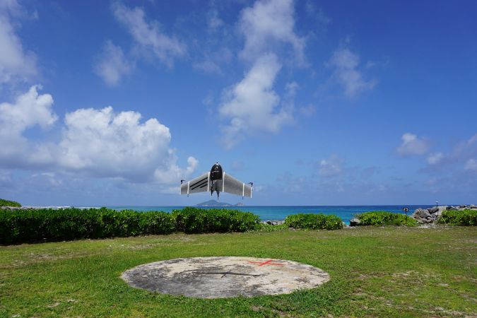
The island covers more than 2,100ha and is known for its rough terrain with scenic yet dramatic mountain peaks, five of which are above 500m (1,640ft) in elevation. At 751m (2,464ft) Mont Dauban has the highest peak, and there are only a handful of days a year on which it can be mapped because it is almost always covered in clouds; the constant wind blows hot and humid air from sea level to the peak, cooling down the air and causing the water to condense. The level of detail of satellite imagery is insufficient, and aircraft fitted with high-resolution surveying equipment are often too expensive to operate in such remote locations, which explains why the most recent map is almost half a century old. In order to create an up-to-date map, TFC International selected the Dutch hybrid drone Marlyn that was able to meet all the challenges mentioned in this article.
Three types of UAVs: Multicopter, Fixed Wing & Hybrid
Traditionally, a UAV could be one of two categories: the multicopter or the fixed wing. Nowadays, a new type has become available: the hybrid drone. The multicopter has flight characteristics that are best compared to a helicopter and often has four or more rotors. Fixed-wing drones have comparable characteristics to conventional aeroplanes, and can fly fast and long. Finally, the hybrid drone is a cross-over between a multicopter and a fixed wing, having the vertical take-off and landing capabilities of helicopters and the efficient cruising of conventional aeroplanes. However, only correctly engineered and designed hybrids offer good performance, stability and safety during all phases of flight.
Drone Survey Challenge 1: Take-off and landing
To start, it is necessary to find a suitable location from which to launch and recover the drone. Since multicopters and hybrids can take off like helicopters, they only need a small location for this manoeuvre, making them very flexible to deploy. When using fixed-wing drones, finding a suitable location can prove challenging since they need a large, flat, open space to land – and even then, their ‘belly landings’ regularly result in damage to the airframe. If the project does not have large, open, grassy fields, the drone will need to be capable of taking off and landing vertically, i.e. a multicopter or hybrid drone should be used.
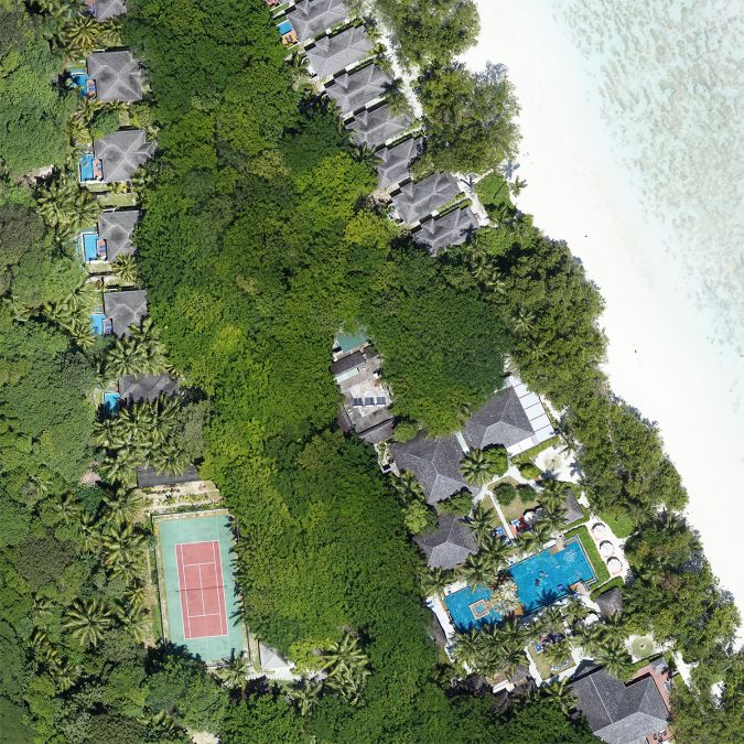
In the Seychelles project, most parts of the island that are flat enough to deploy a UAV are covered with trees; even the relatively small beaches have overhanging palm trees. As a result, only three small take-off locations of approximately 20x20m (65x65ft) were found, and it was essential to perform pinpoint take-offs and landings.
Drone Survey Challenge 2: Size and layout of the area
The second thing to consider is the area that needs to be mapped. The size of the area has a direct correlation with the time it takes to cover the area and therefore with the operational costs. The rotating propellers of multicopters consume a lot of energy to stay airborne, which is why multicopters intrinsically have a short endurance and are therefore only effective for very small mapping projects. In contrast, fixed-wing and hybrid drones use the aerodynamic shape of their wings to stay airborne. This enables them to fly faster, longer and with a superior range, making them efficient and effective in any mapping project, large or small. In general, drones with wings can map up to ten times faster than multicopters or helicopters.
In the case of Silhouette Island, multicopters would not even have been able to map the island from the three possible take-off locations due their limited range and the mountain peaks present. If the project entails mapping a large area or overcoming high mountain tops, a fixed-wing or hybrid drone would be the best option.
Drone Survey Challenge 3: Accessibility of the project area
A large number of projects have partially or totally inaccessible areas, perhaps due to heavy and dangerous machinery on location, unstable/swampy ground or impenetrable regions such as on the vegetation-rich Silhouette Island. For these kinds of projects, it is a challenge to guarantee a high relative and absolute accuracy, since it will also be impossible to use ground control points (GCPs) in such locations. The solution to this problem is to use a drone that is equipped with a post-processed kinematic (PPK) module. Similar to real-time kinematics (RTK), this module generates geotags of the photos at a far higher precision. The increased accuracy of the geotags also significantly increases the accuracy of the resulting model so that few, if any, ground control points need to be measured for the entire project.
The vegetation and steep slopes present on Silhouette Island mean that it is impossible to cover the whole island on foot, so laying out GCPs is not feasible. A drone equipped with a PPK module was crucial for this project.
Drone Survey Challenge 4: Transporting the mapping equipment to the location
To maximise its full potential as a mapping tool a UAV must be used as frequently as possible for different or recurring projects, and hence moving the drone from one location to another should be as easy as possible. Depending on the project, this could mean that the system must be suitable for shipping as air freight, fit easily in a small car and be easy to carry around in the field. The best option is to use a hard transport case that can withstand air freight and which is also engineered to fit in a small car. A system such as a backpack can be used for on-site portability.
For the Seychelles project, the system needed to be transported in a small car and carried around on the beach and through the jungle on Silhouette Island. A backpack was used in order to achieve a high degree of freedom to move the system around.
Drone Survey Challenge 5: Wind resistance
To achieve on-time delivery of a project it must be possible to deploy the drone as much as possible, and wind resistance is the most important influencer of drone deployability. A system with a higher wind resistance can be deployed more frequently, increasing the ability to finish the project on time. Multicopters have good wind resistance when taking off, because their four propellers ensure a steady take-off and landing in windy conditions. However, the low cruising speed of multicopters is a deal-breaker, since flying into the wind detracts from performance and reduces their endurance even further. UAVs with built-in wings have higher cruising speeds, enabling them to fly against the wind. Note that traditional fixed-wing drones have to launch and land into the wind, which can lead to problems when there are obstacles in that direction. The solution is a hybrid drone with high wind resistance throughout the entire flight, from take-off, during cruising and during landing. Hybrid drones with at least four propellers have high wind resistance and stability during take-off and landing, just like multicopters, and, due to their built-in wings and high cruising speed, they also have high wind resistance during cruising.
On Silhouette Island there is a constant wind and there are obstacles all around the take-off and landing location. The only way to successfully complete the project was to deploy a hybrid drone with high wind resistance during all phases of the flight.
Selecting Drones for Mapping Conclusion
If you have a challenging project or are planning to use drones in the near future, be sure to consider which type of drone is the best fit for your situation.

Value staying current with geomatics?
Stay on the map with our expertly curated newsletters.
We provide educational insights, industry updates, and inspiring stories to help you learn, grow, and reach your full potential in your field. Don't miss out - subscribe today and ensure you're always informed, educated, and inspired.
Choose your newsletter(s)


