Free Satellite Data Creates New Commercial Applications
Market Growth Requires Effort
The National Satellite Data Portal, managed by the Netherlands Space Office (NSO), is an interesting phenomenon. Despite existing for just five years, its user base and their usage patterns have become so diverse that its level of success is already beyond quantification – and yet the organisation is convinced that the bulk of the market growth still lies ahead. NSO ensures that its customers and partners in The Netherlands can respond to new opportunities in a timely manner.
Employing 28 people, the Netherlands Space Office is responsible for the execution of the Dutch space policy. 75% of its annual EUR100 million budget goes to the European Space Agency (ESA), and the remaining 25% is spent on realising the national space policy. One of the NSO’s instruments in particular, the National Satellite Data Portal, is becoming more important every year, even though the team comprises just three people. The number of users of the Satellite Data Portal is rapidly growing and extremely diverse.
Two sorts of images are available: optical and radar. “The Netherlands does not own satellites; in that sense we are an independent agency,” explains Dr Jasper van Loon, advisor on science and applications. He is also the National Satellite Data Portal project leader and the liaison on satellite data between the Dutch and European governments. “We stimulate the use of satellite data by public and private organisations, and facilitate companies to add value for their clients. With the data portal, we aim to make government processes more efficient and stimulate Dutch trade and industry. Our activities are coordinated by the Dutch Ministry of Economic Affairs and Climate Policy.”
Mercantile genes
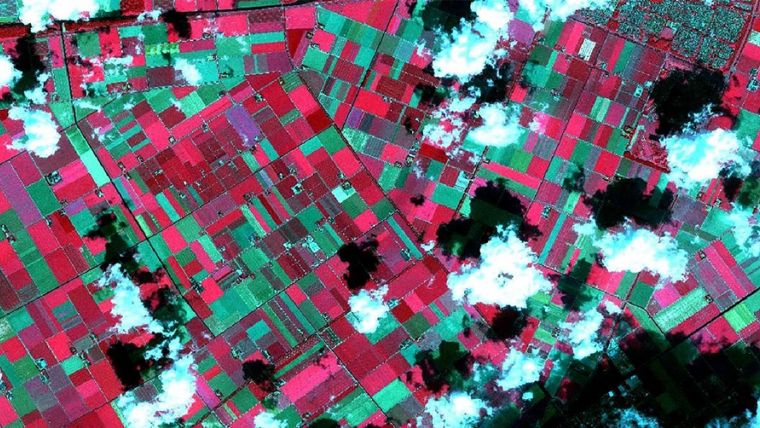
The implementation of the satellite portal is a good example of the notorious Dutch mercantile genes. The portal was built in 2012 to prepare The Netherlands for the satellite data that would, in a few years’ time, become freely available from the Copernicus programme. Thanks to a joint investment programme by the European Commission and ESA, several Sentinel satellites have been providing free data since 2015; in 2018 there will be six satellites in space and several ground stations. Other European countries waited longer to develop such a portal and they are now facing the problem that the benefits of modern satellite data are largely unknown and there are very few companies who can build applications around it. But the Dutch government took care that both the supply side and demand side of the market were ready for Copernicus. NSO bought data similar to the Sentinel data that would later become available for free, invested in a national distribution channel – the National Satellite Data Portal – and organised the contact between potential users and potentially capable added-value companies. This approach worked brilliantly. Many applications are up and running and many other interesting ones are being built, which is already giving Dutch companies an excellent export position. Periodically NSO meets with potential and existing users as well as companies to discuss new possibilities and needs in terms of spectra, frequency, regions and resolution. Van Loon: “As a trained surveyor myself, I know what the geosector thinks about satellite images: low resolution, clouds everywhere, not there when you need them. But that is an outdated idea. You can buy a fresh image of the whole country with 30cm resolution every day, available within hours. Free Sentinel images in open data format with 10m resolution are available every five days via our portal, either raw or already GIS-friendly.” In the crop-growing season (March-October), NSO buys high-resolution (3.1m) images every two weeks and images with a very high resolution (80cm) every two months from commercial data providers.
Co-creation
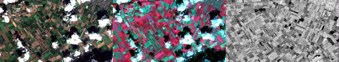
That is one of the reasons why the number of private companies adding value to the NSO satellite data has been picking up speed over the past three years. Whereas in the early days they came from the remote sensing and space sector, now almost every large firm that builds GIS applications is involved. “It is not so much a matter of how to use the continuous dynamic image stream, but rather how to combine the images with other information layers. In the beginning, our mistake was to think that satellite data was the solution to almost every problem – we oversold it. But in those days clouds were a serious problem. Today that is less the case because the satellites pass over The Netherlands every day. And four times a year we put all the mosaics on top of each other and select the cloud-free images to produce a blended ‘fair-weather’ image. More crucially, we’ve learned that you have to co-create; you need to involve parties in the whole chain at an earlier stage. Don’t see yourself as the end solution, but as part of a product or service,” states Van Loon.
He also admits that it is difficult to measure the portal’s success. Counting the number of existing and new users, monitoring their revenue or counting downloads says nothing any more. The data is used by a broad range of companies such as engineering firms and industry-specific portals. They might look like one client and they download the data only once, but that data is then actually consulted by thousands of users (e.g. boerenbunder.nl and akkerweb.eu represent 3,600 farmers) who do not even know where the data comes from. “We are certain that we stimulate the economy very effectively, but we can no longer give concrete numbers. More and more links are being added to the chain, including via advisors we do not see or even know about. Nevertheless, if we had more personnel we would be able to bring more parties together, inform more organisations of the benefits, help organisations in their search for a technically suitable solution but also share our experiences with workflow integration. In short, we could stimulate the economy much faster.”
Agriculture
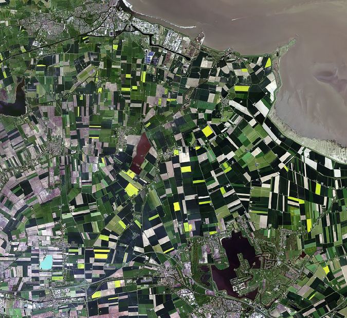
From the Dutch Ministry of Economic Affairs, the organisation recently received EUR1.4 million extra to invest in high-resolution satellite data for precision farming over the next four years. The agricultural market is the largest at the moment – from precision farming to identifying illegal activities such as marijuana plantations in the middle of cornfields. And on the topic of corn: as of next year, the Dutch authorities will use satellite images to check nationwide whether farmers have sown the right vegetation after harvesting corn to improve the condition of the soil again. In another use case: farmers can receive subsidy if they inundate a certain section of their land for nature conservation purposes and to create a foraging area for birds. Until now, the relevant authority conducted random checks by visiting farmers who were eligible for this regulation. Thanks to satellite images, a first check can be done from the office in order to see if the land really is wet or not. Inspectors can then perform much more targeted field checks. It is not yet common practice to use satellite images in this way to check compliance with the terms for EU subsidies. However, Van Loon expects the EU to change its rules to permit monitoring and inspection using satellite images, and several EU countries are working together to improve such inspection methods. Once the European agricultural policy rules have been adapted from obligatory visual inspections to the use of satellite images in selecting which farms to visit, it is certain that all European farmers will be checked this way for every rule that requires visual inspection. In view of the fact that 40% of the total EU budget is spent on agricultural subsidies (EUR434 billion), the business case in the EU speaks for itself. Thanks to the NSO creating timely awareness of new possibilities on both the demand side and the supply side, Dutch companies can show governments in other countries a solution that already works. This puts them in pole position in international tenders.
Emerging markets
Emerging markets include homeland security, safety (to prevent mishaps), justice (investigating crimes) and defence. Fire departments are also enthusiastic about using the data for modelling fire scenarios. For example: if a fire breaks out in a particular national park and the wind comes from the west, how will the fire spread and where should the firefighters be deployed? Until now this has been done with a 1:10,000 vector map, but the vegetation detail is often insufficient. Heathland is indicated as sand on the vector map, for example, but – unlike sand – heather does not stop fire; in fact, it spreads it faster. The map is now combined with satellite images, making the predictive models more accurate.
Another trend is the automatic detection of mutations: trees growing into electrical cables, cracks in dikes and dams, ground movement around pipelines, building activities on areas with right-of-way, refugee camps being established high up in the mountains, and suchlike. One good example of commercial use is by port authorities. The data not only helps them to evaluate their own activities but also to look at their competitors in other nations: which activities are growing or declining, whether new infrastructure has been developed, etc.
Time-critical
Although the imaging is refreshed much more frequently than before, it is still not done in real time, so that is one area for further development. Time-critical applications are more powerful, of course. In the case of incidents such as pirate attacks, unwanted activities around pipelines or a farmer who is deep ploughing where that is not permitted, the aim is to take action as quickly as possible. The EU recognises that speed is increasingly of the essence. Data is being sent to more ground stations so that the new images are in the national portals within just a few hours. To improve the download process, next year the NSO is implementing a new system in which more and faster computers will be integrated.
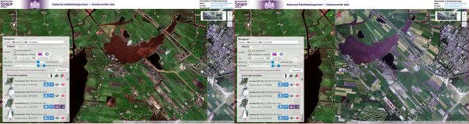
In the case of a large-scale emergency, every EU member state can immediately activate measures to ensure that all Sentinel satellites passing over the area capture images which are then automatically transformed into a damage map, among other things. Everyone can use the data and the maps for their action planning. The NSO (together with the Dutch Ministry of Justice and Security) pushed that button when a hurricane hit the Dutch Caribbean island of St. Maarten in September 2017. The Dutch Red Cross was not aware of this possibility and was trying frantically – with amateurs – to map the devastated island, Jasper van Loon recalls: “That was an item on the national news; otherwise we would not have known to call them to say that better options were readily and freely available.”

Value staying current with geomatics?
Stay on the map with our expertly curated newsletters.
We provide educational insights, industry updates, and inspiring stories to help you learn, grow, and reach your full potential in your field. Don't miss out - subscribe today and ensure you're always informed, educated, and inspired.
Choose your newsletter(s)


