GAF Wins Framework Contract for the Validation of Innovative Geospatial Tools
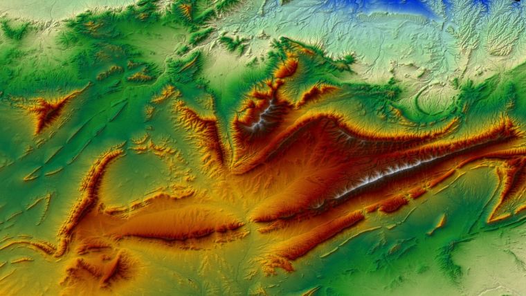
GAF AG, together with e-GEOS, has been awarded a framework contract by the European Union Satellite Centre for the provision of satellite-based digital elevation models to support the validation of innovative geospatial tools for SatCen’s exploitation activities. These digital elevation models have a resolution of between 0.5m and 10m and are generated using a highly automated multi-source production line. Additionally, the products are delivered with different quality layers and traceability layers, and the corresponding metadata is adapted to the user’s requirements.
For nearly 20 years, GAF has been providing different institutional and private customers worldwide with various types of high-quality digital surface models (DSMs), digital terrain models (DTMs) and other elevation products, mainly derived from optical (multi-) stereo satellite data. During the last 10 years, GAF has generated a multitude of very-high and high-resolution digital elevation models (GAF Elevation Suite) for a total area of more than 7.7 million km² worldwide.
e-GEOS has longstanding experience with SAR satellite data processing, including the production of digital surface models (DSMs) from SAR images using both, interferometric and radargrammetric techniques. The framework contract will run until the end of 2018, with the potential to be extended for another year.

Value staying current with geomatics?
Stay on the map with our expertly curated newsletters.
We provide educational insights, industry updates, and inspiring stories to help you learn, grow, and reach your full potential in your field. Don't miss out - subscribe today and ensure you're always informed, educated, and inspired.
Choose your newsletter(s)


