Geomatics and Surveying in Support of Land Administration
Implementing Tenure Security for All
Today’s geospatial technology means that land administration systems can increasingly be implemented for the benefit of all. It is now possible to conceive approaches to capturing the unrecorded geometry of boundaries for the billions of unrecognised land interests or spatial units. In addition, new approaches are becoming apparent for the maintenance of collected data. Examples from the field show that we’re well on the way to responding to the challenge. From a geomatics and geoscience perspective, many tools are already available to support development, but further steps are needed to operationalise them at scale. Read on for an article investigating a few of the emerging options.
(By Christiaan Lemmen, Rohan Bennett and Paul Saers, The Netherlands)
Land information tells us about the ownership, use, value and development of land – whether statutory, informal or customary. It provides an overview of people-to-land relationships. It shows us how people relate to the space around them. The information can be used to realise responses to major societal challenges, e.g. the UN 2030 Agenda for Sustainable Development. Geoinformation and Earth observation provide the inputs. These include satellite and drone imaging and mapping, global navigation satellite system (GNSS) positioning, cartography, spatial data infrastructures and many surveying sub-disciplines. This article takes a look at how each of these tools is helping to operationalise land administration at scale – and also what challenges need to be overcome to realise the potential.
Using Imagery
In the last few years, there has been considerable buzz surrounding ‘fit-for-purpose land administration’. The approach argues for cost-effective, time-efficient, transparent, scalable and participatory systems. The philosophy is driven by the idea that, in many situations, it is sufficient to identify visual boundaries based on imagery. This means making use of photographs, images or topographic maps in the boundary adjudication and mapping activities. Alternatively, apps on mobile devices can be combined with imagery to identify plots, thus avoiding misinterpretation of visual boundaries on the image. Images can be collected from satellites, traditional aircraft or unmanned aerial vehicles (UAVs). In cases of high land values or intensive land use, the field surveys can be conventional land surveys using high-precision total stations or GNSS.
Standardising Models
Alongside the push for the increased use of imagery, global standards such as the Land Administration Domain Model (LADM) focus on standardised modelling of information at the conceptual level. The model does not include processes for initial data acquisition, data maintenance and data publication. This is because those processes were considered to be country-specific when the first edition of LADM was prepared; a generic and global approach was likely to be difficult to model. This view now needs reconsideration, however. The fit-for-purpose land administration approach arguably allows for identification of more generic process-related modules in data acquisition and data handling. Standardisation can also make it easier to monitor the progress of global indicators relating to land tenure security.
Focusing on Processes
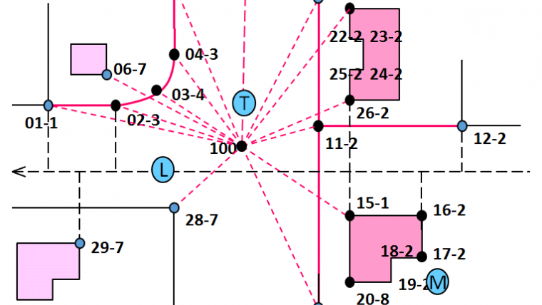
So what are some of these processes that might be supported? Examples include initial data acquisition, georeferencing (based on elevation models), identification of boundaries, surveying (based on imagery, conventional surveys, UAVs, digital pens for imagery and handwriting, feature extraction/data cleaning, radar), area management, linking rights, restrictions and responsibilities (RRRs) to spatial units, linking (groups of) persons to (shares in) RRRs, public inspection, publication of land data, formalisation, map renovation and quality improvement and digital archiving. Computerising large sets of legacy data (maps and archives) requires analogue-to-digital conversion, georeferencing and linking to digital data from other sources. Data may be used for taxation, tenure security purposes, slum upgrading, city management and so on. This also includes land use and zoning plans implemented by land consolidation and land readjustment processes. Statistical information such as fragmentation index and price index may need to be derived from the land administration. Imagery may be available on paper or on mobile devices in the field, or both.
Creating a Tenure Atlas
Another challenge in many countries is that several authorities may play a role in the process of recognising, recording, registering and managing the land tenure, and they may each maintain their own land information sets. Therefore, at national level, coordination is needed; a Land Tenure Atlas could be developed to provide an overview of the spatial distribution of legitimate tenure types throughout a country – be they customary, informal, private, public or otherwise. The Atlas may further include a layer for national and administrative boundaries and potentially a layer for planned and ongoing projects in land administration. The Atlas should be able to be aggregated to global level, enabling linkage to proposals for international data exchange representing the different RRRs in use within countries.
Utilising Devices
Surveyors and geoprofessionals focus on geometric accuracy, and this focus should result in quality labels identifying the relative and absolute accuracy of geometric data. This is relevant for later adjustment and integration of data from different sources collected with different instruments and tools in different approaches. But land administration is not only about geometric data. Talking about quality in land administration means not only talking about geometric accuracy, but also about ‘linking’ between polygons (spatial units) and people (right-holders). It would be nice if functionalities could be combined in one single device, i.e. linking functionalities for image-based data acquisition to handheld GPS, biometric data (fingerprint identification and facial recognition) and voice/video recording in support of object identification. Such devices would also be useful for inspections, for fieldwork related to building and construction permits, for cadastral maintenance, etc. Land data collected on many devices could deliver results in formats based on operational standards.
Integrating with OGC
The Open Geospatial Consortium (OGC) recognises that worldwide, effective and efficient land administration is an ongoing concern, inhibiting economic growth and property tenure. Existing approaches are at significant risk of data loss and failure due to disasters and lack of interoperability. The charter members of an established OGC Land Administration Domain Working Group are seeking to identify enabling standards and best practices to guide countries in a programmatic way towards establishing more cost-effective, efficient and interoperable land administration capabilities. Attention will be paid to upgrading currently manual processes to semi-automated ones, and to suggesting new approaches for data acquisition that are more automated and flexible. These challenges are faced today in ‘developing’ and ‘developed’ countries alike.
Developing Cooperation
Enabling standards are also being developed with other domain working groups within OGC, such as LandInfra. Partnerships and liaisons with other associations and standards developing organisations (SDOs) will be developed to address interoperability issues that span the land administration community of practice, geographic information systems and the broader IT environment. Examples include linkages with ISO TC 211 regarding the LADM as well as those SDOs responsible for IT standards related to topics such as security, the internet and mobile services. Further, the DWG will be open to participation by any interested organisations and individuals.
Industrialising Approaches
The geospatial industry provides tools, products and services in support of a number of important processes required in fit-for-purpose land administration. Image-based acquisition of cadastral boundaries needs access to huge image libraries – including historic imagery – to support large-scale implementations. Detection and selection of cloud-free imagery is needed to create cloud-free compositions, possibly from different sensors. By using orthophotos to produce spatial frameworks, the imagery is typically linked to the national geodetic reference frame through GNSS in space/on the aircraft and on the ground. Furthermore, automated feature extraction and feature classification appear to be very promising developments for the generation of coordinates of visual objects from imagery, and Lidar and radar technologies can also be used for this purpose. ‘Pre-defined’ boundaries resulting from feature extraction may be plotted on paper or visualised in interfaces, and can then be declared identical to cadastral boundaries in the field.
Modernising Demarcation
In general, fixing boundaries should be avoided in the preliminary stages. It has been shown that demarcation with monuments or beacons often takes 80 to 90% of the surveyor’s time. If demarcation is an absolute requirement, let people place the beacons themselves. Otherwise, it is a good idea to explore modern demarcation methods – smart markers could provide a good alternative. Modern markers like the traceable 3D radio frequency identification (RFID) markers can be detected and identified from a distance of several metres using a simple smartphone. The RFID in the marker can store administrative and positional data. It eliminates all known drawbacks of traditional markers. They could be used as main markers or georeferenced markers, supplemented by locally surveyed points demarcated with low-cost materials. RFID boundary marker strips cost less than EUR1 to produce – although that does not necessarily make it affordable in some countries, of course.
Utilising UAVs
UAV or ‘drone’ technology is rapidly developing, although autogyro platforms may represent another possible solution for aerial image capturing. Such platforms can operate at low to medium heights, thus largely eliminating the risk of images being obscured by cloud. In some cases, walking can be an alternative to low-altitude flying, e.g. using a portable 3D laser scanning device, the surveyor can map a strip extending 200 metres to each side of the trajectory on foot.
Handling the logistics
Processes such as initial data acquisition may concern millions of spatial units (parcels) for which people-to-land relationships have to be determined. The organisation of this process requires geospatial support in logistics and case/task management based on geoinformation. This starts with gaining an overview of the density of information. This is about estimating the amount of spatial units in a project area for planning purposes. Provision of materials and tools to data collectors can involve paper-based or digital approaches. A paper-based approach entails using plotted images in the field. This means that the collected field-boundary evidence can be left with the local people, providing a scan is available for the land administration authority. However, even paper-based approaches require a comprehensive range of geospatial technologies. Logistics activities include the processes of creating awareness of and announcing participatory approaches, agreeing on citizens’ roles in the land administration process, and publishing status information online/offline, as well as performing checks on completeness before leaving a location. Collecting copies of people’s ID, photos, signatures, fingerprints and video/voice recording requires field devices and battery power/electricity.
Handling maintenance
Data maintenance can be ‘programme driven’ (systematic) or ‘sporadic’. ‘Programme driven’ means a complete and systematic new acquisition after some time. ‘Sporadic’ means case by case in a ‘transaction-driven’ way and relates to transactions in the land market (buying/selling, mortgaging, etc.). Quality upgrading can be part of the maintenance process. This may be required after digitisation of legacy data or in the case of urbanisation or urban planning. It is crucial that data collected using survey approaches based on different accuracies can be integrated together. This may require adjustment of new observations to existing coordinates in the field or within GIS. Quality upgrading may also entail integration of 3D cadastral data (this includes integration with standards such as IndoorGML, InfraGML, LandXML, CityGML, BIM/IFC) and marine cadastre.
Concluding remarks
Implementation of all the processes presented here is currently undertaken in different places based on customisation from available databases and GIS technology. This is a time-consuming activity which demands GIS and ICT development expertise. Standardisation is required for those processes and needed in order to bring scalable approaches – ones which can be easily implemented based on the defined purposes of each land administration project.
Further reading
- Enemark, Stig, McLaren, Robin, Lemmen, Christiaan, 2015: Fit-For-Purpose Land Administration – Guiding Principles. UN-HABITAT/GLTN, Nairobi, Kenya
- GIM International, 2016. Special Issue on Fit-For-Purpose Land Administration for Sustainable Development. Geomares Publishing, Lemmer, The Netherlands
- OGC, 2016, Domain Working Group (DWG) Charter Land Administration. Open Geospatial Consortium. http://www.opengeospatial.org/projects/groups/landadmin
Biographies of the authors
Christiaan Lemmen
Christiaan Lemmen holds a PhD from Delft University, The Netherlands. He is a geodetic advisor at Kadaster International and visiting researcher at University of Twente/ITC, The Netherlands. He is director of the FIG Bureau OICRF. He is co-editor of ISO 19152 LADM.
Rohan Bennett
Rohan Bennett gained his doctorate from the University of Melbourne, Australia. He is an associate professor working in land administration at the University of Twente/ITC, The Netherlands, where he is also director of the School for Land Administration Studies at ITC.
Paul Saers
Paul Saers has an MSc in geodesy and geoinformatics. He is a geodetic advisor at Kadaster International in The Netherlands. He is specialised in the management of computerised land administration systems, BPR, ERP and QMS.

Value staying current with geomatics?
Stay on the map with our expertly curated newsletters.
We provide educational insights, industry updates, and inspiring stories to help you learn, grow, and reach your full potential in your field. Don't miss out - subscribe today and ensure you're always informed, educated, and inspired.
Choose your newsletter(s)


