
Geospatial Data as a Core Instrument to Transform a Country
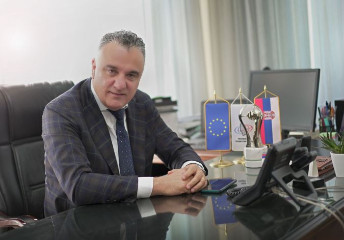
Interview with Borko Drašković, General Director of the Republic Geodetic Authority (RGA), Serbia
After several turbulent decades, the Republic of Serbia is working towards a brighter future, including by radically transforming its geospatial information infrastructure. In fact, the country has received recognition for its reforms in the process of digitalization and economic development of the state. This confirms the role of geospatial data as a fundamental 21st-century resource with considerable potential for economic and social development of state and society. In this interview with Borko Drašković, general director of the Republic Geodetic Authority (RGA), 'GIM International' takes a closer look at the achievements in Serbia, which can serve as an example for other countries in the Balkans and beyond.
A well-functioning land administration system is an important pillar for national stability and social welfare. What is the current cadastral situation in the Republic of Serbia, and how is that reflected in the country as a whole?
A country’s land administration system reflects the conditions within that country. Over the past couple of decades, Serbia has transitioned through a very difficult period marked by great economic, political and social crises, which reflected upon on the land administration system itself. Until recently, the land administration system was admittedly the source of various problems, but also often used as a scapegoat for various malversations within the Republic of Serbia. Shortcomings in the cadastre made it difficult to realize infrastructure projects and to develop state administrative systems. But numerous real-estate intermediaries, business entities and even state authorities have disproportionately blamed weaknesses within the Republic Geodetic Authority (RGA) for their own inconsistencies, ineffectiveness or rising prices.
The strained land administration system even made it difficult to guarantee property ownership, resulting in more than 4.5 million objects still unregistered today, as well as approximately 3 million people without an address. Regulating this state of affairs and legalization of property allows for economic development of the country, legal certainty and the creation of an attractive investment environment. Today, in accordance with the national government’s activities and with considerable help from the World Bank and other partners such as the Food and Agriculture Organization of the United Nations (UNFAO), RGA is solving the issues inherited from the past by making great strides, digitalizing data within business processes and introducing innovative solutions and technologies. We have completely changed the regular, inefficient property rights registration system following the passing of the Law on Registration in the Real Estate Cadastre and the Utility Cadastre in June 2018. We operate as a modern and pragmatic institution; it is no longer a traditional register of properties, but a digital public-sector platform that allows citizens to access geospatial data in a transparent, reliable and efficient manner. Our plans and activities are outlined in our 2021 Development Strategy. The vision and its implementation has invoked some strong and even judgmental reactions, but it is motivating other parts of the system to be proactive and participate in the reform of the entire country. The demand for geospatial data has multiplied, and geoinformation professionals are becoming a regular part of working teams.
In view of the millions of unregistered buildings and so many people without an official address, I guess it would be fair to say that the Republic of Serbia still faces some cadastral challenges. What is your main focus when it comes to tackling them?
That is correct, there are still some cadastral challenges to be faced. The major change compared to the past is that we are now talking openly about these challenges and how best to solve them. Previously the problems were just brushed aside, and underwhelming legal solutions and inefficiencies of other institutions were blamed for the existing sad state of affairs. That led to such huge issues that we became an irrelevant and dysfunctional institution which housed inaccessible and imprecise analogue data that was of little real use. As a result of our inefficiency, other institutions created their own address registers and datasets, which led to new procedures and placed new burdens on citizens and the economy. We have now defined our challenges and embarked on a path less travelled – a less certain path, but one that will lead to our goal faster and more efficiently. This path requires a completely new way of thinking (digital), as well as the introduction of new and innovative technologies and business processes. By utilizing the Geosrbija geospatial platform, new methods of collecting data – such as crowdsourcing – can be integrated into a National Spatial Data Infrastructure (NSDI). We have managed to completely update the address registry in record time (two years to be exact), plus we are currently working together with municipalities to perform street name and number demarcation. Not only are we saving time by introducing these updating technologies, but we have also achieved tenfold financial savings.
In addition, by utilizing satellite imagery and machine learning methods, we’ve successfully recorded all the objects in the Republic of Serbia and, in cooperation with other institutions within the country, we are working on their registration in the real-estate cadastre system. So as you can see, new technologies and a different mindset, together with a dedicated and professional team working within RGA, are allowing us to solve problems that spanned decades and to give our institution the central position it deserves in the 21st century. It is important that everyone in the system understands that digitalizing does not mean simply introducing IT systems and converting analogue processes. Instead, it involves digital business processes, digital legal frameworks and a digital mindset along with the relevant technical solutions for successful and operational digitalization. Otherwise, the door is open for misuse and a dysfunctional and unsustainable system. We are focused on this challenge, and are mostly working on the introduction of complementary digital processes, paying particular attention to simple solutions that are defined clearly and precisely.
In your country, you have been recognized as ‘Reformer of the Year’. What were the main achievements that led up to this?
We made it possible for other state authorities to be visible. We offered all the institutions the opportunity to present their data on a national digital platform free of charge and in a simple manner. Their data is spatially defined in the UTM system (Universal Transverse Mercator coordinate system), with all the datasets overlapping, thus providing a plethora of information to users. We currently have 250 different datasets, and we are especially proud that we have mapped and digitalized the historical period that shaped the territory of Serbia, such as the Great War. It has been an achievement of the entire profession. The fact that the institution dealing with geospatial data has received recognition for reforms in the process of digitalization and economic development of the state only confirms what is often mentioned in the global discourse – that geospatial data is a 21st-century resource and that it has considerable potential for economic and social development of state and society. Up-to-date property registers represent secure ownership and a healthy economic environment. We have proved this in real life in Serbia. So far, these sorts of recognitions were mainly ‘reserved’ for other professions instead of the geoinformation profession. However, I am certain that we have entered the age of digital geospatial data, and that recognition of the geoinformation profession as a whole will be a regular occurrence from now on. Many key factors have led up to this achievement, including the new way of functioning for real-estate and utilities cadastres, new information systems, improvements in data quality, the Geosrbija digital geospatial platform, the new and efficient NDSI, and RGA’s transparent and efficient work in cooperation with other institutions in the field of digitalization.
How does RGA see its role in this age of digital transformation?
If we succeed in realizing the reform project, we will certainly be one of the leading and most important state institutions. Economic advancement crucially depends on high-quality land administration – Serbia cannot be successful unless RGA is successful. Geospatial data, and therefore our institution, is indispensable in the process of making smart decisions and creating legal certainty. Our goal is to establish a complete platform of public-sector geospatial data. The spatial georegister will play the central role in managing the workflow of different systems. In addition, our idea is to unify and host all the services and data in one central hub so that data can be processed and made available to the user in the most efficient manner possible. We are developing new services; today all of our data is available via API so it can be optimally utilized by public-sector organizations, businesses, citizens and educational institutions alike. They have access to the most up-to-date data at any time. Similarly, not only can we help the public sector to make genuine and high-quality decisions, but we can also help to develop business and the economy in the country as a whole for our citizens.
We have always emphasized strong cooperation, both regionally and internationally. In this time of rapid technological advancement, knowledge and experience are quickly exchanged and no one has the right nor the luxury to work alone and endanger the sustainable development of the planet. And in the upcoming period we see it as a necessity to continue to connect with other regional institutions, with institutions from Europe and with the rest of the world. Besides the World Bank, the United Nations and the European Commission, our friends from the Netherlands, Sweden, UK, Norway and others have also played an active part in our success. Also, we wish to provide assistance to other countries interested in achieving similar results.
What is the prevailing attitude towards the economic value of 3D geoinformation in Serbia right now?
Due to activities and results we achieved in the previous period, the government of the Republic of Serbia and the public have now come to understand the importance of spatial and 3D data in the economic development of state and society. As evidence of that, we only need to consider the improvement of the NSDI, the improvement of geosector and the adoption of strategic changes at the national level – such as the government’s economic reform programme, Serbia’s rise in the World Bank’s ‘Doing Business’ index, Serbia’s public-sector strategy and the government’s Action Plan. Hence, geospatial data remains a key factor in developing state and society, all based on our results and that make us proud. I should also point out that RGA’s new approach has also resulted in considerable advancement of the private sector. As RGA began to provide up-to-date and high-quality data in a contemporary manner, big and small private firms began to expand their businesses, to provide new services and also to employ geoinformation professionals. However, due to the country’s geopolitical position and human nature in general, the prevailing thought still seems to be that although everything being done is probably good, it should be kept ‘at arm’s length’ – which is the Serbian equivalent of saying ‘not in my back yard’.
What role do you foresee for institutions such as the United Nations (UN-GGIM) and the World Bank, not only in Serbia but throughout the world?
In our experience, it is practically impossible to see the wider picture without the support of the UN and World Bank. The geosector and land administration are both complex systems, and geospatial information management is inconceivable without a global framework. The United Nations 2030 Sustainable Development Goals are a beacon for the development of missions, visions and goals to strive towards. So in our opinion, UN-GGIM and the World Bank will play a key role in the further development of the geosector and institutions such as RGA at both a global and a local scale. Activities on integrated frameworks for geospatial data worked upon by both UN-GGIM and the World Bank will provide a basis for the further development of geospatial data infrastructures, taking into account the fact that different countries operate in different environments. Recommendations allow countries to create action plans in accordance with their priorities and circumstances. I think this ‘global for local’ approach is excellent, and the only feasible one.
How do you expect the Serbian land administration system to look in five to ten years’ time?
I expect it to be a highly transparent and reliable system, with considerably improved efficiency and accessibility. In five years’ time we will have achieved all of our projected goals, meaning that we will be one of the most successful land administrations in the world. We will certainly be within the top 20 in the Doing Business index, and we hope to reach the top 10. The system will also be fully functional, with all the inherited problems solved. In ten years’ time, if we use the new technologies wisely for the common good, in line with the new user needs and in accordance with technological trends, we will be transformed and integrated into a uniform technological geospatial system of the highest order.
Lastly, Mr Drašković, you recently have organized a joint international conference in Serbia, together with the EU’s Joint Research Centre (JRC), the World Bank, UNECE, UNFAO and UN-GGIM Europe. What was the topic of this event?
The main topic of the conference was the importance of digital transformation of state and society, including a focus on digital spatial data and the introduction of innovative services that relate to regional and spatial planning, smart cities and next-generation agriculture. The goal of the conference was to inform the different stakeholders (public sector, private sector, academic community, etc.) about the importance of applying ICT technologies and about the trends in Eastern Europe. RGA was chosen as host and organizing partner due to the results achieved previously relating to digitalization of its services, introduction of modern technical and technological solutions, and innovation in the field of managing geospatial information and real-estate cadastre. This is a special honour for the Republic of Serbia, RGA and our employees who work hard to provide our citizens with high-quality and efficient services. Thanks to our work, RGA is today an institution where colleagues and students from abroad (e.g. Kingdom of the Netherlands, Republic of Slovenia, Guyana, North Macedonia) arrive to exchange knowledge and experience and organize important international meetings. Hence RGA has shown, together with the government of Serbia and supported by the World Bank, that it is now on the right path to respond to all the challenges of the 21st century.
Borko Drašković has been director of Republic Geodetic Authority (RGA) of Serbia since July 2015, during which time he has helped to improve transparency in the real-estate cadastre and work of RGA. As a result of the reforms he has undertaken, he was named ‘Reformer of the Year’ by the National Alliance for Local Economic Development (NALED) in January 2019. He is also a member of UN-GGIM and played a key role in laying down the foundations for Serbia’s crowdSDI. The digital geospatial platform for Serbia’s NSDI has been in operation for more than a year, during which time it has gathered over 240 datasets from many institutions in Serbia.


Value staying current with geomatics?
Stay on the map with our expertly curated newsletters.
We provide educational insights, industry updates, and inspiring stories to help you learn, grow, and reach your full potential in your field. Don't miss out - subscribe today and ensure you're always informed, educated, and inspired.
Choose your newsletter(s)


