GIS Enabling a Smarter World - Esri User Conference 2017
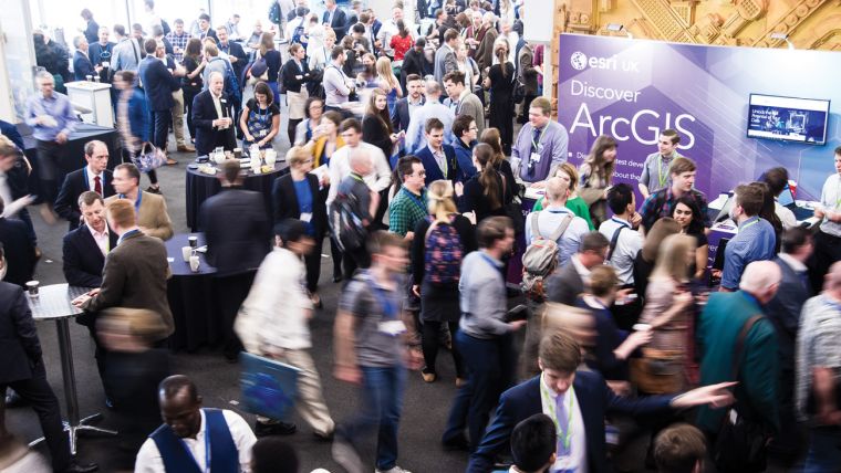
On the 16 May 2017 for the fourth year running, the QEII Conference centre in bustling Westminster, within walking distance to the houses of parliament, Big Ben, Westminster Abbey and the London Eye in the distance played host to the popular Esri UK Annual Conference. With record-breaking attendance of 3,000 visitors it was clear that the industry was here for the event and not the sightseeing!
‘GIS Enabling a Smarter World’ was the theme of the conference and delegates were welcomed in the Plenary by Pete Wilkinson, Head of Professional Services Group Esri UK, who gave a brief overview of the day before handing over the Stuart Bonthrone, Managing Director Esri UK.
The conference itself boasted an impressive 60 individual sessions across a number of tracks covering a vast range of topics from training and demos to examples of how ArcGIS has assisted with projects within various industries and organisations.
Stand out sessions included the plenary opening session with Stuart Bonthrone, managing director of Esri UK. He hit the nail on its head by looking at the urban geospatial aspects as well as the need to protect the environment: “The UK’s steadily growing population is creating challenges that affect us all. There is the urgent need to build more homes and schools for young families, expand our healthcare services to meet the needs of our aging population, improve our transportation infrastructure and increase food production. Yet, at the same time, we need to preserve our natural landscape, protect wildlife habitats and ensure public safety in an ever-changing context of risks ranging from flooding to terrorism. The challenges are getting tougher. So the solutions need to get smarter.”
Engaging with Local Communities
Another standout presentation made was by Zennon Hannick, CTO of Comic Relief, the charity that’s moving towards engaging communities and is using ArcGIS to visualise relevant data, make decisions and to create engaging and locally relevant content: “If you consider that you are likely to be within 30 miles of a Comic Relief funded project, you can understand how far more compelling it is to engage with local people through geo-targeting around a locally funded project. The result is better awareness, better fundraising and vitally better understanding of how raised funds actually make a difference to people’s own local communities.”
Sessions on the use of GIS with urban planning by Land Use Consultants focused on finding spots for new housing and the Greater London Authority on long-term planning for infrastructure. National Trust presented a session on understanding and restoring the natural world using ArcGIS. Huw Davies, head of conservation information at National Trust, unveiled that “60% of species in the UK have decreased in number over the last 50 years and, as a major British landowner, we are helping to reverse this catastrophic decline in biodiversity. We are using ArcGIS to identify threatened habitats, implement conservation schemes and monitor the success of wide-ranging initiatives to create thriving natural environments.” During the day, other sessions focussed on the role of GIS when coping with floods, optimising mobile phone networks, facilitating meetings and retail results. Esri UK also took care of various sessions on working with ArcGIS - professionals shared how to get the most out of the package. And this was just some highlights from the long list of knowledge available from a wealth of different angles.
Time to Celebrate
Of course, the conference was an ideal time to highlight performances achieved using the Esri software. This year, a record number of applications were received. The winners of the awards were called on stage:
- Planning & analysis: Hampshire Fire & Rescue Service
- Operational awareness: Transport for London
- Field data collection: TEAM2100 CH2M and Environment Agency
- Asset management: Tarmac
- Community engagement: University of Exeter
And actually, a bit of the best was kept until last. Keynote speaker guerrilla geographer Daniel Raven Ellison concluded the day with a thought-provoking concept of highlighting the city of London as a nature park city, of course illustrated by various maps and interesting facts. A side lesson of the afternoon being that the delegates in the room seemed to better appreciate foxes than hedgehogs.
Who Exhibited?
Alongside the conference was a packed room of over 20 exhibitors. The room had a good position for attendees to visit all exhibitors during the lunch and refreshment breaks. Ordnance Survey, Britain’s mapping agency, was in a prime position as the events platinum sponsor.
Gold sponsors of the event included Harris Geospatial Solutions, who demonstrated their latest automated exploitation solutions to solve complex problems in a variety of industries including agriculture, utilities and defence; while 1Spatial showcased their 1Integrate for ArcGIS solution, which provides automated data validation and management for the ArcGIS platform.
EOS Positioning was exhibiting alongside MGISS, the UK distributor of the Arrow series of High-Accuracy GPS and GNSS receivers for mapping, field data collection and inspection; GeoSLAM exhibited their market leading “go anywhere” 3D mobile mapping technology alongside their UK distributor Opti-cal Survey Equipment. The companies gave live demonstrations of the handheld ZEB-REVO mobile scanner.
Other exhibitors included Avineon, DigitalGlobe, Differentia Consulting, Helyx, HERE, MarkLogic, BlueSky International Ltd, InstantAtlas, TomTom, Royal Geographical Society, Edina, Field Studies Council, The Geographical Association, British Cartographic Society, 42 Engr Regt, MapAction and Transport for London.
Despite being a UK conference the whole event had a global forward thinking feel and a great buzz, full of opportunities to network, learn and expand our knowledge of how GIS is being used more and more in day to day living - super conference and trade show provided by Esri UK.
This article was published in GIS Professional August 2017

Value staying current with geomatics?
Stay on the map with our expertly curated newsletters.
We provide educational insights, industry updates, and inspiring stories to help you learn, grow, and reach your full potential in your field. Don't miss out - subscribe today and ensure you're always informed, educated, and inspired.
Choose your newsletter(s)


